
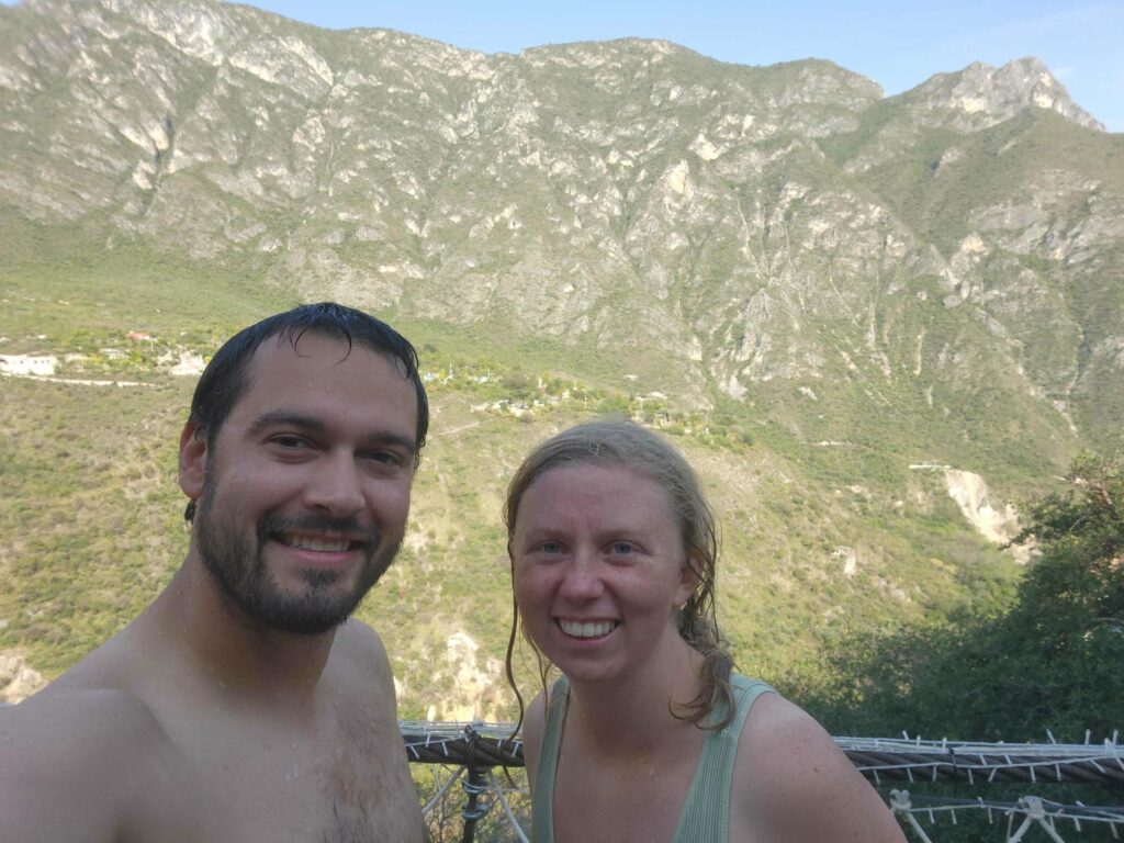
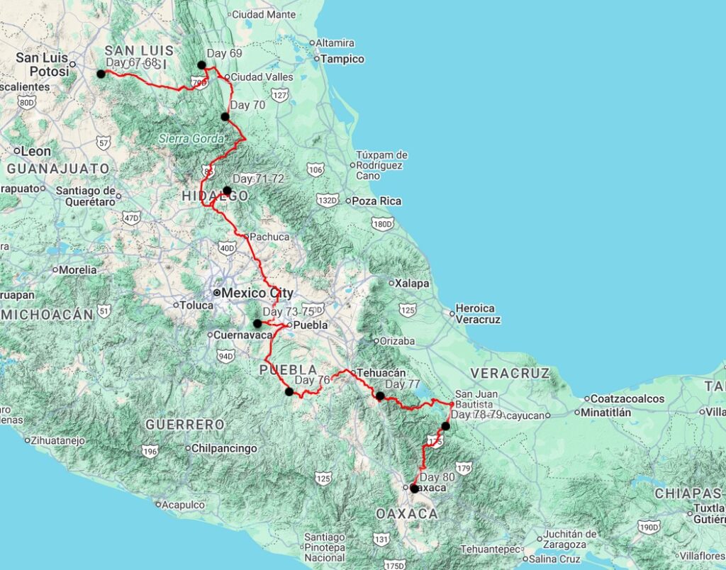
We spent two days in our camp spot above Alvarez in San Luis Potosi. We didn’t go more than about 100 yards from the Jeep the whole time. We spent our time relaxing after two long drive days- from Parque National Mexiquillo to the western border of Zacatecas, and then from there all the way across Zacatecas and through the city of San Luis Potosi. We took care of a few small things- cleaning, writing for the website, fixing some clothes, and airing out the Jeep. We got caught in a small rainstorm around midday on our second day there- we hurriedly reconfigured the jeep so that we could sit up inside, and had a wonderful cozy afternoon inside with the hammering rain outside. Our second day there was also the feast day of Our Lady of Guadalupe, one of the most important celebrations in Mexico. We had seen people processing along the highway the day we drove in, and were a bit confused until we realized what day it was. There were lots of fireworks in the small town both nights, and we could hear some sort of celebration going on in the small town.
We left fairly early the following morning, on 12/13/25. It had been a wonderful, quiet spot to relax after some long stressful days. We were headed east on Highway 70 into a much wetter climate. We stopped at a small roadside gordita stand for lunch. The two women working there spoke no English at all, but there was a mostly toothless truck driver there who spoke a bit. He was amazingly friendly, and helped translate our order for us. He also asked the women there for a bit of the cheese they used in the gorditas for us to taste. It looks a bit like wet and clumpy powdered parmesan cheese, but it tastes a lot like mozzarella. It was delicious! We had a great time with the truck driver comparing the weather of Alaska and San Luis Potosi. We were sweating standing out in the sun at 80F, but he said it was quite cool this time of year, as it can get nearly 120F in the summer! I showed him a picture of me up on the North Slope at -30F, and he could barely comprehend being that cold.
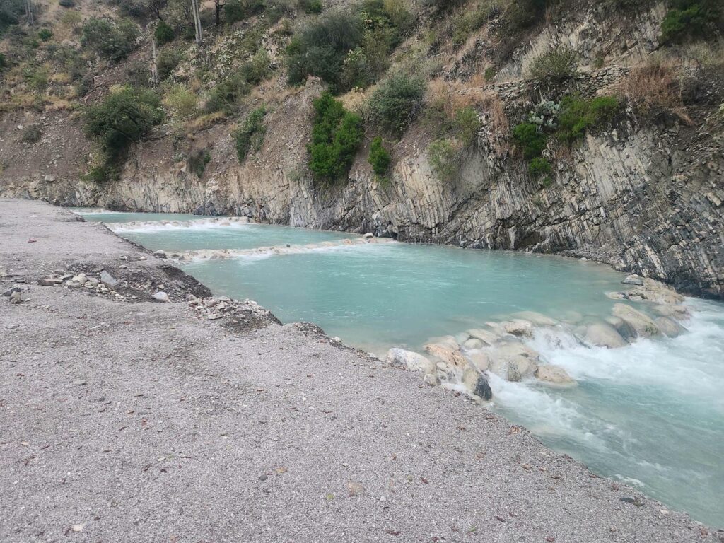
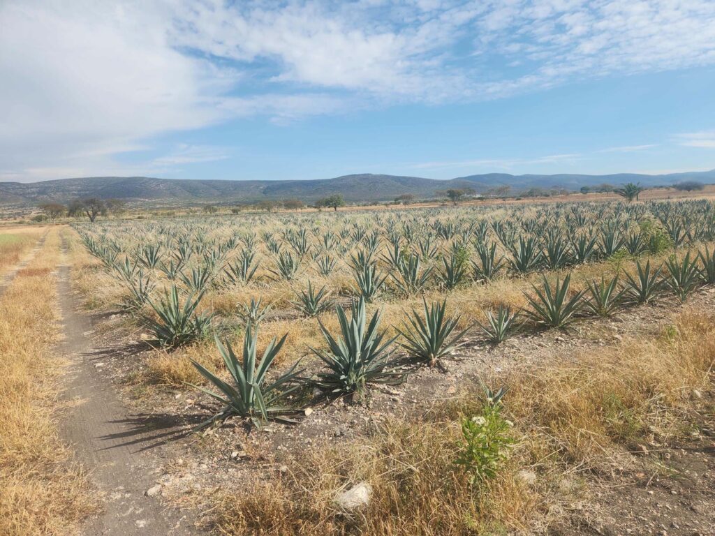
We had intended to take the free road all the way east, but there was an accident somewhere up ahead, so after waiting in a long line of cars for a few minutes we turned around and got on the toll road. The toll road was equally beautiful- winding through some wonderfully green mountains. We dropped back down into the lowlands, and after we got off the toll road headed north, fields of sugarcane stretched out in front of us. We drove through the small town of Tambaca, and were nearly caught in a huge traffic jam of sugarcane trucks. Tamabaca has a huge sugarcane plant, and there must have been at least 50 semi trucks, all piled impossibly high with sugarcane. We fortunately scooted right through, but we could have been stuck there for quite some time. As we drove north through a broad valley on a rough country road, we were amazed at how sugarcane seemed to be planted everywhere they could possibly fit it. It filled the valley from east to west, and it went on for miles and miles as we drove north. It was unbelievable- kind of like driving through cornfields in Nebraska or Iowa, but sugarcane grows at least twice as tall!


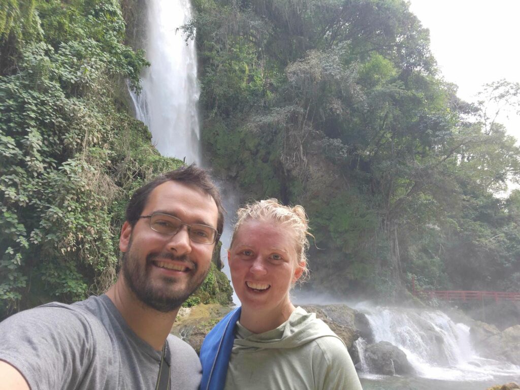
We finally arrived at our destination, Cascada de Aguacate. Eastern San Luis Potosi is filled with impressive waterfalls, and as far as we could tell, this one seemed to be one of the least commercialized. It still had a restaurant and some rooms for rent, but it was very tastefully done and didn’t overwhelm the waterfall. They also allowed camping in the parking lot, which was very nice. We arrived at around 3pm, and walked around the place. The restaurant and other buildings stood level with all the miles of sugarcane fields around- but behind the buildings, the ground fell away into a deep gorge with high, vertical walls. There was a river at the bottom of the gorge, but the source of the waterfall was a creek that came across the fields of sugarcane perpendicular to the gorge. The creek plunged down into the chasm right behind the restaurant. From the top, we could barely crane our heads and see the waterfall, and we weren’t allowed to go down that late in the day and would have to wait for tomorrow. We ate a tasty, but touristy and uninspiring dinner at the restaurant, and went to bed.


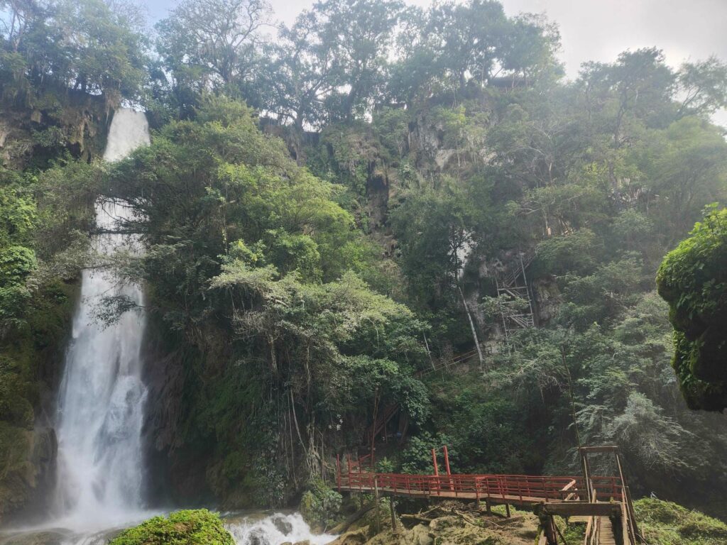
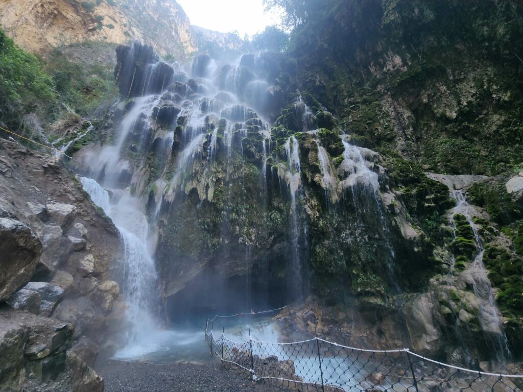
The next morning, we made breakfast, put our swimsuits on, and headed down into the gorge. There were a series of stairways down, all of different construction. First, a narrow 3-spiral staircase, then down some stairs made of wood timbers, then several flights of metal stairs, back to wood, then some rock steps, etc. We descended over 200 vertical feet, only going about 15 feet horizontally. The gorge was incredibly vertical- I was very much reminded of the Narrows in Zion National Park, but instead of sandstone walls, it was rough white limestone with dripping vegetation everywhere. As we went down the stairs, the waterfall came into view. It was a pounding torrent that fell from the valley bottom above into the gorge. It measures at 65m/215ft, and it put out an incredible amount of spray at the bottom. There was a foot bridge at the bottom of the stairs that went across the river at the bottom of the gorge, exposed to the full brunt of the spray from the waterfall. We were soaked as we hurried across!


We made our way through the spray and to a flat bank on the far side of the river. We were upstream of the falls here, and the river made a nice deep pool for swimming. It was definitely too cold for swimming, but we did anyways! Even before getting into the water, we noticed a huge amount of small fish in the water, each an inch or two long and heavily built. Schools of them followed us wherever we went, no doubt feeding on all the food we kicked up as we waded through. The only way upstream was to swim, as it was too deep to wade, so up we went. The water was beautiful, and perfectly clear despite frequent small rapids. It really felt a lot like the Narrows in Zion, with the river stretching from canyon wall to canyon wall at times. We made it upstream a few hundred yards, half of it swimming and half of it scrambling over submerged rocks, before turning around. It sure was a lot easier to swim with the current than against it! We noticed on the way down that the side of the canyon with the waterfall was covered in travertine deposits, kind of like you would find in a wet cave or near a hot spring. In places, the deposits were extensive, creating overhangs and protrusions. We are guessing that the creek that is now the waterfall used to be more spread out on the valley floor above us, and dripped into the gorge over a length of the canyon, creating all the crazy shapes and overhangs. The extensive agriculture in the last few hundred years probably collected all the water into one channel, forming the waterfall. This is pure speculation on our part, but it was clear that a lot of water had dripped into only one side of the canyon!


On our way out, I counted the steps up- 194 of them! I can’t imagine how they built all the stairs down into the canyon, but after seeing some Mexican construction in action, I am sure that it involved quite a few people and absolutely no OSHA oversight. We headed out to our next destination, Sotano de las Huahuas, and fortunately found a much better road out- the road in the night before had been quite punishing. We passed the entrance to one of the other more popular waterfalls, and were very glad we hadn’t gone there instead- it was packed! We’d had Cascada de Aguacate all to ourselves, but here there were 3 full tour buses parked outside, and each visitor was required to wear a life vest anytime they got anywhere near the water. No thanks!
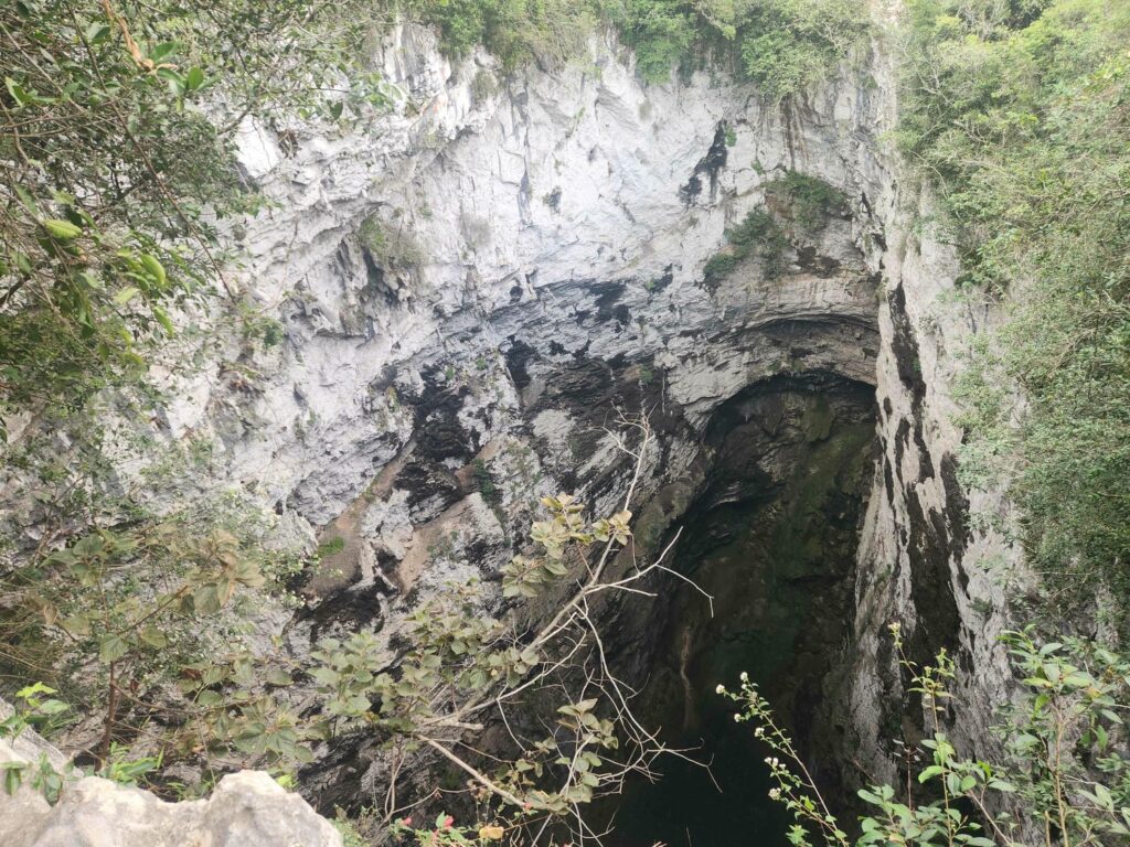
Much of our drive was in the tropical lowlands- very flat, hot, and humid. We passed over several large brown rivers- we really hadn’t seen rivers of any size since the Colorado River north of the Grand Canyon! We turned off the main highway 85 and went up a winding road into the mountains to the parking lot for Sotano de las Huahuas. A “sotano” is a sinkhole, and we were about to see just how huge they can be! We were here to witness an incredible spectacle: thousands of White-Collared Swifts returning to the sinkhole to spend the night. They leave every morning and return every night, and we had read that we should be at the sinkhole before 5pm to not miss the evening return.


We filled a backpack with some food and water and headed up the trail. The trail was about 2 miles, and it was all made of rock, all fitted and concreted together. It must have taken forever to build! The area felt incredibly jungly- huge trees and dense green undergrowth. About halfway up, we heard a whooshing sound, almost as if a huge gust of wind was approaching. We looked up to see hundreds of swifts zooming by, just above the treetops. They came in waves, the numbers ebbing and flowing over nearly 10 minutes. It was crazy! We couldn’t believe how much noise they made.
A short climb later and we were at the end of the trail. We could see ahead of us through the jungle a giant black hole, and as we approached the edge, we realized just how big the sinkhole was. It was 250ft in diameter, and it is apparently 1500ft deep. We could only see down perhaps 500 feet, but the chasm goes down at an angle underneath the main viewpoint. It was ridiculously big- it looked like it could swallow several high schools and still be hungry! We stood there in silence for a few minutes, not able to comprehend the hugeness of it all.
The silence was broken by some loud chattering calls, and we saw some neon green birds flying in circles, down in the sinkhole. They flew around and around, higher and higher each time, until they came out and perched in some trees not far from us- Green Parakeets! It took us a surprisingly long time to get eyes on them in the trees- they were exactly the same color as all the leaves around. We did finally find them only about 50 feet from where we were standing.

There are several giant sinkholes in this area, some more popular than others. The two most popular ones are Sotano de los Golondrinas, Sinkhole of the Swallows, and this one, Sotano de los Huahuas, Sinkhole of the Parrots. Both Golondrinas and Huahuas are indigenous words, and the local indigenous people claim that the Huahuas sinkhole used to host large parrots, but as the sinkhole became popular, the parrots left. At least these little parakeets are still here!
It was clear we had gotten up to the top in plenty of time, as we had the first half hour completely to ourselves. Slowly, others started to appear, including some Peace Corps volunteers that had just finished their service in Mexico and were now taking a short vacation before returning home. How amazing it was to speak English to other people! We hadn’t spoken a lick of English to anyone since we had said goodbye to Scott in Mazatlan, and before that we really hadn’t spoken with any English speakers since we entered Mexico. Delaney was used to not speaking English during her time in the Peace Corps, but I hadn’t realized how much it had been affecting me. They compared notes with Delaney about the Peace Corps, and we ended up following them up to a higher viewpoint, on the other side of the sinkhole. There still weren’t any swifts coming in, but the parakeets became more active, and more and more of them kept showing up. There were probably 200 of them, all in groups around the sinkhole, sometimes flying across, sometimes wheeling in circles down into the blackness below.
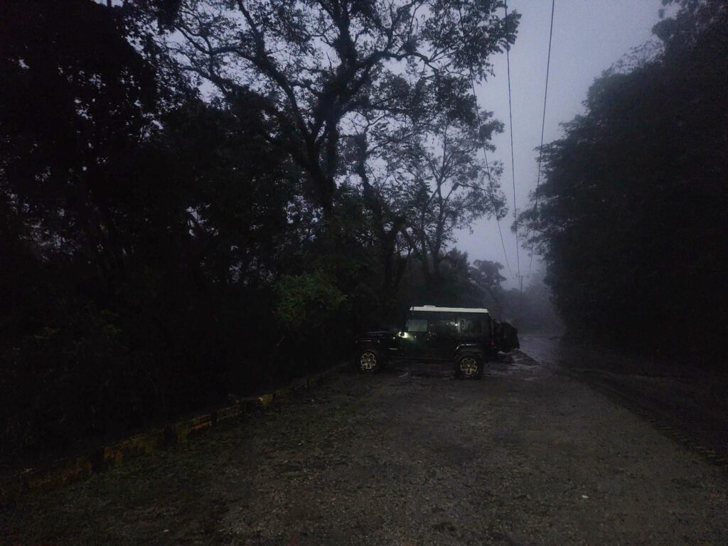
Clouds had been slowly building all day, and by 5pm, when the swifts were supposed to start showing up, the rain started. Before we knew it, it was a torrential downpour. We scurried down to the lower viewpoint with hopes of waiting it out, but it was soon clear that it wouldn’t be ending anytime soon. We hadn’t noticed just how many other people had come up to the lower viewpoint in anticipation of the swifts- there must have been 40 people down there! We were so grateful for our time alone in the beginning, and then just having 6 or 7 people at the upper viewpoint. We left just as the swifts started showing up, but we could barely see them through the rain and the fading daylight, circling high overhead in a huge swarm. We walked down the path in almost the hardest rain I’ve ever been in. I had to take off my glasses- I couldn’t see a thing through them, and I decided that blurry vision was better than no vision at all. By the time we got back to the trailhead, we were soaked to the bone. We may as well have been chucked in a swimming pool.
We dove into the jeep, laughing at just how wet we were. We changed into dry clothes, leaving our soaking wet clothes at our feet. In a small interlude between sheets of rain, we made a quick ramen dinner, before diving back into the Jeep as the rain started up again. How glad we were we hadn’t tried to tough it out up at the sinkhole! In another interlude, we popped the top and climbed upstairs. We were comfortable and dry, but it absolutely poured rain the whole night long.

We woke the next morning to a drizzle- a big improvement! We headed back down to the main highway and headed south. We were on Highway 85, which at first was a good quality 4-lane highway passing through the occasional town, but as it climbed into the mountains, the highway got smaller and smaller. Before long, it was a narrow 2-lane twisty road perched on the side of the mountains, passing through tiny village after tiny village. Although the worst of the rain had passed, it was still quite foggy all day long. We’re sure the view was incredible, but we only had glimpses, shrouded by clouds. We climbed and climbed, out of the jungle lowlands, into jungle mountains, and finally into pine forest at the very top, before passing back down through jungle mountains and down into scrubby desert on the south side of the mountains. We got caught behind a semi truck pulling a heavy load through the mountains, and were soon part of a large train of vehicles. Mexico doesn’t really have passing lanes, so we were stuck for about half an hour going normal speeds downhill but only 10mph uphill. At one point an ambulance came up behind us, and had the unenviable task of passing one vehicle at a time- like many mountainous Mexican roads, there was no shoulder to pull off onto!
We finally made it to the city of Ixmiquilpan, a dry and dusty town surrounded by farmland. After a few tiny city streets, we made it out to the other side and were headed back north into the mountains. Starting just outside Ixmiquilpan, the topes, or speed bumps started. We had probably 20 miles of speed bumps, leading us to affectionately nickname the city “tope town”. I think the longest stretch without one was only a quarter mile or so, and they were usually spaced around 100 yards apart. Mexico has speed bumps everywhere, even on major highways, so that was nothing new, but there were just so many of them! We were headed up into a touristy area, and at nearly every speed bump there was some sort of side-of-the-road shop, either selling food or swimming accessories. Most of them were closed as this was the off-season for tourism, but it was amazing how many dusty little shops there were. We finally left most of the speed bumps behind and had lunch on a beautiful ridge, looking down into a massive valley below.
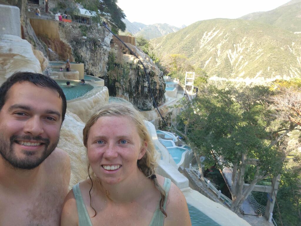
Our destination for the night was Tolantango, a massive hot springs complex. The springs are at the bottom of the massive valley that we’d had lunch on, and now we had to descend all the way down to the bottom. Looking at Google Maps later, I counted 24 tightly spaced switchbacks down to the valley bottom. They were fortunately well paved, but they were very tight and very steep! Even with the Jeep’s tight turning radius, we couldn’t stay within the lanes on some of the tighter corners. We couldn’t believe how large tour buses could make it all the way down- they would block the entire switchback every time they traversed one. Chaos! After paying our entrance fee, we were free to camp pretty much anywhere within the massive complex of hotels, springs, restaurants, and other facilities. We found a nice place next to the river at the bottom of the valley, a bit away from the chaos of the resort-like atmosphere. Again, we were very thankful that it was both the tourist off-season, and that it wasn’t a weekend! We’d heard that it can get extremely crowded in the summer or on weekends.
We had only a bit of daylight left with which to explore the place. We wandered up the river, past some of the facilities, looking to find a waterfall and cave we’d seen on the map. This area was unfortunately closed for the night, so we resolved to visit it first thing in the morning. After wandering through some of the closed restaurants, we walked along the river back to the jeep. Delaney was curious how cold it was, and tested it- it was HOT! The river was not small, and the whole thing was bathtub-temperature water. The whole river was divided into pools, each 50 feet long or so. It was obvious that the pools were artificial, with strategically-placed river rock to dam up each section, but how nice to have separate sections to soak in. We had a quick dinner and went to bed, excited for the following day.

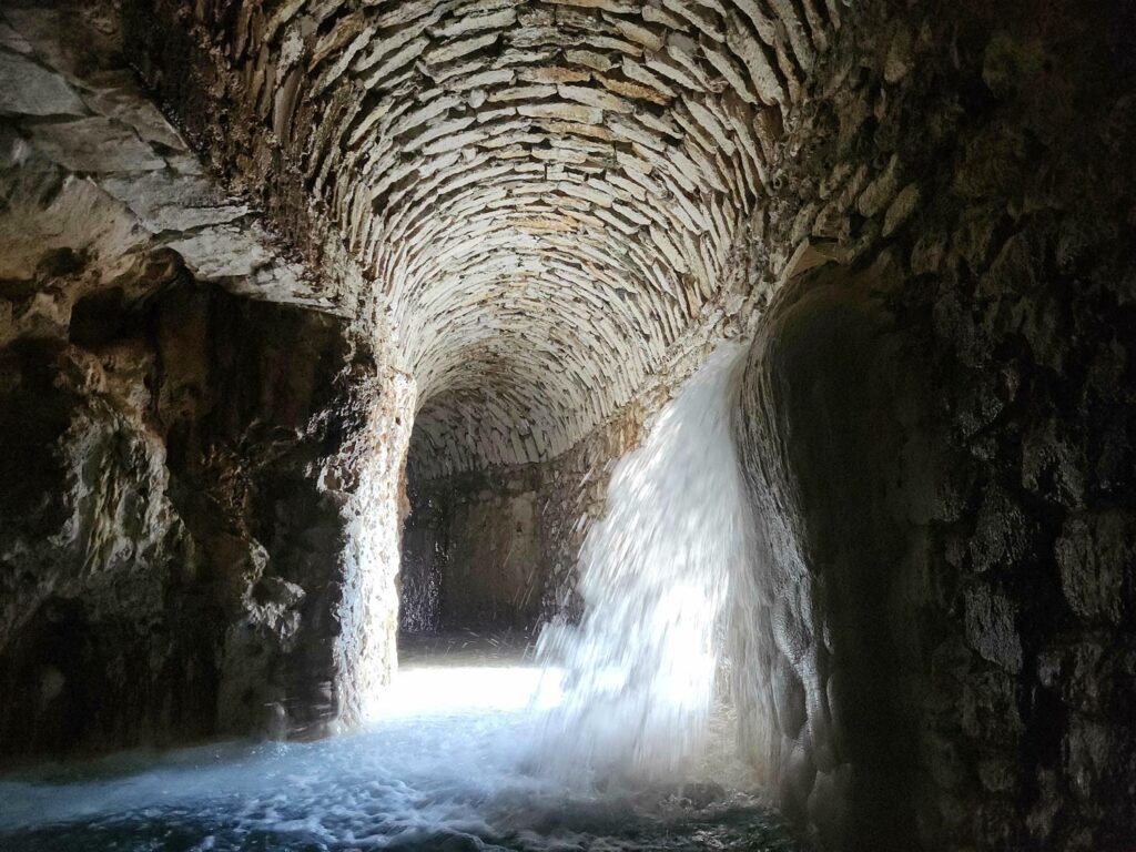
After a quick breakfast, we put on our swimsuits and headed back towards the waterfall. It was stunning- not so much a waterfall as an enormous moss-covered cliff, dripping water down on the path and river below it. The river, which was the same river that we’d discovered was hot the night before, came out of a cave beneath the waterfall. The path here split- we could go into the cave, or into a tunnel. We chose to visit the tunnel first. It went straight into the hillside, right next to the cave. The entire tunnel was gushing water from everywhere- the floor, ceiling, and walls. It was well over 100ft long, perhaps 8ft in diameter, and completely dark. We were glad to have a waterproof headlamp along! The water was a perfect temperature- warm, but not scalding hot. It was such a unique experience to be in a cave, in a swimsuit, with hot water pouring down on us. There was so much steam in the air that it became a bit hard to breathe, so we headed back out, through the cold waterfall at the entrance- what a shock after being under so much warm water!


Next was the cave. Again we went under the dripping moss waterfall, and waded into the cavern. The entire cavern was a natural pool, 3-5 feet deep, and perhaps 100ft in diameter. The water was the perfect temperature. There were several holes in the ceiling through which hot water was pouring through, including one about a foot in diameter. I could barely stand upright underneath the flood of water rushing through! It had quite a bit of pressure behind it. Most of the water entering the cavern was through a dark passage that was roped off- this was the source of the hot water river passing by our campsite, half a mile away! Other than Yellowstone, I’ve never seen such a huge amount of hot water from a spring. The water poured out of the cavern over an embankment, forming a beautiful waterfall. Pictures really don’t do this place justice: it is one of the most unique natural phenomena I’ve ever seen.

After the cave and tunnel, we soaked in the river a bit downstream for a while, before returning to the jeep for lunch. After lunch, we went back to the tunnel with our GoPro, but it sadly was malfunctioning! We haven’t been able to get it to work, and will probably have to get a new one. We put our phones in a plastic bag and I risked taking mine out of the bag a few times to take a picture from within the tunnel, but it just isn’t the same.
Half of the attraction to Tolantango is the cave, tunnel, and river, but the other half is the pools. They are much further up from the valley floor than we expected, and ended up hiking over a mile to get to them. This is where most of the people who visit Tolantango hang out, and where the huge hotels are. After trudging up the trail, gaining quite a bit of elevation, we passed through a more resort-like atmosphere of shops and restaurants. We then found ourselves at the top of the “pools” complex. This is fed by a separate hot water source, which is split again and again into a series of pools. There are at least 50 pools, all the size of a hot tub, which are fed by pipes, aqueducts, and waterfalls from the pools above. The pools are all artificial, but they are absolutely beautiful, all surfaced with white plaster. It really is quite a sight to behold.

We were able to find a pool to ourselves, and spent half an hour lounging and staring across the valley. We checked out a few other pools, as well as a suspension bridge that gives a great view of all the pools perched on the hillside, but the real treat was a passageway underneath some of the pools. It felt like what a Roman bath must have felt like, except underground- it was mostly white brick, with archways, deep pools with benches in them, and side caverns, all full of wonderfully warm water. It reminded us a bit of the tunnel, as hot water dripped and poured through the ceiling. If we’d planned on staying another night, we absolutely could have sat in the pools all day. If you ever find yourself anywhere near Tolantango, it is absolutely worth the trip.

We packed up and headed back up the 24 switchbacks, back through “tope-town,” and began skirting around the north-east corner of the State of Mexico, being careful not to accidentally drive in. Both Mexico City and the State of Mexico have very strict rules about what vehicles can drive when, depending on the last character in your license plate. These rules began in the 1980s to limit the air pollution in the area. Depending on how you count population, Mexico City is larger than New York City and is the largest city in North America. The city (and much of the State of Mexico) also sits within a geological “bowl”, where polluted air settles and can’t leave or be blown away. Salt Lake City, UT and Fairbanks, AK have similar issues, but at a much smaller scale! This issue in Mexico City likely gave rise to the trope you often see in movies set in Mexico, where everything looks kind of orange. Even today in Mexico City, there is an incredible orange haze all around.
The driving rules, called hoy no circula (literally, “no circulation today”), usually mean that you have to alternate which day you drive in the city, depending on your license plate. However, the rules get a bit fuzzy with foreign vehicles, and though there is a “tourist pass”, the website to get the pass was horribly broken when I tried for a few hours when we were at Tolantango. At the end of the day, it wasn’t worth it, and we’ll go see Mexico City some other time, and just fly in and use public transportation.
We’d started seeing signs on restaurants advertising “pastes” in Zacatecas, and we finally got some for lunch in Pachuca. The restaurant we stopped at was called Pastes Kiko, a chain that we’d seen a few of. Pastes came to Mexico with British miners in the 1800s, when they brought over their Cornish Pastys. It is basically a Mexican calzone, except the bread is much more flakey, like a croissant. The British pasteys were filled with meat and potatoes, but the Mexican pastes have all sorts of fillings- chicken, beans, chili sauce, even pineapple! We got 4 different ones: meat & potatoes, chicken, Hawaiian, and pineapple. It was clearly fast food as the cashier merely turned around and grabbed all 4 out of a warming oven. However, they were amazing! We are very sad we didn’t start stopping at them earlier, and we will have to learn how to make them when we get home. They were absolutely delicious.


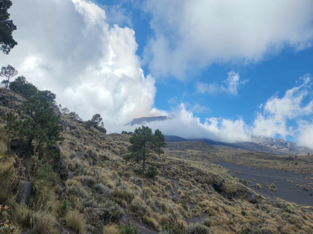
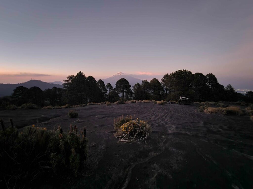
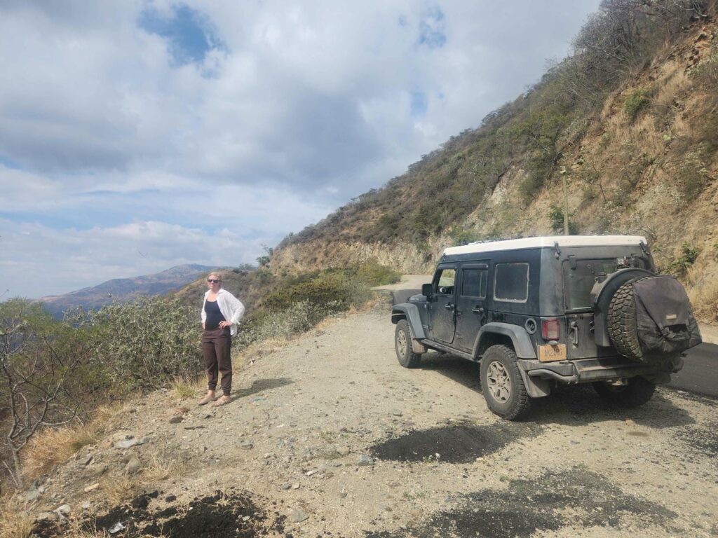
The rest of our drive that day was fairly uneventful- just flat, straight highways through the desert or winding roads through tiny villages. We stopped for groceries at San Martín Texmelucan de Labastid, and headed further south to San Nicolás de Los Ranchos, where we took a wrong turn into the middle of town, where the tiny city streets were almost too narrow for us! Finally getting through, we headed west up into the mountains. This road goes over a saddle between two volcanoes: Popocatépetl, which is active, and Iztaccíhuatl. The high point of the road is the border between the state of Puebla and the State of Mexico, so we would have to stay on the Puebla side. We found a campsite up an old logging road that hasn’t had a vehicle up it in years. It was very brushy, but a good spot to relax after a very long drive day.


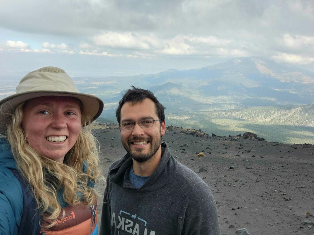
One of the reasons we’d come to this spot is to find the rare Strickland’s Woodpecker, which is very range-restricted and is only found here and in the forests south of Mexico City. I was able to find several in the morning! We liked the area so much that we decided to try and find a better campsite and stay for another day or two. We found a back road on google earth that looked like it would get us close to tree line on Popocatépetl, and after several miles of windy, steep logging roads, we were close to tree line. The trail kept going though, up a sand hill that looked like some side-by-sides had been up. We had to pull out all the stops, but we managed to get the Jeep up the hill, and popped out of the trees right at treeline. We had a ridiculous view of the active volcano, and an amazing campsite for two more nights at 12,900ft. The previous night, we’d heard some booms that we thought were fireworks or construction work in the town way below us in the valley, but the booms were louder up here- they were in fact coming from the volcano! When we got up to the camp spot, it was pretty cloudy, but when the clouds cleared we could see that the booms coincided with belches of steam from the top. It was totally surreal being so close to the top of an actively erupting volcano- I calculated that as the crow flies, we were only 2.1 miles from the crater rim!


We had a wonderfully relaxing day, all alone, with the very comforting knowledge that we were miles and miles from the nearest people. We had come a long way up logging roads that looked like they hadn’t been used in a while, and passed absolutely zero other vehicles. We were also confident that there are very few other vehicles that could make it through what we had! We watched the volcano all day, went on a few short walks in the thin air, and watched a movie that night on the laptop.

The next day, we hatched a plan. Popocatépetl is the second tallest mountain in Mexico at 17,883ft in elevation, and though it is illegal to climb due to it actively erupting, we felt safe enough to try to get to 14,000ft. Our camp was right at treeline, and above us the only vegetation was bunches of grass, with rough sand, or really ash, in between. We trudged up through the ash, slowly but surely, pacing ourselves in the thin air. We’d acclimated pretty well in the past few days, camping first at 8,900ft and then at 12,900ft, and we’d also been above 6000ft for much of the past week or two.

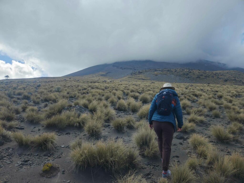

We stopped for a snack at some crazy volcanic boulders, then continued. We soon made it to 14,000ft, and realized that we could quite easily exceed the elevation of Mt. Whitney in California at 14,505ft, the tallest mountain in the lower 48 states.


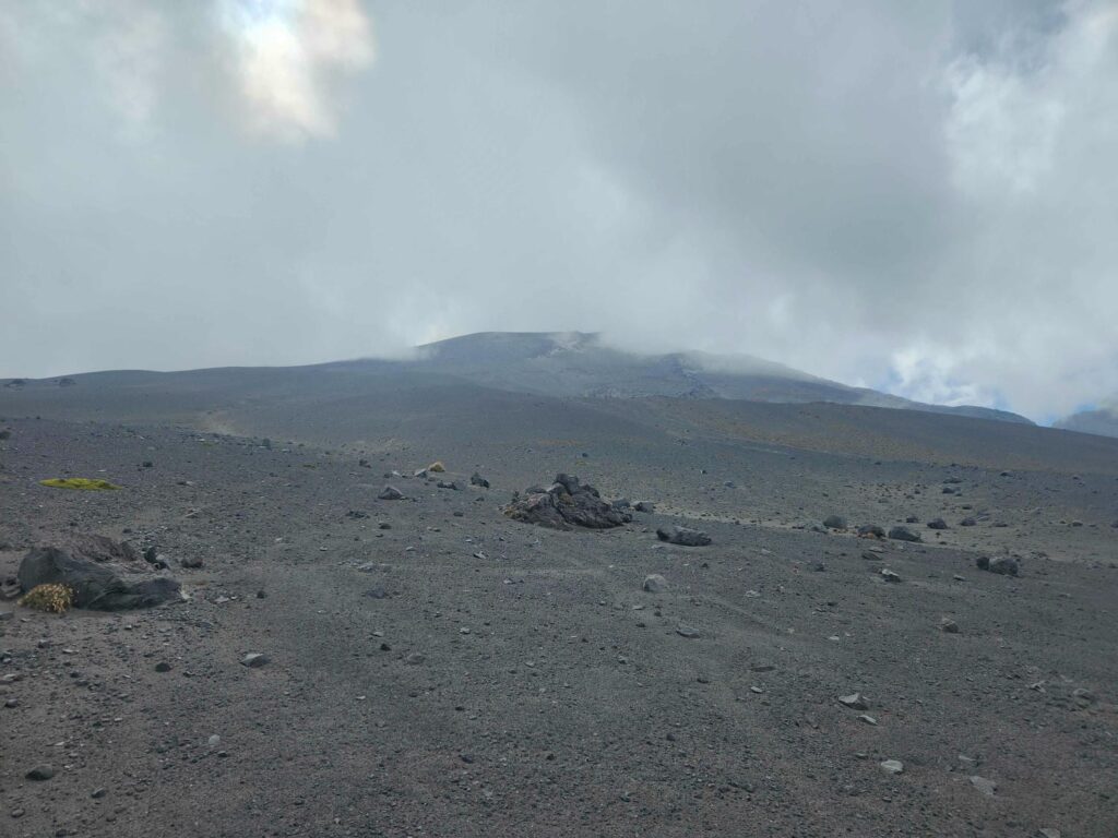
It took us another half hour or so, but we made it all the way up to 14,578ft. Our view down to the northeast was spectacular. We could see the town of Puebla, Volcan de Malinche 40 miles away, and we even caught glimpses through the smog of Pico de Orizaba, the tallest mountain in Mexico, 90 miles away.


We had a very slow rest of the day, but we were both very surprised at how good we felt after being that high up. We definitely could feel the thicker air 1600ft lower though! The next morning we packed up and headed back down. We had a beautiful drive back through the pine forest to the main road, and then headed into Puebla.


We drove into the outskirts of town and visited the Cholula Pyramid, the largest pyramid by volume in the world. It isn’t as tall as the Egyptian pyramids, but it is much, much wider! The Spanish had subtly plopped a church down right on the top of the pyramid when they conquered the area, and it was open to walk through. It was a beautiful church, and had an amazing view over the whole area. Through the smog, we were able to see Popocatépetl belching steam, and it was pretty neat knowing we had been up on the slopes just 24 hours before!
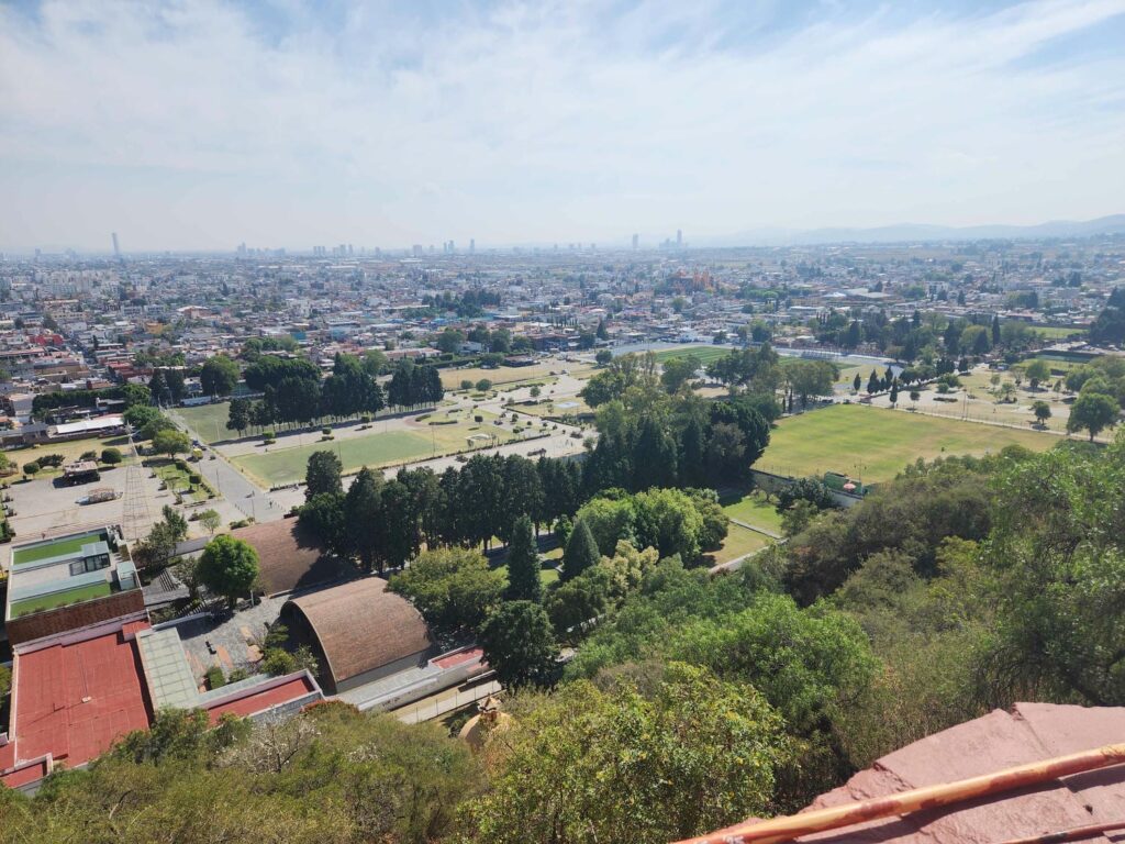

After seeing the church, we descended the pyramid all the way down to the bottom. The pyramid is so huge that it really just feels like a small mountain, and due to its age, very little of the stone is visible. I never would have known it was all man-made if not for the uncovered stonework at the bottom of the pyramid. Before Covid, entry to the archeological area included tours through tunnels dug through the middle of the pyramid by archeologists, but they have not been restarted. The fee to enter the aboveground area has not changed though, so we passed and just admired the stonework from through the fence. I hope someday that the whole area is uncovered- it is really a spectacular area, but 95% is under dirt still.
After the pyramid, we dove into downtown Puebla in search of the cheap gas at Costco. It was the busiest Costco I’ve ever seen, and it took us a full half hour to get into the parking lot, fill up with gas, and get back out. The parking lot was an amazing traffic jam with poor Costco workers directing traffic, armed with only a whistle, which seemed to be the only language they knew- a blown whistle meant stop, go, back up, turn left, let this person in, etc, etc. It was total chaos. We were glad to get out of the parking lot and back onto the main road, where we headed southeast out of town. We camped in a desert wash a few hours to the southeast near the intersection of highways 293 and 190 before heading out early the next morning. This was another long drive day, and after miles of winding highways through farms and ranches, and then miles more of stop and go traffic through the valley south of Tehuacán. We camped in a hidden spot above the village of Teotitlán de Flores Magón, just off the road on highway 182. We had gotten here several hours before dark, but it was a great hidden camp spot, and it didn’t look like we’d find anything better if we kept going.

The next day was a beautiful drive through foggy rainforest. We’d been in either desert or dry pine forest for the last week, and being back in a more humid area meant we were driving past waterfalls, massive trees, and fog. The fog was extremely thick, and we missed most of the amazing views that the road promised. We passed innumerable small villages hidden high in the rainforest, all full of people going about their daily lives. We love these small back roads that few people take, and actively seek them out, even if it takes much longer to get to where we’re going. We dropped down into the tropical lowlands, passing farm after farm (mostly sugarcane) and crossed Lake Miguel Aleman, a massive hydroelectric reservoir. We stopped for more groceries in San Juan Bautista Tuxtepec, and headed back south into the mountains on highway 175. Before gaining much elevation, we camped in a large city park area in the village of Vega del Sol.
We planned to do a few things here- laundry, clean the jeep, and relax after 3 long drive days. We did our laundry and had just hung it to dry and started to relax when the rain began. It rained on and off, but mostly on, for the next 48 hours. It was the heavy kind of tropical rain that just soaked us to the bone. We were dry in the jeep as it rained all night, then it stopped for a moment for our breakfast before continuing. It hammered rain all day, and we spent most of it sitting in the jeep or lying down upstairs. We have an awning, but it’s meant more for sun that to keep off torrential rain, and it was fully saturated by mid-morning. I ventured out to look for birds during a small break in the rain that afternoon while Delaney took a well-deserved nap, and I returned fully soaked just before dark. On my way back, I had a frustrating exchange with the park attendant- we had paid 100 pesos for camping the night before to an attendant, but this different one said that the price was now 200 pesos for this next night. The difference is only 5 dollars or so, but I hate getting scammed, and by the looks that the guy’s wife gave him as we were haggling, she knew he was trying to pull a fast one and pocket the difference. There was a severe language barrier, but I told him we would stay the night if the price was 100 pesos, but that we would leave if it was 200. I think that he knew it was close to dark and that he had us in a bind, as most people in Mexico do not drive at night. I didn’t yet know if I was bluffing or not, and I went back to where we were camping and talked to Delaney. She went out herself to talk to the guy as she is much better at haggling, but couldn’t find him, and the people she could find wouldn’t take the 100 pesos she was offering them, saying that we were fine to camp! Now we were really in a pickle- who should we believe? In the end, it started raining hard again, and we spent the night, banking on the unscrupulous attendant not bothering to get soaking wet to come talk to us. Looking back, there may have been such a language barrier that he hadn’t understood we’d already paid for the first night and wanted 200 for both nights. I kind of doubt it, and I am pretty sure that he was a bit tipsy and trying to pocket some extra beer money. In any case, we decided to just leave quietly in the morning. We packed up our laundry that we’d hung out to dry the day before, still soaking wet, and hung it in our makeshift clothesline in the jeep. The gate to the campground, which we had appreciated for keeping people out at night, now kept us in as it was still closed at 7am when we had hoped to make our quiet exit! I stealthily checked back every 20 minutes or so, until it finally opened at 9. We made a swift exit, and didn’t see anyone trying to flag us down. So much for that.


As is the theme for many of the out-of-the-way places we find ourselves, this area was known for being the only place to find a rare bird, the Sumichrast’s Wren. It’s where I had walked to the day before, and now we drove out, 2 hours later than I had hoped. We weren’t able to find one, but we have really begun to appreciate how the spots to find rare birds are often interesting places in their own right. Range-restricted birds are often restricted to a specific habitat, different from all the areas around them, which makes for interesting places to see. It’s also a great way to pick which way to go- there are so many ways to get from A to B, and going to these out-of-the-way places really narrows it down.


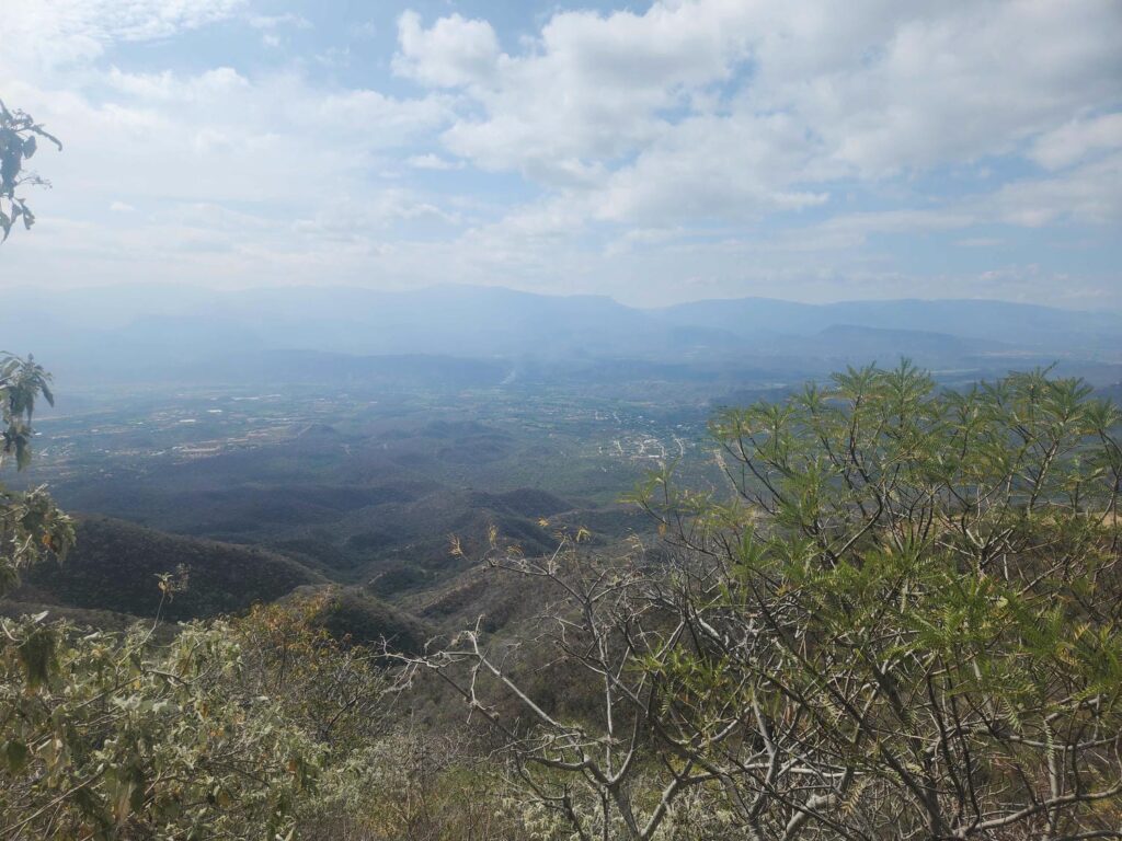
We now drove south on highway 175. This road is another incredibly windy mountain road, going up one side of the Sierra Madre Oriental mountains and down the other into Oaxaca. The top of the pass was nearly 10,000ft, still in crazy thick jungle. We drove through huge tropical vines hanging down into the road, passed plants with leaves as tall and wide as I am, and were treated to amazing views over the jungle landscape that we’d missed through the fog on our previous trip over this mountain range on highway 182. It was a stunning drive. The southwestern slope of the mountains was much drier, and as we descended, it turned into a thick pine forest. We zigzagged down and down through the mountains, steering wheel barely every staying straight, until we came down into the flatlands and pulled into a campsite near the village of Santa Maria del Tule, where we would spend the next 5 nights.
Thoroughly enjoy this amazing travelog and all the great pictures.
You two are great.
Thanks Marc! Some great history down here. You’d love it.