We’d only spent 7 nights in Belize, but we’d really enjoyed the laid-back nature of the country. Everything seemed to move just a little bit slower than Mexico. At the border crossing to Guatemala just west of San Ignacio, we got our passports stamped out, and then canceled our TIP. We then drove across the border and parked at the immigration office, where we were quickly stamped into Guatemala. Then came the vehicle paperwork- a bit more difficult. We first needed a copy of our newly-stamped passports for the Aduana office, which we managed at a tiny copy-shop across the street past a throng of waiting taxis. We then took this copy, as well as copies of my driver’s license, vehicle title & registration, and passport to the Aduana office. The ladies at the Aduana spoke no English, but we were still able to have a fun conversation about how cold Alaska is. They were all bundled up in sweaters, but it was over 70 degrees out, and we were in shorts and t-shirts! They told us that this was about as cold as it gets here, and that they were freezing!
After about an hour and a half after we’d arrived at the Belize side of the border, we were into Guatemala! We restocked on food in the busy town of Melchor de Mencos, but we struggled a bit to find an ATM to get some Guatemalan Quetzals, as their currency is called. It is named after the national bird, the Resplendent Quetzal, a spectacular green bird of the humid forests here. We were able to kill two birds with one stone (not quetzals fortunately) as we finally found an ATM where we filled up with gas. Belize’s gas is quite expensive, around $5.50 a gallon, and Guatemala’s is relatively cheaper, at $4 a gallon. We’d managed to avoid buying any gas at all in Belize, thanks to our fantastic fuel range.
Now that we’d loaded up on cash, food, and gas, we were ready to go adventure! We drove west until we hit our turnoff, a rough road that led into the Peten jungle and to the Mayan city of Yaxha (pronounced yash-ah). I’d hoped to drive further into the jungle on a 4×4 route to another Mayan city, Nakum, but apparently that was only allowed during February-May, the driest time of year. It seemed plenty dry to us; there was barely any mud around. One of the guys at the entrance station seemed to tell the guy in charge, “look at their vehicle, they can make it no problem,” but he was overruled- they must be under strict orders not to let anyone through until a certain date.


Yaxha is situated on the north side of Yaxha Lake, a large lake that seemed to have risen in recent years- there were tons of submerged and dead trees lining the entire lakeshore. Yaxha has an official campsite, but most of it is now underwater! They’ve built some new tent platforms which look very nice, but we struggled a bit to get the jeep leveled out. After we’d found a good parking spot, we headed into the ruins. It was nearly 3pm, but Yaxha was a smaller site than some of the others we’d been to, so we figured we’d make it back to the jeep in plenty of time before dark.
Yaxha was much like many of the other Mayan ruins we’d been to, though each seems to have a specific quirk- Yaxha’s was the massive causeways. There were flat boulevards, as wide as a modern highway, leading in between major buildings throughout the site. Every Mayan city had these, and some are even miles long between different cities, but the ones here were very well preserved and easy to see in the dense jungle vegetation. There is also a massive causeway from the city down to the lake, which was used to access a small port. This port was used to trade with Topoxte, a Mayan city on an island in the lake, and probably other smaller settlements around the lakeshore.


Yaxha also had more monkeys around than any of the other sites we’d been to so far. We barely went a minute without hearing a howler monkey, and we sat on top of a pyramid and watched a group of 20 or so spider monkeys playing, eating, and chasing each other around the treetops. There were also quite a few parrots flying around and making quite the racket- between the howler monkeys and parrots, it was hard to talk sometimes!
The causeway down to the lake was the last part of Yaxha that we visited, and we’d hoped to follow a trail along the lakeshore back to our campsite, but the recent lake level rise had submerged the trail. We found a small less-defined trail a bit higher up which fortunately led to where we wanted to go. We were hot and sweaty enough to jump in the lake, which is unfortunately not allowed- there are crocodiles! It seems one nearly killed a Dutch tourist in 2018. We had a hot but good night’s sleep, and a bit of a lazy morning, as we had only a 2-hour drive today, to perhaps the most famous of any of the Mayan cities: Tikal.


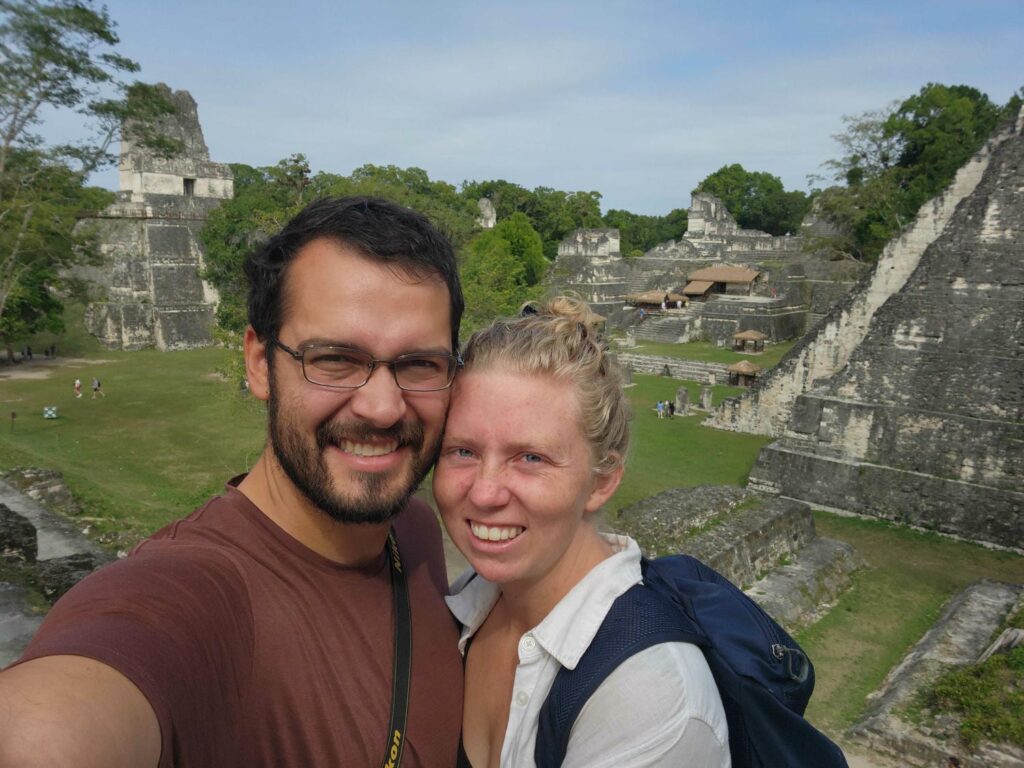
Tikal is the crown jewel of Guatemala’s tourist attractions. It is the largest, best-known, and was the most politically and militarily powerful of all the ancient Mayan cities. It lies in the center of the Peten jungle in the northern part of the country. As we drove closer, we could tell that the area was getting more and more touristy. It seemed that every little shop on the side of the road was oriented not towards local commerce, but rather tourism. We made it to the entrance station and purchased our entry tickets. It was interesting to see the difference in paperwork between Mexico and Guatemala- for Calakmul, a similar site in a very similar place, our tickets were very simple to purchase. Here, it must have taken 20 minutes for the clerk to put together our 3 tickets each- one for camping, one for the road, and one for entrance to the ruins. She even needed our passport numbers, which we hadn’t encountered before. Each ticket was stamped and copied, with the copies filed away at their office at the entrance.
Tickets finally in hand, we drove slowly down the nicely paved road into the jungle. Our time was recorded when we left the entrance station, and it was recorded again when we reached the end of the road half an hour later, to make sure we hadn’t been speeding! They are quite serious about enforcing the 40kph speed limit. We parked in a large open field that had been set aside for camping, and soon met some other travelers- backpackers from the Netherlands (Maite and Pim), Germany (David), and Poland (Sara). We all went out for dinner together and had a great time getting to know each other. We’ve both found it interesting that when we meet other non-Hispanic tourists, they are almost never Americans. We generally only meet other tourists at major tourist attractions like this one, but they are almost always German, Dutch, or Swiss.
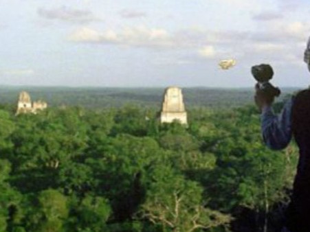
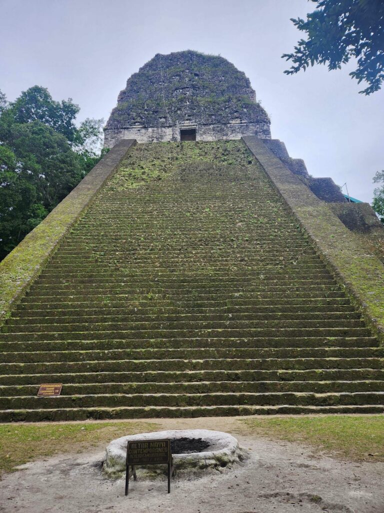
The next morning, we got up early to be at the entrance gate when it opened at 6am. It was still nearly dark, but we quickly made our way to the main section of the ruins, hoping to be there before too many other tourists arrived. There are 6 main pyramids, or temples at the site, and Temple IV is the tallest and most famous. Of the 6 pyramids, this is the only one that is climbable, so it is very popular. We hurried there, all the way to the far side of the site, and climbed up to a magnificent view over the jungle canopy. This temple is 230ft tall, and one of the tallest pre-Colombian structures in the Americas. It is surpassed only by one pyramid near Mexico City and two other Mayan pyramids in the Yucatan lowlands, each only taller by a few feet.
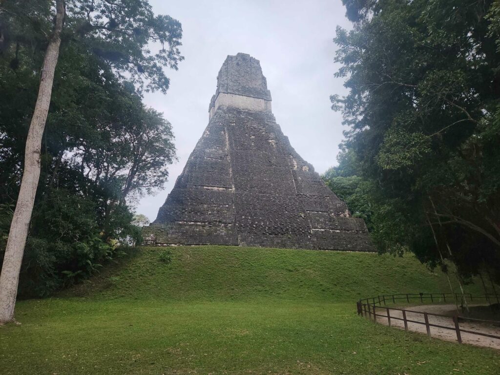


Temple IV is famous for another reason- a scene from the first Star Wars movie, A New Hope, was filmed from the top. I’m not a huge Star Wars buff, but it was pretty cool to see the exact same view as in the movie, looking at some of the other temples peeking through the jungle canopy. We’d made sure to watch A New Hope the night before, so the movie was fresh in our minds! The scene is of the Millenium Falcon coming in for a landing at the rebel base on Yavin 4 after the Death Star was destroyed.

We spent a while up on top of the temple, looking out on the canopy before. We watched all sorts of wildlife below- toucans quietly eating fruit, parrots noisily chattering away at each other, spider monkeys squabbling, and a lone howler monkey slowly waking up. The other tourists we’d met the night before were also here, so we all enjoyed the majestic scene together. I noticed a falcon fly up and land on the top of the temple behind us, and I assumed it was a Bat Falcon, which are common at many of the Mayan sites. I snapped a few pictures of it and didn’t think much of it. Later on, after talking to a few excited other tourists, I learned that it was an extremely rare Orange-Breasted Falcon. The species is widely distributed through Central and South America, but in very low numbers, making it extremely hard to find. I was very lucky!


After Temple IV, we wandered through the rest of the site. Tikal is an absolutely massive site, and it took us most of the day to see all the palaces, temples, acropolises, and other buildings. The six temples were of different construction to most of the others we’d seen- for one, they are very well preserved, with much of the complex and fragile “roof comb” still intact on their roofs, unlike most of the other ruins we’d been to.

The pyramids were also much steeper and taller than the other sites we’d been to. Caracol remains our favorite site, but Tikal is undoubtedly the most impressive. The scale of the ruins, especially the pyramids, is just mind boggling. It makes sense, as Tikal was usually the most powerful of all the Mayan cities throughout its history, but it was still stunning to see just how much rock had been stacked up to form the buildings. It is also crazy to learn that only 15% or so of the city has been excavated!

After wandering the ruins all day, we made our way back to the jeep and had a quick lunch. We weren’t done for the day yet- we’d made plans to visit the ruin of Uaxactun (pronounced wah-shock-tun), further into the jungle. After a bit of paperwork to allow our vehicle to drive the road, we were able to drive right through the entrance station to Tikal, amid throngs of tourists. We definitely got some strange looks, but this was the road! We finally got off the trail to Tikal a few hundred yards later, and began a slow drive through the jungle. The road had been paved at one point, but there were large sections of potholes and missing pavement.


Very few tourists visit Uaxactun compared to Tikal, which was part of our excitement in visiting it. We also really wanted to drive a smaller road through the Peten jungle, where we could easily stop and look at stuff without worrying about other traffic. Both the road to Yaxha and the road to Tikal were busy roads, which kept a lot of the wildlife away. We’d hoped that the road to Nakum would provide us with a slower drive through the jungle, but this would have to do!
After 10 or so miles, we turned off to a large observation tower which we’d heard you could see Tikal from. We parked at the base of the rickety metal tower (complete with slack guylines) and carefully climbed up and up until we were above the jungle canopy. We were amazed at the view of Tikal- only a few of the highest temples were visible, but they were in perfect relief on the horizon. We watched a few spider monkeys climbing around at eye level, as well as a few different kinds of parrots, before climbing back down and turning in for the night.


We enjoyed a bit of a lazy morning, before we heard a bus stopping at the entrance to the short road to the tower. We hopped out of the jeep and greeted the man that was walking up the path. The day before, we’d met a Swiss couple heading away from Uaxactun, who after a short discussion of life on the road, had asked us to apologize to a German named Andres for them. He was staying at Uaxactun and they had mistakenly told him that the observation tower was only a kilometer or two from the village, when it was actually well over 5km. I greeted the man walking up to the observation tower and asked him in Spanish where he was from- he replied “Alemán”, which is Spanish for “Germany”. I then asked if his name was Andres, and he looked like he’d seen a ghost! How did this person in the middle of the jungle know his name!? I then explained what had happened, and he said that he’d been warned by someone else in the village to just take the once-daily bus between Tikal and Uaxactun, so he fortunately hadn’t tried to walk all the way to the tower. He was planning on walking all the way back to Uaxactun, so after he enjoyed the tower and we made breakfast, we gave him a ride back to the village.


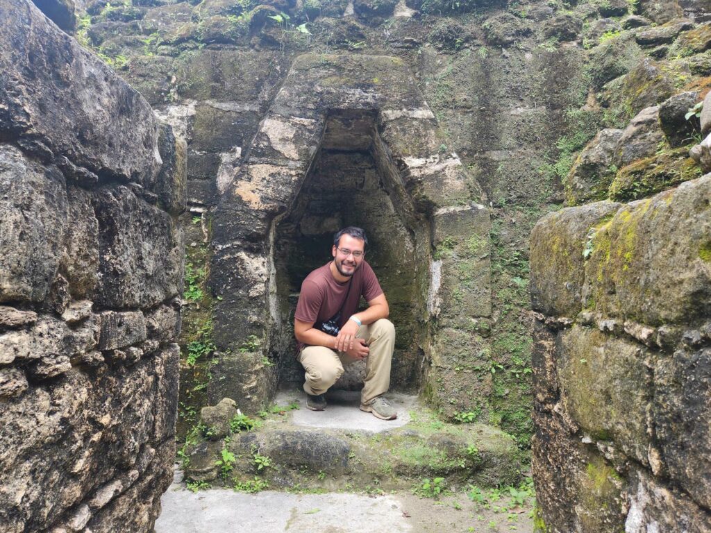
Uaxactun is a large and spread-out Mayan ruin. It is only about 15 miles from Tikal, and the two cities were closely entwined. During the original exploration of the site in the 1930s, before a road was built, the only way to access the site was a small airstrip carved out of the jungle. Lots of local labor was hired from cities further south to help excavate the site, and the descendants of those laborers now live in the town of Uaxactun, which is built around the now-defunct airstrip. The city is centered between 5 or 6 different groups of ruins, and we only visited two of them. The ruins are not nearly as impressive as Tikal or really any of the other sites we’d been to thus far, but they were very well cared for. There were some signs in both Spanish and English, which hadn’t been particularly common at any of the other sites we’d seen. The locals had also done a great job keeping the underbrush down, which meant that the ruins were more visible than some of the others we’d seen. There were also a great number of stelae scattered all around the site.


One building in particular was the most interesting to us- it was the most intact of any non-temple building we’d seen so far. It still had a roof over a large portion of the building. In most of the sites we’d been to, the roof had long since collapsed, with just waist or shoulder-height walls remaining. Here there were six completely intact rooms, in pitch darkness! We moved through carefully to not disturb the bats roosting on the ceiling, and made our way to the back of the building, where there was a stairway which was only accessible by going through the building interior. We climbed up the stairway and back out to the sunshine, where we continued climbing up to the top of the building. It wasn’t nearly as tall as some of the others we’d been on top, but we were fascinated by the need to go through the interior of building to get to the top, which was different than all the other buildings we’d seen at any of the ruins.


We only needed around two hours to see the whole site, so we headed back to Tikal. We pushed our way back through the throngs of tourists entering Tikal and were let back through the entrance gate. After a long slow drive back to the edge of the jungle, we needed a food restock. We’d been in Guatemala for 4 days now, and still hadn’t really stocked up on groceries, so we headed for Flores, the largest city in northern Guatemala. There was supposedly a “mayan market” here, which sounded pretty touristy to me, but local fruits and veggies are always way cheaper than grocery stores. Right before getting to Flores, we were waylaid by a McDonald’s sign- the first one we’d seen since the U.S.! It was in the middle of a massive shopping center, with all sorts of American fast food- Little Caesars, Starbucks, KFC, Wendys, Pizza Hut, and Taco Bell! It seems that so many tourists come through Flores on their way to Tikal that it has spawned a full-sized American-style shopping plaza here. We couldn’t help ourselves and enjoyed a great lunch in McDonald’s. It was totally bizarre, and the interior of the McDonald’s was just like the ones in the U.S., only nicer and cleaner.
We stocked up on groceries in the massive grocery store on the other side of the parking lot, before grabbing a pair of Little Caesar pizzas to go. We drove several hours south through flat farmland, only interrupted by a short ferry. There were several flat-decked ships working together to get the highway traffic across the wide river, each which would fit perhaps 8 vehicles. It was very amusing to see that each ferry was powered by no more than a single 40hp outboard motor! We found camping at the edge of Lake Petexbatun. The spot was really just a boat launch, and the guys there said that it was totally fine and safe to camp. They were really friendly and we had a short conversation with the help of Google Translate about our life on the road, and their life here. They told us that there are some villages on the other side of the lake that aren’t accessible by road, so the boat launch connects them to the road system. There is also a Mayan site on the other side of the lake, Aguateca, which is famous for all the artifacts left behind- it seems the city was abandoned rapidly ahead of an invasion, with people leaving all sorts of food, tools, and other daily objects behind. Much of archaeologists’ knowledge about the daily life of ordinary Mayans comes from this site.


The next morning, we headed south, and soon saw mountains on the horizon. We hadn’t seen any real mountains since leaving Palenque in Chiapas, 2 weeks earlier! We were very glad to be finally leaving the tropical lowlands, headed for cooler temperatures at higher elevation. After an ill-advised shortcut suggested by Google Maps just before reaching Coban, we were on a beautiful highway headed east through the central Guatemalan mountains. After several hours of steep and ridiculously curvy roads, we reached the parking lot for Semuc Champey.
Semuc Champey is a collection of brilliantly blue swimming holes at the bottom of a steep valley. They are well-known but very difficult to visit, as they really aren’t near anything else, and until recently, the access road was in atrocious shape. We were thankful that we had our own vehicle and didn’t have to sit on a bus for hours and hours from Guatemala City, as most other tourists do! Upon entering the parking lot, we were immediately beset on all sides by children trying to sell us things. We’ve experienced this before, but never this persistently. They needed to be told no at least five times before giving up. After shooing all the kids away, we packed up a backpack, paid our entrance fee, and headed down the trail. The trail is a loop, with one fork leading down to the pools, with the other leading up to a viewpoint. We decided to visit the viewpoint first, thinking that after our hike we could cool off in the pools. We are glad we did, as the viewpoint, or mirador, was a long way up! The trail basically climbed up a cliff, with wooden staircase after wooden staircase leading higher and higher. Every few hundred yards, there would be a vendor of some sort selling drinks or fruit. These vendors, too, were incredibly persistent! It felt so rude, but we finally stopped even replying to them, just ignoring them and walking past. After a much longer and more strenuous hike than we were expecting, we came to the viewpoint. We were way above the valley floor, and the view of the pools below was exquisite, and well worth the climb. We could hardly wait to get down and jump in!


After a long descent down more wooden staircases than we could count, we got down to the pools. The pools are at the bottom of the valley, and extend for about a quarter mile, each one spilling into the next. We were stunned to find out that the river in the valley floor goes underneath into a cave. The pools are really on top of a limestone “bridge”, reaching from one side of the valley to the other, with a torrential river running beneath it all. Just a trickle stays aboveground, which feeds all the pools.We quickly changed and jumped in. I was expecting the water to be a bit chillier than it was, as the day really hadn’t been that warm, but the pools were the perfect temperature. We spent a few hours swimming, jumping from pool to pool, and exploring all the neat limestone formations. The water was a ridiculous shade of blue, and it totally felt like a jungle paradise.


All finished swimming, we began the climb back up to the parking lot. We found gigantic black, yellow, and red caterpillar on the way back up, which looked quite poisonous! When we got back into the parking lot, we were again accosted by children trying to sell us chocolates, touristy knick-knacks, and food. It was really quite frustrating, but our anger was more with the parents of these kids who have certainly put them up to it- cute kids are better salesmen than adults. Delaney experienced this in Malawi during her Peace Corps service- parents would even keep their kids out of school to do the same thing. The next morning while making breakfast, we were able to get some of the kids out of “sales” mode, and we taught them some English words, while they taught us some Spanish.


Back on the road, we retraced our steps back west towards Coban, with amazing mountain views. After passing through Coban, we headed west on Highway 7W, which was beautiful but in really terrible shape. We made pretty slow progress. We had a couple camping spots scoped out for the night, and one in particular looked very promising. We just had to get there! It was up on top of a mountain ridge, on the far side of the valley from us. We tried to get down across the river at the town of Uspantan, but the road was closed to rebuild the bridge. I asked the foreman if there was an alternate way around, and he tried to show me on the map on my phone, but he couldn’t find it- none of the locals use maps around here! I was a bit dejected, but another few miles down the highway, there was another bridge. I figured we may as well see if it led to where we wanted to go! After some very steep and tight roads, we found our way to the far side of the bridge we’d originally tried to get across! We were elated, but only a few hundred yards later, there was an excavator in the road making it wider. We waited nearly 45 minutes for it to let us by, and it was well worth the wait- another few miles down a two-track and we were at the campsite. It was high in a pine forest, with no farms or people nearby. This is quite rare in Guatemala- the population density isn’t super high, but the population is very spread out. There are very few back roads that don’t lead to a house or a locked gate.
We ended up spending two glorious days here. Other than a few pickup trucks and dirtbikes on the next ridge over, we saw no one. The weather was perfect- sunny but cool at our high altitude, with a nice breeze. We hiked around a little bit to an amazing view of the town of Uspantan, but other than that we stayed put, enjoying the solitude. We were very sad to leave!


We now had a decision to make. We had to meet Delaney’s friend Brooke and her boyfriend Kevin in Antigua in six days. We could either go straight to the beautiful Lake Atitlan for the next six days, or we could drive way out of our way to go see a rare bird, and spend four days at Lake Atitlan instead. Can you guess which we chose?
It was a long drive, but beautiful. We climbed higher and higher through beautiful pine forests and tiny mountain villages. We were delayed for an hour or so just north of Chiantla due to road construction, but we eventually made it to the Sierra de los Cuchumantes, a sort of national park. We wanted to camp at Ordonez Lake, at the center of the park, but there was a gate across the road. We headed back into the dusty little mountain town and asked the old lady at the tiny store who we could get the key from. She didn’t really speak Spanish or English- the locals in some of these isolated towns still speak in one of the many Mayan languages or dialects. She did call someone and then tell us “media hora”, which means half an hour, so we went back up to the gate and waited. Only about 10 minutes later, a young man rode up on a dirt bike, collected our entrance fee, and opened the gate for us. We told him that we’d spend two nights here, and he gave us his number so that we could text him when we wanted to leave.
We continued past the gate on a rough 4×4 road through a beautiful pine forest. It looked a lot like Montana or Idaho, with massive pine trees interspersed with grassy meadows. We made our way to the lake, which was unfortunately completely dry this time of year. We set up camp and made dinner before hopping in bed- it was very cold here, down to 40F by 8pm! Our camp was at just over 12,000ft, which was the 2nd reason we’d come here, other than the bird. We were going to climb a volcano with Brooke and Kevin, and we needed all the high-altitude acclimatization we could get! We’ve both found that hiking at altitude helps, but that the best way to acclimatize quickly is to sleep at elevation. So really… we hadn’t come here just for the bird.


Soon after we laid down in the jeep, the wind picked up and continued all night. We were warm enough, but only just! It dropped below freezing overnight, and we were very glad to have our cold-weather gear with us. We woke up to a thick layer of fog and mist, with the wind still blowing. It was very chilly, but I sure wanted to find the bird, and Delaney is thankfully always up for a hike! We geared up, putting on long underwear, down jackets, and our raingear, before starting off into the wet, foggy, and blustery morning.


We really didn’t find a whole lot of anything for the first hour or two, as the wind was too strong for any small animals to come out. We did come across an abandoned field of potatoes, the plants long dead, fallen, and dried out. We dug three potatoes out and tossed them in our backpack, planning on making them for dinner. Nothing like a hearty potato on a cold windy day! The wind finally started to ease up, and the fog and rain slowed as well. Delaney startled up a pair of quail, which we tried to refind off the trail, when I heard a small bird in a tree further off. I soon spotted it- a small bundle of black feathers, with yellow and white patches: Goldman’s Warbler! Its entire population is restricted to this tiny high-altitude mountain range, which measures roughly 10 miles long by 3 miles wide. It is closely related to the migratory Yellow-Rumped Warbler, which can be found all over the U.S. and Canada in the summer, but Goldman’s Warbler stays here in this tiny slice of habitat year-round. I was elated to have found it after a discouraging morning!


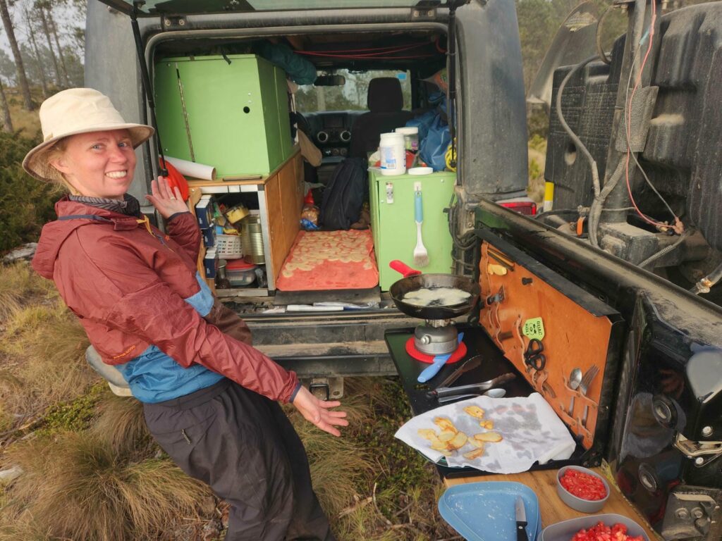
We were really enjoying hiking through the wilderness, and the weather continued to improve, so we kept exploring. Some of this area seems to have been farmed a while ago, but there was little evidence of recent activity. We explored all over for most of the day, finding several more Goldman’s Warblers. Back at the jeep, we moved to an area that was a bit more sheltered from the wind. It also had a much better view of the surrounding mountains! That night, Delaney sliced up all three potatoes, soaked them in water, and then spread them out to dry on one of our towels. We then fried them in coconut oil- homemade potato chips! We’d planned on having them for a snack for our long drive day to Lake Atitlan in the morning, but none of the chips survived more than about 20 minutes after they were all done. Warm potato chips are just incredible, and we’ll definitely be making them again.

Delaney went for a short hike in the morning as I slept in- I really hadn’t slept well either of the last two nights up at 12,000ft. We texted the young man with the key as we left the campsite, and then waited at the gate for over half an hour, texting him a few more times. There were some other phone numbers on a sign near the gate, and none of those replied either. Fortunately, someone from the village must have seen our windshield glinting or something, and just as we were about to hike the mile or two down, a different person with a key thankfully came up on a dirt bike and let us out.

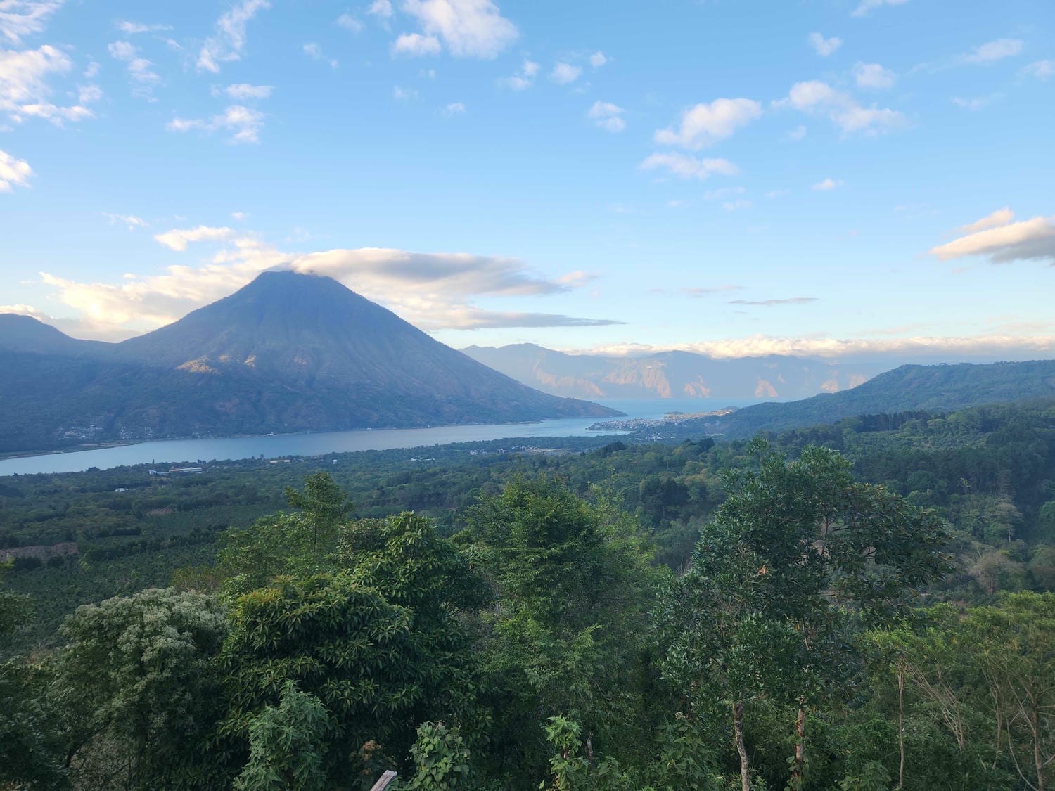
Our planned drive for the day was only about 115 miles, but it took us nearly 7 hours. Between congested cities, road construction, and getting stuck behind slow trucks on steep mountain roads, it took us all day to get to Lake Atitlan. It was worth the wait though- Lake Atitlan is a huge lake in an ancient and massive volcanic caldera, surrounded by several smaller volcanoes. We’d planned to stay in a campground we’d found online, but when we arrived the gate was closed with no one around. We fortunately found a backup spot on a ridgetop with amazing views of both the lake, and to the south of us towards the Pacific Ocean. We couldn’t quite see all the way to the ocean due to fog, but we knew it was out there, way below us!


Our camp spot was really just in a parking lot on the side of the road, but traffic was very light overnight and we slept well. In the morning, we began a hike up Volcan Atitlan, a massive volcano. The trail is beautiful and goes straight up the mountain. It passes first through fields of coffee plants, followed by undisturbed jungle further up. Many people start the climb early in the morning to see the sunrise, but we had started much later, and weren’t really aiming to get all the way up. We were unsurprisingly here to find more birds!


This mountain is one of the best places in Guatemala to find the Resplendent Quetzal, the national bird. It is brilliantly green, and the males have extremely long and flowy tail feathers, twice the length of its own body! Despite lots of searching, we didn’t find one- but we did find the much rarer Horned Guan, which can only be found on a few volcanic mountaintops here in south-western Guatemala and southern Chiapas. We obliviously walked right under it, looking out at a viewpoint, before I noticed the gangly black-and-white turkey-sized bird in the trees behind us. At first I couldn’t believe it- this bird is so rare, even in the prime habitat that we were in, that I hadn’t even mentioned it to Delaney to be on the lookout for it. But there it was- black with a white belly and white tail stripe, with a bright red “horn” on its forehead. We watched it clamber around in the branches for a few minutes, before seeing another one climb into view. I really couldn’t believe we’d actually found one, much less two. We never did find the Quetzal!


We made good time back to the trailhead, and found lunch in the nearby town of Santiago, sweaty and sore. We spent the rest of the day and night at a nearby beach, Playa Cerro de Oro. The next morning, we drove a short distance to a nature reserve, where we walked around near the lake on some shady trails. Delaney’s Uncle Mike had passed away the week before, and we watched a livestream of his funeral while looking out over the lake. Watching a funeral virtually was a good reminder of some of the things we have given up by being on the road- being around family when it matters most.


That afternoon, we drove from the south side of the lake to the north-east side, to the city of Panajachel. We camped up at a well-known tourist camp spot, an old soccer field right on the lake. We spent the rest of the day relaxing and watching all the tiny boats criss-cross all over the lake. Many of the villages along the lakeside are only accessible by boat, which reminded us a lot of the villages in Alaska we’ve worked in. Thought it’s quite popular for tourists to visit one of the villages, we chose not to- we’d already driven all the way around the lake and it didn’t make sense to take a boat back across.
The next morning we decided to do touristy things and walked a few miles to a breakfast spot our friend Tevin, whom we’d met in Oaxaca, had suggested. It was fantastic, especially a spicy salsa that reminded us of Thai chili sauce. It is made from the Chiltepe pepper, which is supposedly the “mother of all peppers,” the original pepper from which all others have been bred and cultivated. It was very spicy, oily, and garlicy, and we both loved it. After breakfast, we walked further up the street and unwittingly walked into the “tourist” district of town. All sorts of vendors would yell at us and try to sell us things, especially some older women who were incredibly persistent in attempting to sell us some beautiful cloth- one of them came up to us three times in 15 minutes, despite our firm “NO” each time. We wandered through the tourist market for a while, mostly browsing. We did stop and buy a beautiful belt for me- I’ve lost a little weight since leaving Alaska and some of my pants don’t stay up anymore! The sad lack of my beloved Cheeze-Its south of the U.S. has some positives, I suppose.


We met some of the other travelers in our campsite when we returned from our morning walk- a family of Colombians who’ve lived in the U.S. for the last decade or so, and were now living on the road in a large RV! We had a wonderful time getting to know them, and hope we see them down south somewhere, as they have roughly the same plan as us of being in Patagonia at the end of this year or early next. After a day or two of talking with them on and off, they told us that they have a YouTube channel, Los Sagi, with over a million subscribers. They showed us their gold plaque that YouTube sent them- so cool to see one in person! We were very jealous of their son and daughter’s Spanish and English skills- perfect with no accent in either language. What a superpower for a trip like this! We hope to see all of them in Alaska someday.
After two relaxing nights in Panajachel, it was finally time for us to meet Brooke and Kevin in Antigua. We arrived in plenty of time and met our friend from Oaxaca, Tevin, for lunch. He’s been staying in Antigua for the last two weeks as his girlfriend Bri travels back to the states for some work obligations. Lunch was excellent, and afterwards we drove off down the cobblestone streets of Antigua to meet Brooke and Kevin at the AirBNB we’d be staying at for the next week. They met us as we drove up, and it was surreal to see a familiar face for the first time since seeing Scott in Mazatlan! The AirBNB had secure parking for the jeep, which was great peace of mind when it would be out of sight for a few days. The place was lovely- a bedroom and bathroom for each of us, plus a kitchen, patio, and rooftop with views of the surrounding volcanoes. We took some much-needed showers and started the first of many loads of laundry while Brooke and Kevin went out to reacquaint themselves with Antigua. They’d lived here for four months last year while Brooke volunteered at a school as an English teacher. We met them for the first of many dinners out together, before having the best sleep either of us had had in a while back at the apartment. We didn’t really have an agenda for the next day beyond packing for a hike the day after that, so we had a lazy morning before going out to brunch. We wandered around town for most of the day, before returning and packing our things to climb Volcan Acatenango.
Along with Antigua, Lake Atitlan, Tikal, and Semuc Champey, Acatenango is one of Guatemala’s top tourist attractions. It provides a close-up view of Volcan Fuego, an active volcano which regularly spits ash and lava into the air. The “thing to do” is hike up and spend the night, watching Fuego belching red-hot lava, before climbing to the top in the early morning to watch the sunrise. It is possible to do the hike without a guide and bring up your own tent, and we probably would have done this if Brooke and Kevin had not come down, but they much preferred the more comfortable accommodations you get with the guide- small cabins at the top! We woke early and walked a few blocks from our apartment to a hostel which had organized the transportation and guide, had breakfast there, and hopped in a van for the hour or so drive to the trailhead. There, we met our guides and began the hike towards the top.


The trail was well-packed dirt, and very dusty. There were lots of small volcanic pebbles on the hard-packed path, which was a bit like hiking on marbles spilled on a tile floor! We soon began meeting hikers from the previous night heading down, which made for a bit of a traffic jam on the steep, narrow trail. Fortunately, with well-timed breaks, we were able to let most of the downhill hikers through. We enjoyed views out to the north and west, even climbing high enough to spy Lake Atitlan through the haze. The trailhead was at 8,406 feet, our camp at 12,037 feet, and the top of Acatenango at 13,045 feet, making for a total of 3,631 feet of elevation gain the first day, which we managed in a bit over four hours, and 4,639 feet in total over the two days.
The scenery turned from coffee plantations, to humid jungle, to finally a pine forest around the top. Just after we entered the pine forest, I spotted a rare Pink-Headed Warbler, which we affectionately dubbed the “donut bird”- it is bright pink, the same color as a frosted donut! Other than the Quetzal, this was the last bird for Guatemala that I really wanted to find, and we’d found it in the last area we were to pass through that it was known to be in. Phew!

After innumerable switchbacks through the pines, the trail finally leveled out a bit, after a punishingly steep grade for the past few hours. We made quick work of the only flat section of the trail we would see, and soon rounded the corner of Acatenango to finally see Fuego up close. It wasn’t long until we reached our cabins- there were three little cabins perched on the side of the mountain, as well as a small “patio” for viewing the action. There were even patio chairs, which we quickly plopped down in after a long hike.


Brooke and Kevin had done this exact same guided trip twice before, with both trips ending in disappointment- fog the first time, and altitude sickness the second, with freezing temperatures both times! This time, the weather was absolutely perfect- not a cloud in the sky. With the sun blazing down, we were soon all in shorts and t-shirts, enjoying the spectacle of a lifetime. Every 10 to 20 minutes, Fuego would erupt with a giant cloud of ash rising thousands of feet. Some of the more violent eruptions would be complete with chunks of rock blown hundreds of feet into the air, which would then hit the flanks of the volcano, sending clouds of ash flying, before tumbling thousands of feet down the slopes, leaving a puff of ash with each bounce. We watched this, uninterrupted, from around 1pm when we arrived, until nearly midnight. The real show began when the sun went down, when we began to see lava erupt along with the ash. We realized that all the chucks of rock we’d seen had actually been molten hot, and with the light of day, we hadn’t seen the glow of lava.
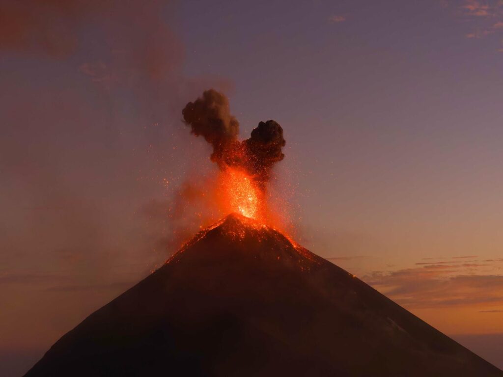
Each night eruption was a fountain of lava spurting from the top, and then tumbling down the slopes. It was absolutely mesmerizing. I’d brought a selection of camera lenses (not just the bird one!) and Kevin had brought his drone. We were able to get some incredible pictures and video footage of the eruptions, despite the difficulty of filming at night. Pictures don’t do it justice- Delaney has uploaded an Instagram video of it, which I’ll link here: Volcanic Sprinkles
We’d half hoped to stay up all night watching the show, but exhaustion soon hit us, and we retreated into the cabins. We had a 4am alarm to begin the hike to the top for sunrise, but Delaney and I were awake 45 minutes early, which we spent staring out at Fuego, still erupting every 10 minutes or so. The previous evening, our guides had told us that we should pack up all our things to climb to the top.


This was unusual, as nearly everyone just hikes to the top with little more than a water bottle, before heading back to camp to gather all their things and hike down. We never got a real explanation due to a bit of a language barrier (our Spanish is still terrible!) but we think it might be because he had seen we’d all been strong hikers the day before. In any case, it meant that we had plenty of time to watch the sunrise at the top! We arrived just as the sky was getting light, and enjoyed some last moments of Fuego’s glowing eruptions before the sun made us unable to see the lava any longer.


One of the guides showed us some vents at the top of Acatenango, which is dormant- they were very warm to the touch! We then headed down the north ridge from the summit, stopping at one of the many craters to explore a small cave. We thought we’d then meet up with the main trail that we’d come up the day before, and battle uphill traffic and volcanic “marbles”, but the guides instead took us down to the northeast. The trail was a wonderful trail to descend- lots of deep sand and gravel made it possible for us to jog most of the way. We kept thinking we’d meet up with the other trail eventually, but we never did! We nearly flew down the trail, stopping only for one final surprise.


The guides had seen my giant camera lens on the way up, and knew that I liked birds. When they stopped on the way down to point one out, I didn’t think much of it- they’d pointed out a few before that were quite common. I was almost a bit annoyed that we’d stopped in the middle of a big downhill section- we were on a roll! I looked up at what they were pointing at, and saw a massive black and white bird perched in the canopy- it was another Horned Guan, the rare bird Delaney and I had seen on Volcan Atitlan a week before! I uttered a very audible “holy sh#t”, as another one flew past us. The guides had never seen one before, despite doing the trail every other day! When I got back to my computer that evening, I quickly posted the list of birds I’d seen on the hike on Ebird (if you don’t know what Ebird is, see my short explanation HERE) knowing that I’d found something rare. I received an email from Ebird the next day, saying that this was the very first time the bird had been seen in this part of the country. Ebird isn’t the end-all-be-all of bird sightings, but this bird had never been reported on this volcano before, and never in this area of Guatemala, despite hundreds of people hiking the trail every day.
Back at the trailhead after less than a 2-hour descent, we met our driver and were shuttled back to the hostel. We walked back to the apartment on shaky legs, showered, and went back out again, walking a few blocks to the most beautiful McDonald’s I’d ever seen. We had a giant victory lunch, enjoying the perfect Antigua weather for hours. That night, we taught Brooke and Kevin our favorite card game, Nertz, which is basically competitive solitaire. Brooke and Kevin took to it like fish to water, and for the next few days, we did little other than play Nertz, walk around town, and sample as many different restaurants as we could. Many of the restaurants, as well as our own rooftop, had amazing views of Fuego, and we watched it erupt over and over again. At night, you can even see the lava from town! The only deviation from our strict regimen of food and Nertz was visiting the school Brooke had taught at. All the kids were very happy to see her again, and they all begged us to play soccer with them at recess, and we happily obliged. There were basketball hoops, and I was hoping to get a game going, but these Guatemalan kids wanted nothing to do with anything but a soccer ball!
We spent more time in Antigua than we’d spent in any one place since leaving Alaska, and we loved every minute of it. Brooke and Kevin had an early flight out, so we said goodbye to them after one final evening of Nertz, before waking up alone in the apartment. We finished packing up the jeep and headed out, not quite sure what we were going to do next! We’d spent 5 nights in a real bed, compared to only 3 nights total since leaving Colorado. We grabbed a quick lunch at the gorgeous McDonald’s, got some groceries, and then settled in to a paid campground just south of town. It was Saturday, and we were going to meet with a mechanic on Monday, so we had two days to kill. Tevin came by that night and we caught up with him- all three of us were sick in some way. He had planned to meet up with us while Brooke and Kevin were still around, but he was just getting over a stomach bug that had put him down for nearly a week. Delaney and I had developed a nasty cough a few days earlier. It was our first time being sick on the road, and we were glad to be in a nice campsite for it.
The next morning, we got up early and hiked from the campsite to a small wildlife reservation just up the road. There, we ran into a French Canadian birder who we’d seen at Tikal, but hadn’t spoke to- too bad! He was on a specifically “birding” trip to Guatemala, and had spent the last 3 weeks crawling all over every corner of the country. We’d found a lot of the same rare birds, but with his intense schedule of doing nothing but birding, he’d found a lot more than me!


After our hike, we walked back into town and met Tevin at a beautiful restaurant and had a great lunch together. It was Super Bowl Sunday, and the outdoor restaurant had a massive projection screen up. It was very odd to see all the football jerseys and hats come out of the woodwork- I think the NFL is becoming more and more popular in Latin America. We chose not to stick around and watch, and instead Tevin gave us a ride back to the campsite. There was a massive birthday party for a young child there, complete with a circus clown, piñata, and loud music, so we mostly holed up in the jeep.
We did notice that there was a new van in the campsite- with Alaska plates! The van’s owners were out, clearly to avoid the blaring and repetitive birthday music, but we went up and introduced ourselves when they returned. They were Craig and Summer, from Anchorage, and we had an amazing number of similarities between us: Summer was from Anchorage, like me, and Craig was from Wyoming, like Delaney. He’d grown up in Laramie and went to UW, graduating a few years before we started. Summer and I had both been engineers in the oil & gas industry, and Craig and Delaney were both environmental engineers! To top it all off, Summer had been a student of my dad’s at Service High School in Anchorage. Instead of driving north to south as we were, they had shipped south 3 ½ years ago, and were on their way north back to Alaska. We will definitely be keeping in touch with them, and plan to see them when we return!
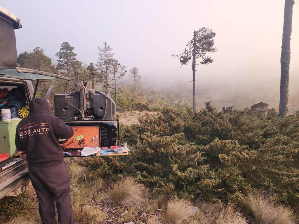
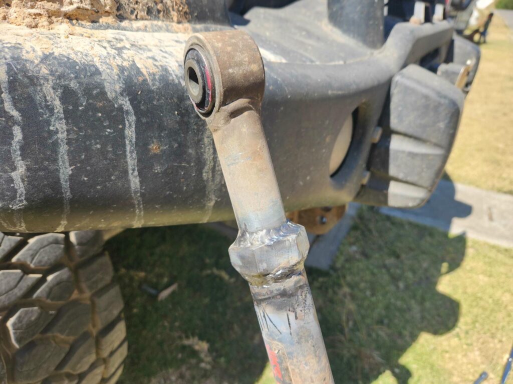
The next morning, we had our appointment with a mechanic. We’d found him online as a recommended mechanic by lots of other travelers passing through, and he operates a shop and campground. Overlanders often have a difficult time with more serious vehicle repairs, as unless the repairs can be completed in one day, their “house” is stuck in a shop! Axel solves this problem by having the shop right next to the campground, so people can stay in their vehicles while work is being done. He and his helper Rodrigo are very well spoken of by other travelers we’d talked to online. Our problem was a loose front track bar- a suspension component that holds the front axle in place. It was an aftermarket part, with a large adjustment nut that had come loose several times over the past month or so. I’d kept cranking it tighter, but the threads were completely blown out at this point, and so I just needed it to be welded together. The nut was only to adjust the length of the bar to accommodate different suspension lift heights, and now that I had mine dialed in, we no longer needed the adjustment! I removed the bar, and Axel did a fantastic job welding it together. It felt great to not have to worry about it anymore- I’d been a bit stressed about it on some of the offroading we’d done looking for campsites in the past weeks.


It was only around 1pm by the time I’d put everything back together, but Axel’s place was so nice that we decided to stay. We also still weren’t feeling great, especially Delaney- I’d had the worst of my cough when we were still at the AirBNB, but this was her worst day. We enjoyed the wonderfully sunny afternoon, the four massive and playful Rhodesian Ridgeback dogs, and the company of a few other overlanders also getting work done- some Germans with a massive Unimog, and a pair of Brazilian vans headed north.
We had a very lazy morning, but were soon on our way south to Volcan Pacaya, another active volcano. We weren’t planning to climb this one, but there is a very interesting 4×4 trail through some lava flows that we just had to explore. Our route to Pacaya took us through the outskirts of Guatemala City, and we were stuck in a small traffic jam for a bit as school was getting out. It is amazing how tight some of the city streets are, and how the locals can get large school buses through!
After weaving through some smaller villages, we aired down the tires and began the trail. It wasn’t a difficult 4×4 trail, but the terrain was fascinating- giant frozen rivers of black lava rock. Pacaya loomed high overhead, with all the black lava streaks leading up and up towards the pointy top of the volcano. Pacaya is still active, but not nearly as much as Volcan Fuego- we only saw one larger eruption with rocks flying, with everything else just being puffs of steam or ash. We eventually found a small sandy side trail, and were able to get to a sandy bowl out of sight of the main trail. No sooner had we gotten out of the jeep, that three young locals on dirt bikes rode up- we’d found the one “hidden” spot on the trail, and had been found in less than five minutes! They were super friendly and curious about the jeep. They looked pretty dusty and thirsty after riding on dirt bikes through the volcanic ash and sand and gladly accepted some water from us.


Delaney still wasn’t feeling great, so we ended up spending two nights here. The first night was perfect weather- cool enough to sleep, but not cold enough to zip up our canvas. We didn’t do much of anything the next day, and enjoyed our first day without being around people in over two weeks. We didn’t sleep nearly as well the second night, with the wind howling all night long, shaking the jeep back and forth. We were in a pretty sheltered spot, but I still couldn’t believe how hard it was blowing. I suppose it’s some good preparation for the famous winds of Patagonia!


We got moving early the next morning and headed east towards the El Salvador border. We were soon on a fabulous 4-lane highway, reaching speeds of nearly 60mph! The vegetation grew increasingly arid as we descended out of the Guatemalan Highlands- we’d been above 5000 feet for well over 2 weeks straight. Soon, we would be in the oppressive heat of El Salvador!