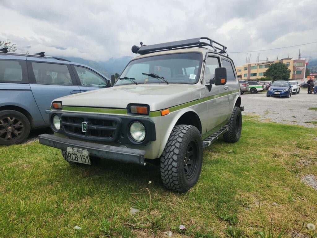
We entered Ecuador the morning of 6/7/26, after spending nearly 3 months in Colombia. The border crossing was pretty easy for us, but Tevin had a small issue canceling his Colombian import permit. The three of us (me, Tevin, and Patricia) all presented our documents to the Colombian aduana, but they couldn’t find Tevin’s permit in the system! The border guard said that this normally would have been a big problem, but since we were traveling together and all of our import documents were from the same person (our importer in Cartagena) and around the same time, he would just let us go. Phew! Fortunately at this border we did not have to show the canceled permit to Ecuador, and getting stamped in and getting new Ecuador TIPs was a breeze. We were soon on our way south, in the 12th country of the trip.
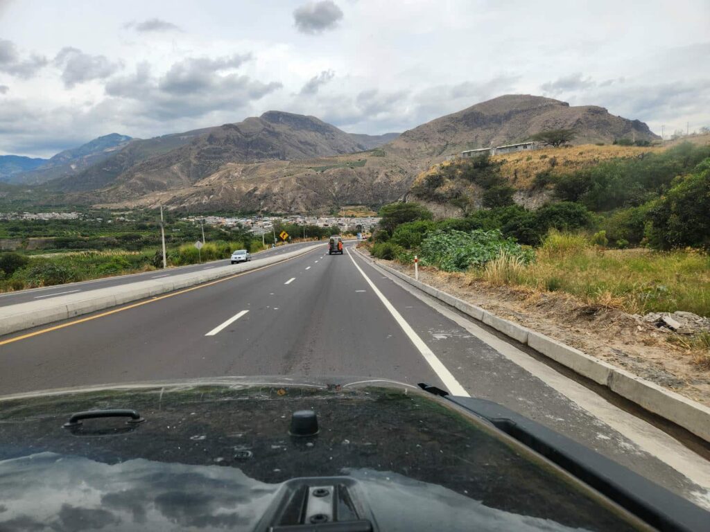
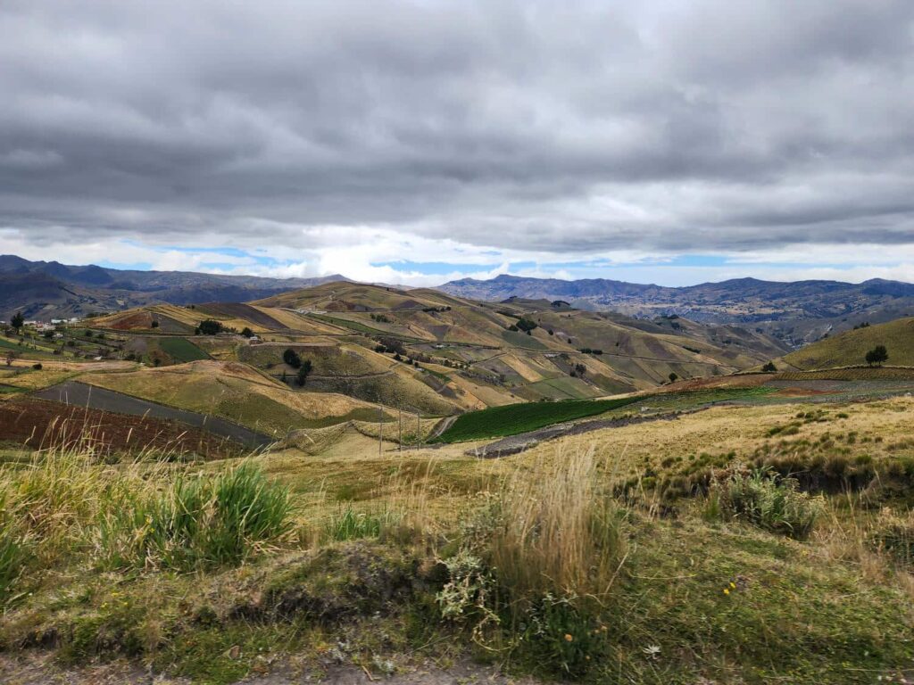
We noticed a few differences between Colombia and Ecuador immediately- even though both countries are ranked about the same as far as GDP, Ecuador has far more infrastructure. I don’t think we saw a single tractor in all of Colombia, but we saw many on our 2-hour drive south, plying the incredibly steep fields. We also saw far more general infrastructure- modern power lines, large irrigation canals, wider streets, etc. The scenery was beautiful- similar to what we’d driven through in Colombia from Pasto to Ipiales, but less populated and a bit dryer. We drove up and down some massive, broad valleys, completely devoid of trees. I’m told that this is what much of the Andes look like, but it was our first time seeing such a treeless and dry environment, which was accentuated by the imposing slopes and ridges. We climbed a long hill, stuck behind some trucks struggling up it at less than 10mph, and found ourselves in Ibarra, the first main town of Ecuador. We all convoyed through town to a large grocery store, where we stocked up, none of us really having been to a decent store in over a week- for us, not since Ibague before we got to Bogota!
The store was massive, modern, and well stocked. The prices were quite varied- you could get a massive ribeye steak for around $8, but a can of whipped cream was a shocking 11$. We restocked on just about everything, including some of those steaks, and loaded everything into the vehicles before stopping at the tantalizing KFC that was next to the grocery store. I had a bad experience with KFC years and years ago, and hadn’t had it since, but it was fantastic. Those in the group who had gone more regularly said that it was the best they’d ever been to. It was absolutely packed with locals- there must have been 100 people in there. We ate in the parking lot next to the vehicles and headed off to our campsite for the night- Finca Sommerwind.
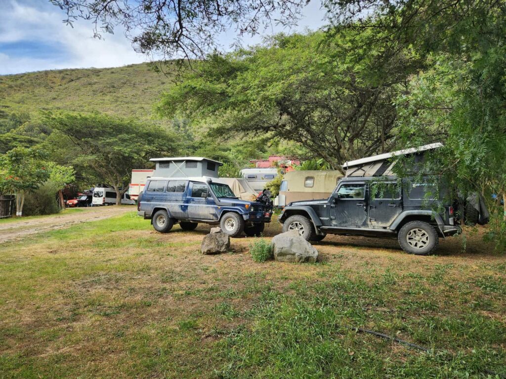
Finca Sommerwind is a well-known overlander campground just outside of Ibarra, owned and run by Hans, a old German ex-pat. He has built up the campground over the years, and now has a full restaurant, beer garden, and bakery, as well as camping, showers, laundry, and vehicle storage. It is quite difficult to pause or extend your TIP in Colombia, so many of the more long-term travelers will leave their vehicles here when they travel back home to work or visit. The vehicle storage area had 20 overlanding vehicles of all kinds in it- from SUVs like ours up to massive Unimogs, Steyrs, and ManKats. We found Karin and Frank’s Hilux there- they’d gone back to the Netherlands to visit family.
We also found something we’d been looking for- a sticker. Many overlanders carry stickers with them, to give to other travelers and locals, as well to stick on “sticker walls” that are fairly ubiquitous at border crossings, campgrounds, and other places- we’ll often find a street sign at a mountain pass or some similar location, absolutely covered in stickers! Most are from locals, and it seems to have started with motorcycle groups, but it has definitely bled over. I was against the whole thing when we left Alaska, but I came around after seeing how common it was, and Delaney brought some back when she came back to Medellin. Anyhow, we’d been looking for a sticker from some very particular travelers: Matt and Stacey of Toyota World Runners. They had done the Pan-Am a few years previously, and made some pretty incredible YouTube videos while doing it. They seemed like some pretty cool people, and had helped out Bri and Tevin quite a bit while they built their first overland rig (long story). Unfortunately, they tragically passed away in an offroading accident in British Colombia in the summer of 2025. We’d been looking out for their sticker the entire trip, and finally found it on Finca Sommerwind’s sticker wall. It was a bit of a somber moment, but also joyful. Matt and Stacey had lived out their dream of doing the Pan-Am, and successfully completed it. We were following in their footsteps, also living out our dreams.
The campground itself was packed, with the same assortment of vehicles. There was a French Iveco there that must have been the largest overlanding vehicle I’ve ever seen- I’m not sure how you would get something like that through the tiny city streets! It must have been 25 feet tall. There were also motorbikes, SUVs, and in the back of the campground, Gerry and Danya in their Blissmobil sprinter, who we’d met in Jardin! We all had a beer that night in the open-air restaurant- Hans keeps an excellent selection of German beer available.
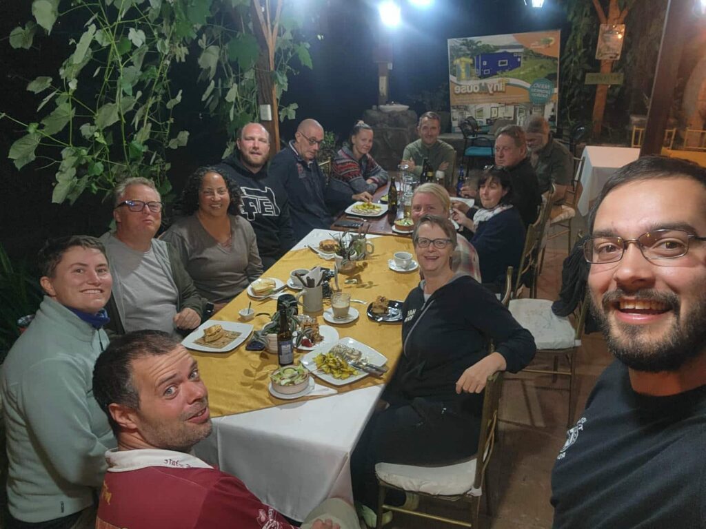
The next day, we mostly sat around the restaurant spending time with each other, meeting other travelers, and enjoying a break after a break-neck travel pace out of Colombia. I’d bought 5 of those giant $9 ribeye steaks at the grocery store, and made them for lunch for the group- they were so large that I had to cook them one at a time, and so thick that it took nearly 15 minutes for each one to finish. Fortunately, everyone was happy to eat in shifts. We finally got a tour of Gerry and Danya’s Blissmobil, which has given me a few ideas for our “retirement rig”. They have so much space compared to us, and even Dan and Patricia in their sprinter. That night, we all ate at the restaurant, as it was Danya’s birthday! Some of the other campers also joined in- I overheard some of the Germans happily remarking that “this would never happen in Germany”. We Americans kept inviting whoever we saw wander into the restaurant to join us! We had a fantastic evening with even better company.

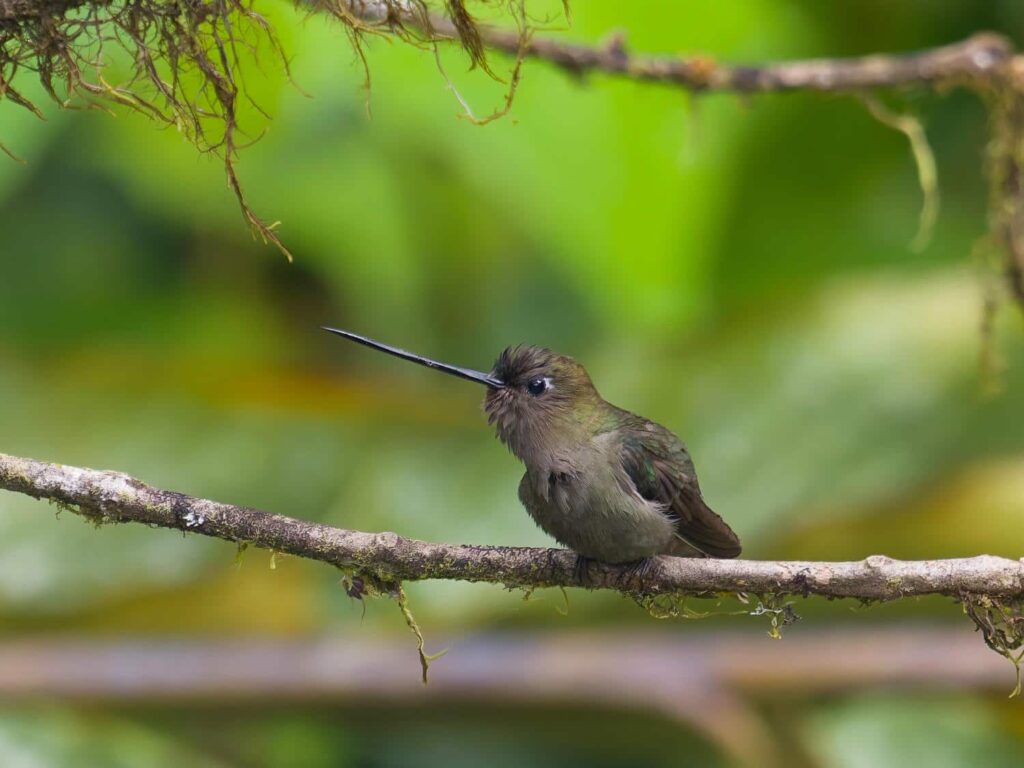
The next morning, we prepared to leave. We were going to head back west to find some much-needed wild camping, while Tevin, Dan, and Patricia were headed to Quito. We had a beautiful drive down another giant dry valley, before climbing into the cloud forest on a rough back road. We were in search for another hummingbird, which we never saw, but we spent two blissful nights of perfect weather in a pullout. I spent the two days we were there wandering around in the forest looking for birds, and Delaney mostly stayed in the jeep reading and working on her Instagram videos. The two days were up quicker than we could blink, and we headed back up the valley back through Ibarra, and headed to meet everyone in Quito. We drove into the bustling city in crazy traffic- I will never get used to how people drive in the cities in Latin America! Tevin had arranged for us to park in the visitor parking spots for the apartment building that his Airbnb was in, and we easily fit into the parking garage. He’d rented the apartment for a little over a week, and we planned on staying for 3 or 4 nights with him. Dan & Patricia had a separate Airbnb a few blocks away, as they were scoping out places for Dan and Brody to stay for two weeks while Patricia went home the following month.
Tevin had just gone to a dentist with an office nearby for his annual teeth cleaning, and I also needed to see a dentist- one of my front teeth is half fake, and it had chipped a few weeks earlier. It had chipped two other times back in Alaska over the past few years so I wasn’t too worried about it, but I made an appointment to see them the following afternoon before we even arrived in Quito after Tevin said that it was a good place to go. It felt very modern, except without all the bureaucracy that has become familiar at U.S. medical centers- it was so easy to get in and out! At first they said that they only had time for the cleaning and that they’d make an appointment for the following day for the chipped tooth, but they then said that they could fix it right away. I thought that they would just fill in the chip with epoxy as the previous dentist in Alaska had, but they ground out all the old epoxy before sculping a “new” tooth in. It was a really significant repair, and it feels like a better repair than my original repair in Alaska 6 years ago! They also found a small cavity, my first since I was a pre-teen, and fixed that in an appointment the following morning. I was happy to have the chip fixed, but Delaney was even more happy- I was threatening to just leave it unfixed!
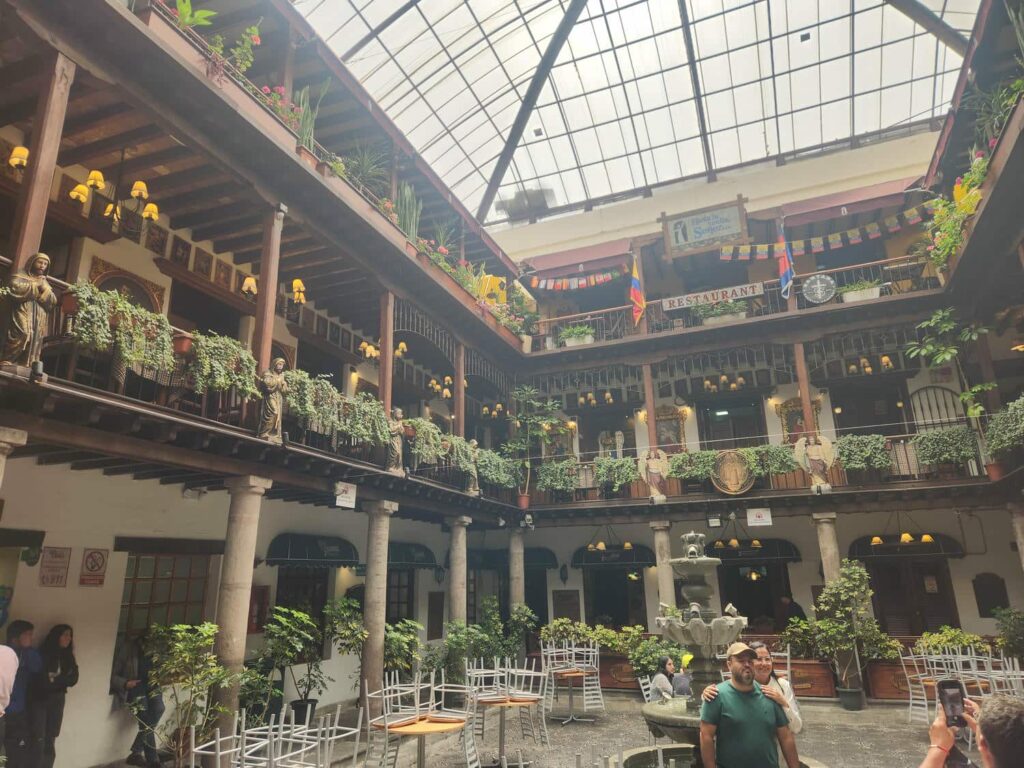
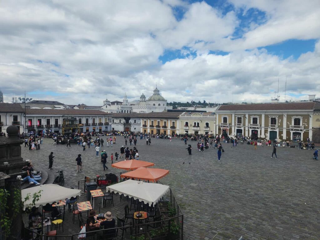
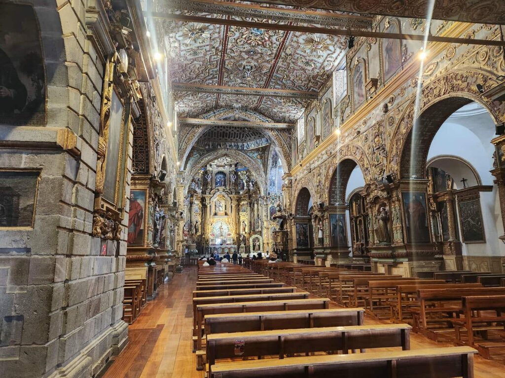
The first two days in Quito, we also went to a few restaurants with Tevin, including an excellent Ramen place nearby, and a further away pizza place that Dan & Patricia joined us for. It was probably the best pizza of the trip so far- a real Italian place! The third day, after my morning appointment, we all took an uber downtown to the historic district of Quito. It is one of the largest and best-preserved colonial city centers in all of South and Central America, and a major tourist attraction. We first walked through the main square, a massive central plaza, before ducking into one of the many side alleys. In one, we found a beautiful garden surrounded by restaurants and shops. It is amazing what you can find around every little corner or behind a door that is slightly propped open- many of the restaurants and shops may not look like much on the outside, but the inside can be unexpectedly beautiful. We wandered back across the main square, passing church after church- there must be 6 ancient and massive churches in as many city blocks! We stopped into another small side alley and found a store that specialized in Panama Hats.
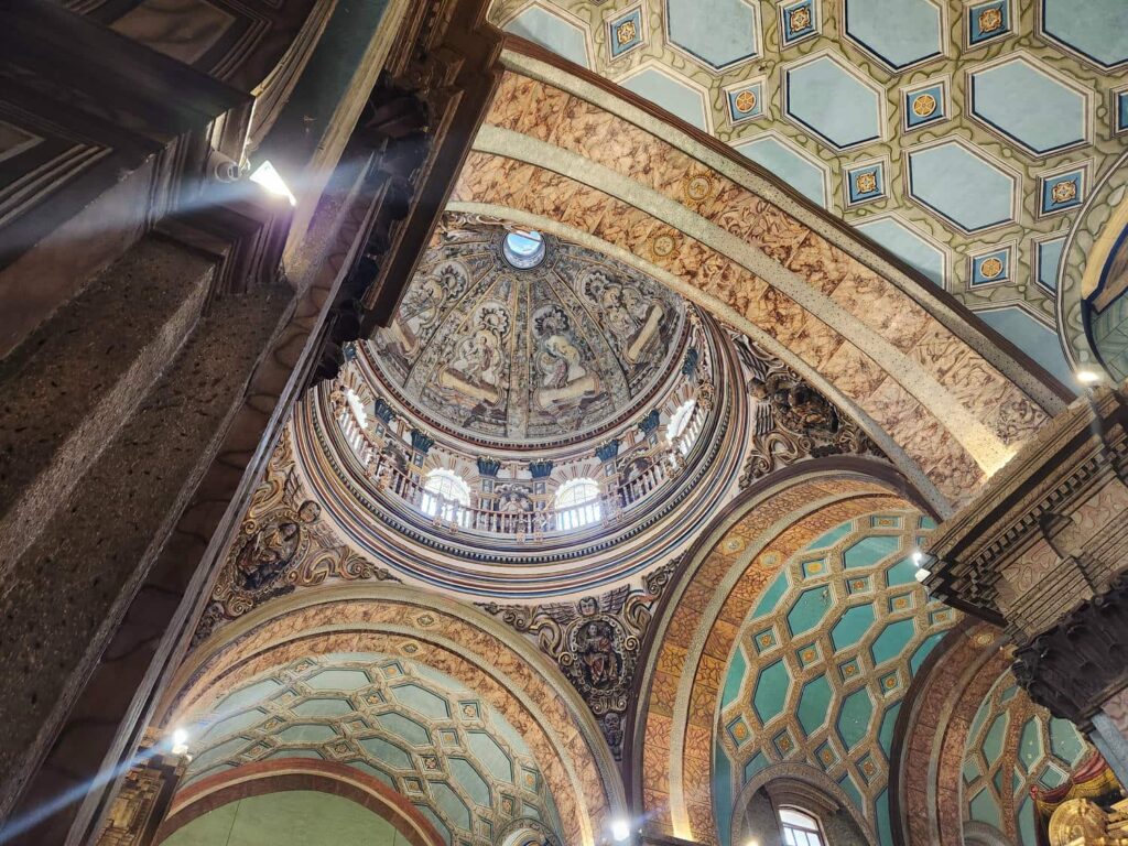
Panama hats are a white bowler-style hat made out of dried grasses. They aren’t actually from Panama- they were invented in Ecuador, but when Teddy Roosevelt was photographed wearing one while inspecting the construction of the Panama Canal, the name stuck! The white of the hat really pops in the 1910-era black and white photograph. It is just a bit of a sore spot for Ecuadorians. The hats are priced and graded according to how finely they are made, with hats being made from smaller and more tightly woven grasses grading higher. They are all made by hand, over the course of as little as a day for a low-grade hat to months for a very highly-graded hat. A normal tourist-grade hat, maybe a grade 10 or 12, will set you back around $50USD. A finer grade 20 or 30 hat will set you back several hundred dollars. The competition-winning hats, up to maybe grade 50, can cost tens of thousands! We wandered around the store for a bit, and had all of this explained to us by the proprietor who spoke excellent English. He even let us try on one of the super expensive hats! We walked into a pair of side-by-side churches, both ancient and beautiful. We really enjoy popping our heads into as many churches as we can- they are almost always the largest, oldest, best cared for, and most beautiful buildings in any town. We went back down onto the main street, and saw the headquarters of the Bank of Ecuador. It had a small “Museum of Money” attached, so I had to go in. It was free, but surprisingly bureaucratic to enter- we had to wait for maybe 15 minutes before giving our passports to the entry guard who recorded our entry time. The museum was unfortunately a bit forgettable, but it had a good view from the upper floor and several small displays of the currency Ecuador has used over its history. They switched to using the U.S. Dollar in 2000 after their original currency, the Sucre, collapsed due to debt problems.
After the museum, we grabbed lunch at Restaurante & Cafeteria Modelo, a family-run restaurant that has apparently been there since the 1940s. It sure felt like an old-time diner, kind of like Arctic Roadrunner in Anchorage. The sandwiches we all got were small but tasty. After finishing our meal, we met George, a friend of Delaney’s godmother Renee who lives on the coast of Ecuador but often comes into Quito to volunteer at a children’s afterschool program. We’d been planning to meet him for a while, ever since Renee had heard we were going through Ecuador. George led us through the beautiful colonial city streets to a beautiful old house about 10 blocks away from the city center, which has been converted into a sort of afterschool/homework area for schoolchildren. The owners, Alicia and Dan, had realized that many people in the neighborhood couldn’t help their children with homework, as they themselves couldn’t read! They also found that as the neighborhood declined, with alcoholism and drug abuse climbing, that many parents weren’t around to help their kids anyways. So, they turned the house into a safe place for children to come after school to learn, do their homework, and also have a bit of shelter from absentee parents. Dan is also a drug addiction counselor and has begun helping families in the area. Alicia is the “force of nature” behind the whole operation, and has the distinction of being the daughter of a former president of Ecuador!
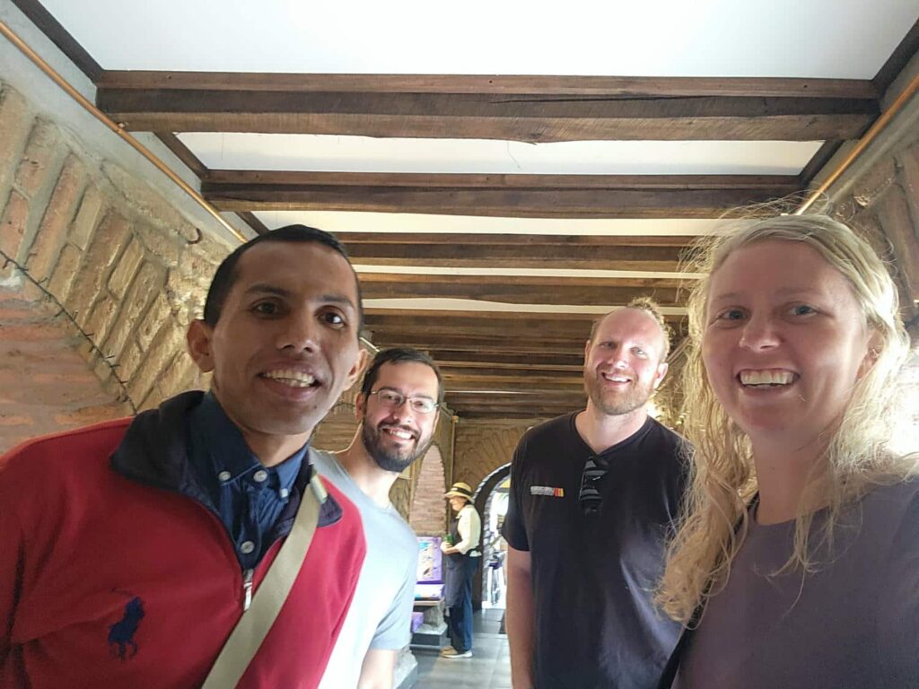
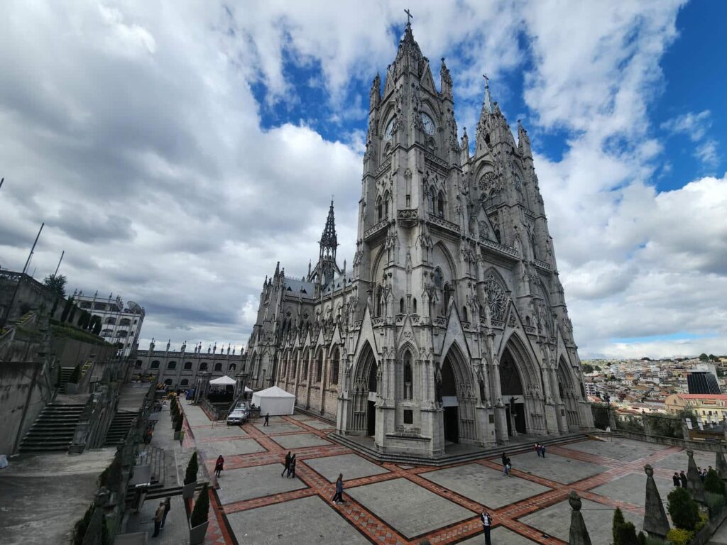
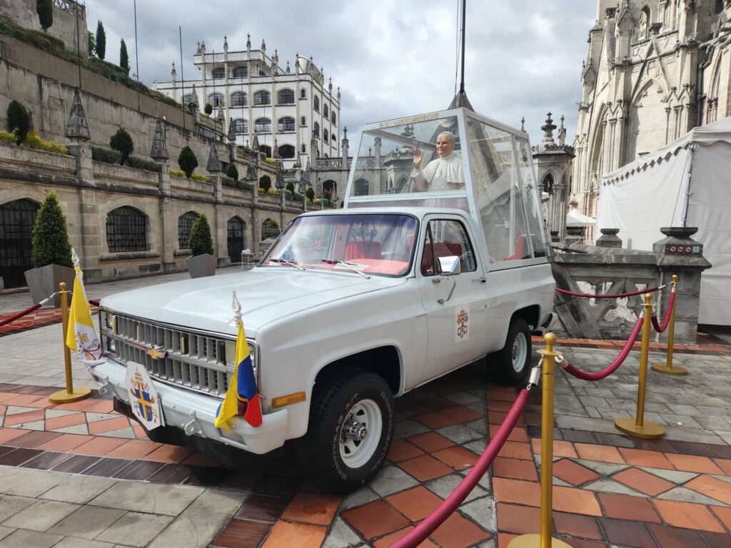
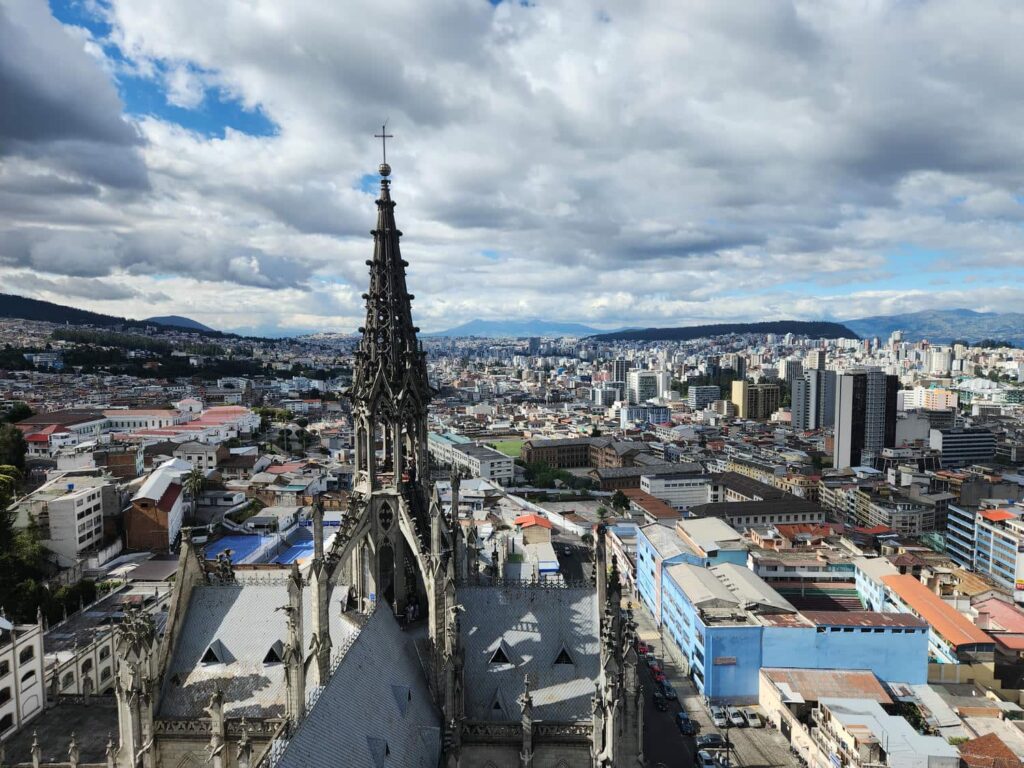
After meeting Dan and Alicia, George gave us a tour of the whole place. He has put an immense amount of work into the place, doing everything from rehabilitating the building from the near-ruin it once was to serving as the foundation’s cook. He showed us where Renee had worked when she had been a volunteer here also. We had heard so much about the place from Renee, and being there was quite amazing. George agreed to join us for our next destination- the Basílica del Voto Nacional, Quito’s largest church. It was a national project started in the 1880s, but only inaugurated in 1988- it still has not been completely finished, though construction has basically stopped. We walked through the tight streets of Quito in an enormous traffic jam- we must have walked 10 blocks and not seen the single-lane traffic through the tiny streets move at all! At the cathedral, we paid a nominal fee to climb up the belltowers, which have a commanding view of the entire city. The last few stories were up a spindly spiral staircase that shook as we climbed higher and higher to the top. Tevin is a big guy, but not a giant, but he still barely fit! We spent a while enjoying the 360 degree view before descending all the way to the bottom. In the huge churchyard there was also the white Chevy Blazer that had been converted into a “Popemobile” when Pope John Paul II visited in 1985, as well as a mausoleum with lots of crypts, but only three occupied ones: three former presidents of Ecuador. We left as people were just starting in on a wedding inside the church- the inside was beautifully decorated with more flowers than I’ve ever seen for a wedding in my life. The flower arrangements would have cost thousands and thousands in the U.S., but George explained that flowers were quite cheap here- perhaps only a few hundred dollars for everything.

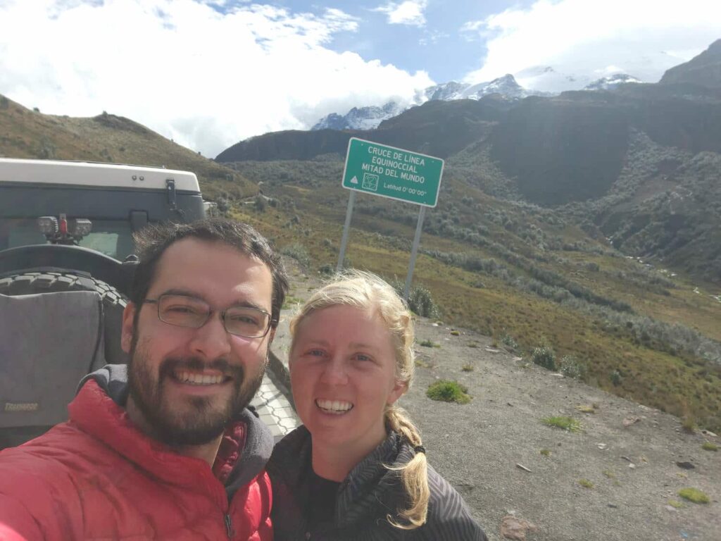
We bid farewell to George and caught an uber back to the apartment. We stayed one more night, enjoying the swimming pool and steam room in the basement of the apartment building that the Airbnb was in, also joining Dan & Patricia again for another dinner at the Ramen place. The soccer World Cup had been going on for a few days now, and the restaurant wheeled out a massive TV so that everyone could watch the game and eat dinner at the same time. It has been so interesting to travel through “soccer country” while the World Cup is ongoing- it seems most people back home barely know that it’s happening, even though most of the games are in the U.S. this year! The next morning, we headed north out of town towards Volcan Cayambe to meet Dan & Patricia. There was a road that led all the way to 15,100ft, and we both wanted to drive it! It took a bit longer to get to Cayambe than we had expected, as the road was quite small and rural. We camped at the ranger’s entrance station in a large parking lot, and enjoyed a chilly afternoon and evening. The next morning, we drove on up. We unexpectedly came across a sign for the equator- we’d passed it a few days before on our way into Quito, but hadn’t noticed. Here, there was no other traffic, a bright clear sign, and amazing scenery, so we all stopped and posed for some pictures. It was amazing to think we had driven all the way to the equator- and also we were definitely past the halfway point on our way south, as the southern tip of South America is further north than Anchorage is south.

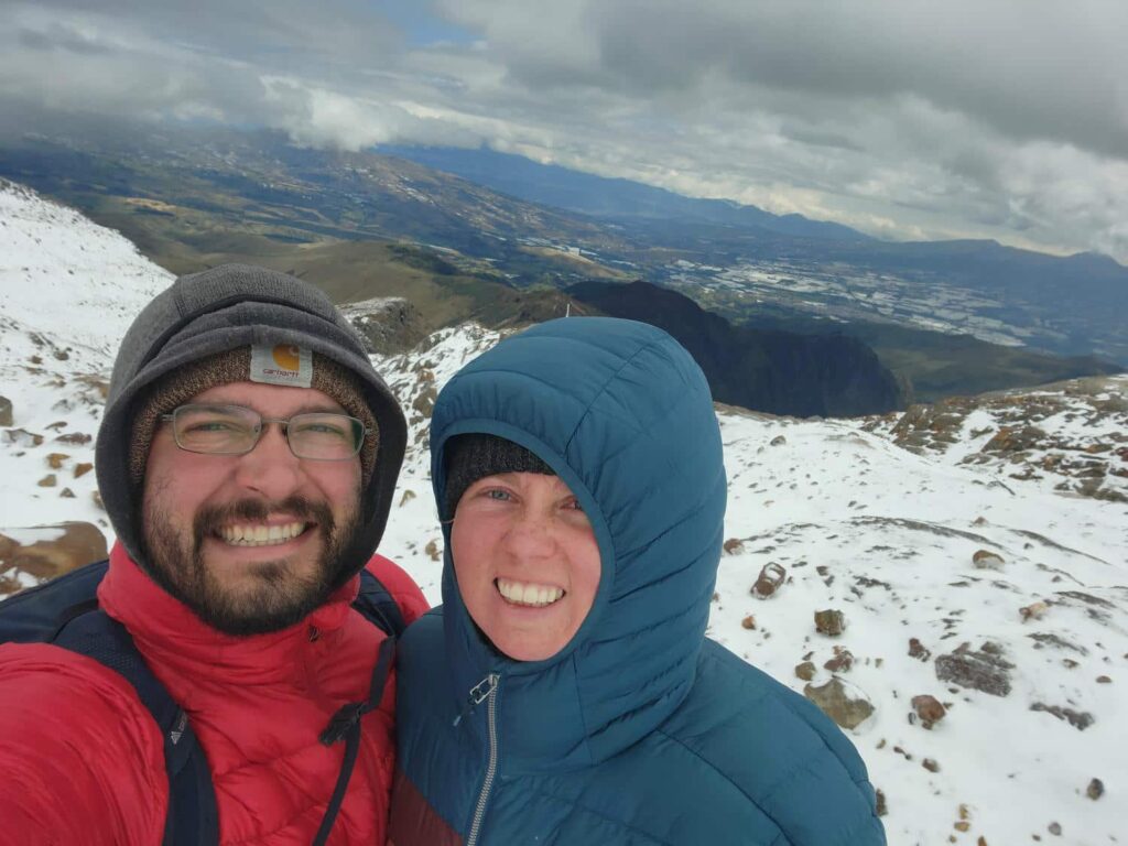
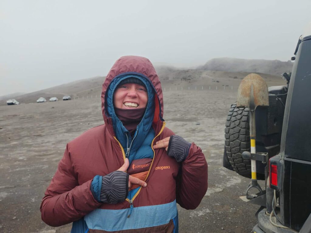
We drove further on up the road as it turned to dirt. It was steep with lots of tight switchbacks and shelf sections, but the jeep and the sprinter van had no trouble. We even drove through a small area with snow on the ground! We finally reached the Oleas Berge refuge at 15,100ft, a stone building similar to one you’d find in a U.S. National Park. It is the trailhead for those who want to climb all the way up the snow-and-glacier capped volcano to a peak of 18,996ft. We did want to go for a hike though- there is a trail up to a small lake at around 15,700ft which we all headed up, minus Brody. They had a strict rule of no pets in the national park, but Patricia had negotiated with the ranger to allow Brody to just stay in the van and not leave until we were back out of the park. Patricia had a tough time making the first ridge in the thin air, but really appreciated our Kahtoolas- spikes that can be attached to our shoes to aid in grip in snow, ice, and dirt. They decided to turn around at the ridge, as the weather was getting a bit worse as we climbed, but we were well prepared for the cold and continued up.

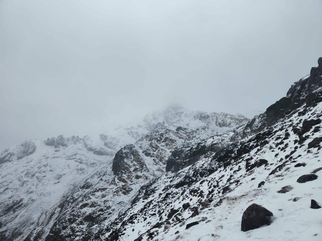

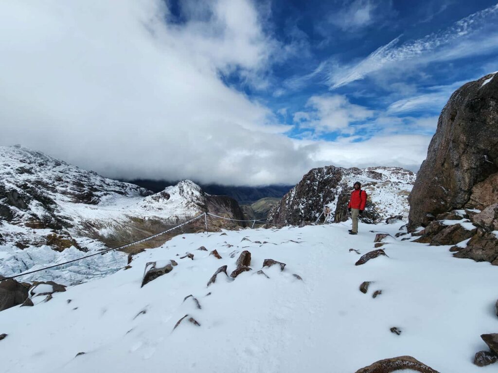
We climbed up a small cliff and crossed an exposed section of the trail, helped by a fixed rope put in the area. We soon reached the lake, a beautiful alpine tarn. The wind had really picked up at this point, and we had climbed up above the snowline while being pelted by windblown snow. We had the idea of climbing above 16,000ft fixed in our head- being above 15,000ft was a new record for us, the previous record being when we hiked up above 14,800ft in Mexico on Popocatepetl. It felt like cheating since we had driven up to 15,000ft, therefore 16,000ft was the goal. We pushed past the lake into even more howling wind, but we had an excellent view down to our south of one of Cayambe’s glaciers. Our Garmin GPS and Delaney’s app AllTrails disagreed on how high we were, so we kept going until both agreed that we were well above 16,000ft. The air was quite thin and we could only go about 10 steps at a time before needing to take a break to catch out breath.


Going down was much quicker than coming up, and we were back down at the jeep before we new it. Dan & Patricia had only beat us down by around 15 minutes, and they prepared some hot chocolate for us as well all warmed up in the van. We headed back down the mountain road, past the ranger station, and on to our next destination. We wanted to drive a little-known back road through another national park, but we couldn’t reach it in one day, so we found a camp spot along the way and settled in for the night. It ended up torrentially raining for most of the evening, so we were glad to have the van to retreat into! We made a big pot of soup and watched one of the world cup games. The sprinter isn’t as capable, or nearly as cheap as the jeep was, but it sure is nice to have some indoor living space! All four of us were tight, but comfortable for the evening. The next morning, I saw some large birds soaring around in the distance. I got out my camera to look at them and they turned out to be Andean Condors, an iconic species of South America. It was so cool to finally see them, and unexpectedly. They are the largest flying bird in the world, with a wingspan of nearly 11ft, and can weigh more than 30lbs.
We headed on down the road, and soon passed the guard shack for the road through the national park. I’d been told that you need to continue on to the next town to buy a permit, but I thought I’d try my luck, but it was a no go. We drove a beautiful road down to Oyacachi, full of waterfalls and amazing views. After a bit of searching, we found the tourist office and paid $5 each for our permits to drive the road. The village was so nice and friendly, with everyone saying hi and welcoming us. It really reminded me of Seward, AK with the foggy mountains and waterfalls everywhere. This area is definitely one we would return to if we ever came back through Ecuador! Permits in hand, we went back to the friendly ranger who let us through onto the road. It was a dirt road that connected the Cayambe area with highway E20, without having to go back to the main highway near Quito. It was stunningly beautiful, with wide-open grasslands, distant mountains, lakes, and waterfalls. It took us several hours to get all the way through, enjoying the scenery. We eventually descended down a series of mountain shelf roads into Papallacta Hot Springs, a very nice resort area. Here, we said goodbye to Dan & Patricia, who were headed east on E20 towards Volcan Reventador, an active volcano similar to Volcan Fuego in Guatemala. We were headed west back towards Quito, and camped in a giant parking lot for another hot springs area. We had a peaceful night in the foggy valley, just far enough away from the highway.


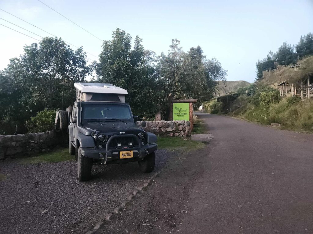
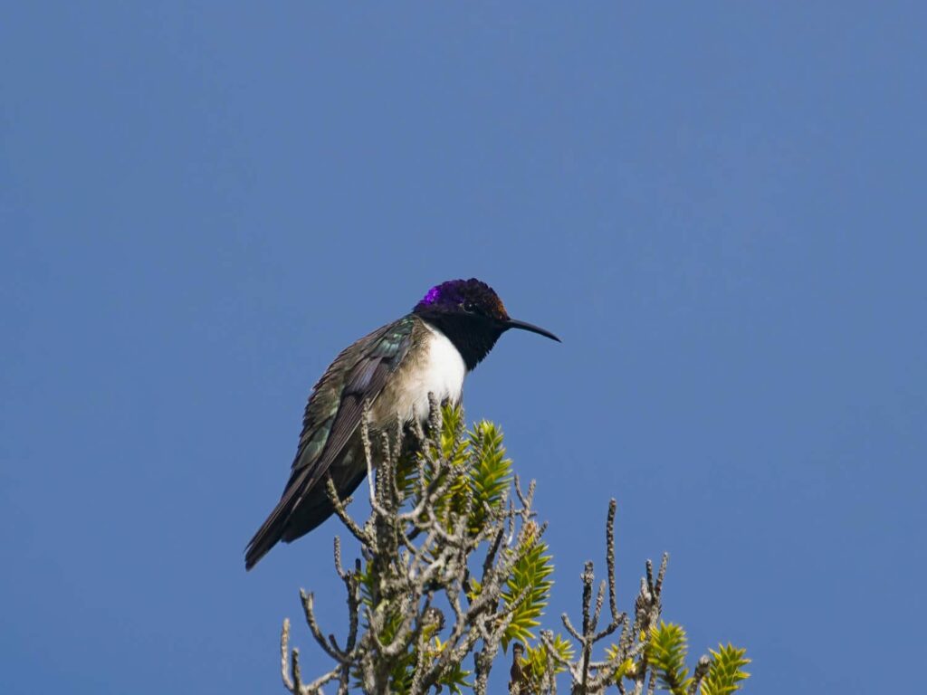
The next day would be spent in search of a very specific hummingbird: the Ecuadorian Hillstar. It is nearly endemic to Ecuador, with a few sightings in very southern Colombia. It is a high-altitude hummingbird, only found above 12,000ft in the paramo and the slopes of Ecuador’s volcanos. The male is quite striking, with a bright purple head that shines in the sunlight. We were completely unsuccessful at the spot we looked first, the Papallacta Antennas. It is one of the best spots to find it, but it was completely foggy and raining there. We spent some time looking around, but it was hopeless in such weather. We then drove back down to the main highway, and headed south up towards Antisana, another volcano. The road up to Antisana passed over and next to a massive landslide and/or lava flow which seemed to be Quito’s main source of gravel and stone. There was an incredible amount of equipment all over the valley floor, and there were dump trucks all over the road and all over the landslide workings. We made our way further up the road and stopped at the Tambo Condor lodge, a hotel and restaurant that focuses on birdwatching. We ate lunch there while watching hummingbirds (not our target hummingbird) swarm the feeders. There were also up to 9 Andean Condors at a time flying around the cliffs opposite us- apparently they nest there! After lunch we asked the owner if we would be allowed to stay the night at the little parking lot along the road, and she said that we were welcome to! Accommodations secured, we left and drove further up the road in search of the Hillstar.
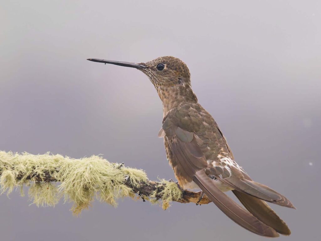
We passed by the friendly ranger who recorded our passports and raised the gate for us. He was very helpful and provided a laminated map of the road system for us to borrow. We drove up to the “spot” that I’d scoped out, and thankfully had been confirmed by another birder at the lodge. The weather was pretty terrible, foggy and rainy, but we tromped out into the grassy paramo up into a ravine. We found lots of the Chuquiraga plants that it nearly exclusively feeds on, whose flowers look like little orange pine cones. We found a few other hummingbirds, and spotted one that might have been a female Hillstar, but the female isn’t as striking as the male- green and white like most other female hummingbirds. We wanted the purple! We stuck around for a while without any luck before driving further up to a second spot. We were only at the second spot for a few minutes when a hummingbird whizzed over to perch in a Chuquiraga plant. It had a purple head, a male Ecuadorian Hillstar! We watched it zoom around between all the different plants in the area for a while before it buzzed off down the valley. I’d planned on spending the rest of the day looking for it, as well as the following morning if we weren’t successful, so it was gratifying to find it so soon. Rather than go back to the lodge, we decided to drive the rest of the road.
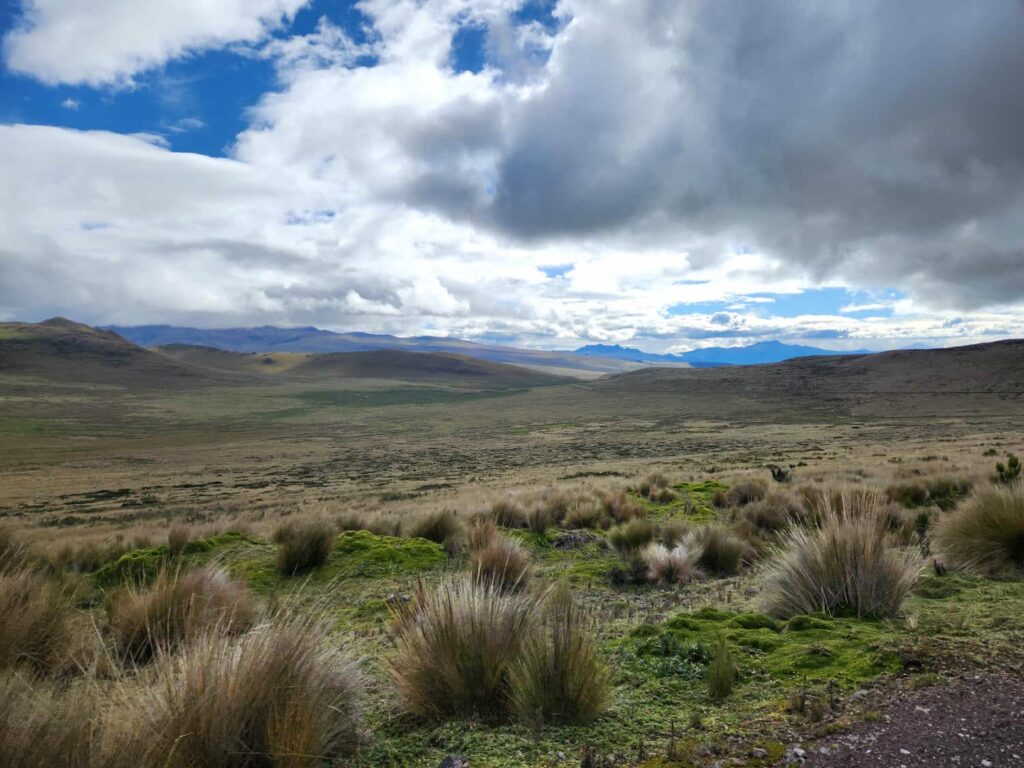
We continued climbing up the valley, and eventually popped out at a wide plateau. The volcano, Antisana, was still shrouded in cloud, but we got some brief looks at it across the endless fields of paramo grass. Deer were everywhere- we must have seen 100 of them in 10 or so miles of driving. We really haven’t seen a lot of large mammals on our trip at all- we could have probably counted all the animals larger than squirrels on two hands since we entered Mexico. The fields of paramo were stunning, and there was no one else on the road. We meandered along through the massive grassland, and could have easily forgotten that we were well above 12,000ft! We eventually made it to the lake, where we wandered around a bit. We spotted a pair of foxes slinking through the grass, but after looking at the lake we beat a hasty retreat- the rain, which had subsided before we’d found the male Hillstar, had come back. We drove all the way back through the grassland and back down to the lodge. It was a fantastic afternoon- we’d seen maybe 3 other vehicles in 4 hours, and some really epic scenery with wisps of fog shrouding the volcano and other surrounding mountains. I think Ansel Adams would have had a field day here.
Back at the lodge, we spent the night in their small pullout parking lot along the road. The stars were simply incredible. In the morning, we had a simple breakfast at the lodge and then headed back down the road, passing the massive earthworks again. Back on the highway, we passed through Quito, meeting Tevin for lunch. After that, we drove north out of town through the “Mitad del Mundo”, or Middle of the World, Ecuador’s massive equator tourist trap. We were sure glad we’d found the equator sign at Volcan Cayambe, where we were all alone! We turned west and headed up and over a mountain pass. Immediately after heading down the other side, we were again in the cloud forest, our favorite biome of the trip- not too hot, not too cold, not too rainy, not too dry, with all sorts of awesome views of foggy mountain forests, and of course birds! We were headed to the “Mindo” area, named after the Mindo valley. It is one of the premier birdwatching locations in the world, with a massive networks of hotels and lodges specifically catering to birdwatchers. Over 550 different species of birds have been recorded in an area of only ~80 square miles!
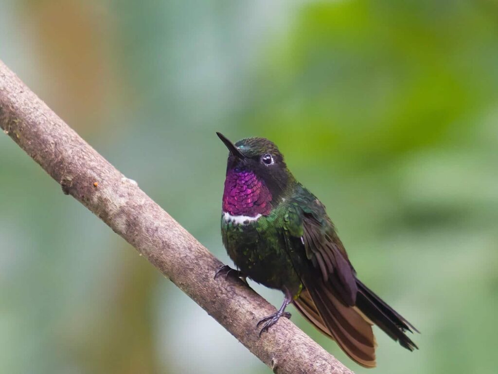
I’d hoped to stay at one of the lodges for a night or two as a bit of a break from the jeep, but the rooms were incredibly expensive- well over $200 a night, in a country where most “nice” hotels are less than $50! I contacted one of the lodges to see if we could just stay in the jeep in their parking lot, and they happily accepted, for only the price of admission! We took the back way in, a long dirt road that switchbacked up through the cloud forest. It is apparently the “old” road, the original way into the Mindo valley that has been long bypassed by the very nice highway we drove in on. We arrived at the Bellavista Lodge in the late afternoon, and were warmly welcomed. We watched the hummingbird and fruit feeders for a while, before settling into their rustic TV room to watch World Cup games. We were eventually tempted into the slightly overpriced dinner at the lodge. It sure was tasty though! I talked to one of the bird guides at the lodge, who gave me a few spots to try for a few of the more colorful cloud forest species I was looking for.


Before dinner, we’d talked with some American volunteers from West Virginia, who were there for the summer studying the Olinguito, a member of the Raccoon family. It was only discovered in 2013, the “first new carnivorous mammal in the Western Hemisphere in 35 years.” Pretty cool stuff! Several Olonguitos visit the lodge most nights, and tonight was one of them- our dinner was gently interrupted, and we all shuffled quietly out to watch the Olonguito in the pitch black, illuminated by a flashlight. It surprisingly didn’t seem to mind. It looked a bit like a skinny brown raccoon, and somehow looked both coordinated and clumsy as it climbed around in the trees.
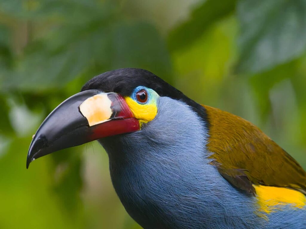
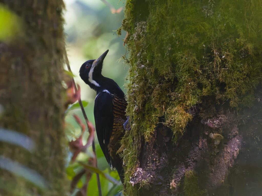
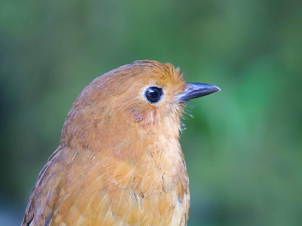
In the morning, we spent a few hours walking around the lodge property, and I got some great pictures of several iconic cloud forest species- trogons, toucans, and tanagers. We went for a long walk in the late morning down the road, enjoying the perfect weather, before following a maze of muddy trails back to the lodge. We decided that the $20/night charge for both of us to sleep in the jeep was just a bit too steep, and decided to spend the next night along the road we’d walked on that morning. We both enjoyed the solitude after the comparably busy lodge! The next morning, we drove the “old” road back towards Quito, stopping only at the Zuro Loma reserve where an extremely rare hummingbird had been coming to the feeders for the last month or so. They are normally pretty much impossible to find, but it would come into the feeder every 20 minutes or so, and I got some great pictures of one of the rarest hummingbirds in the world, the Black-Breasted Puffleg. It is estimated that only 100 to 150 individuals are left in their tiny habitat of just a few mountain ridges outside of Quito.


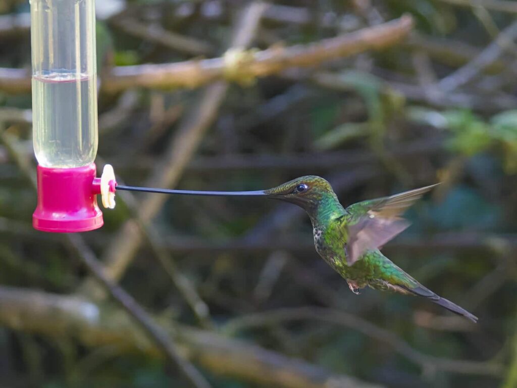
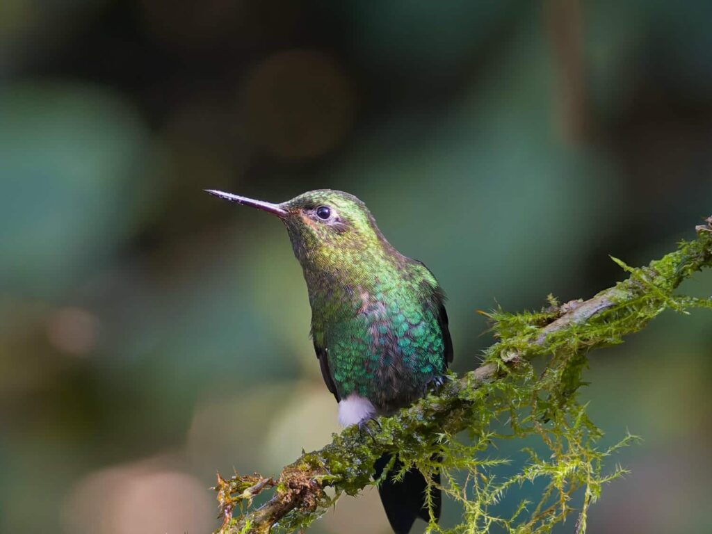
Continuing along the road back to Quito, we drove through some beautiful farmland and pastureland. It was amazing how close to the city the farmland was- one moment we were trundling along a teeny dirt road through picturesque cloud forest and pasture, and the next we were thrust into the bustling cobblestone streets of western Quito. We were due to meet back up with Tevin, as well as Bri who had arrived a few days earlier from back in the States, but they were up seeing the Mitad del Mundo. To kill time, we did something we’d been meaning to for a while- get some convincing laminated copies of our driver’s licenses and passports. We found a small print shop which did an outstanding job, for only $10! We’re definitely past the “danger zone” of corrupt cops (Mexico and Central America), but one of their scams is to take your identification documents, and then refuse to return them until you pay a bribe. There are lots of variations of this scam, but being able to give the police a “fake” document is a big peace of mind. It is something we are often asked about from travelers we meet headed north, but we can honestly say we haven’t encountered a single bit of corruption on our entire trip. Many travelers we’ve read about from 5 or 10 years ago reported rampant corruption at border crossings and police checkpoints, but it seems that it’s been stamped out for the most part. There were some towns in western Mexico that we avoided due to reports of bogus police stops and tickets, but we purposefully avoided those. Nearly every border crossing has large banners saying something to the effect of “zero tolerance for corruption”, and I think it’s working. That definitely isn’t to say that the border crossings are easy and efficient, but at least for now we didn’t have to deal with someone wanting extra kickbacks to do his job!
We met back up with Bri and Tevin at the Airbnb, and had a bit of trouble parking the jeep- it had been no trouble to park it in visitor parking the last time we’d stayed with Tevin just 5 days earlier, but the parking attendent this time was extremely uncooperative. We ended up parking it at a nearby grocery store, but that wasn’t a permanent solution- we had to move it by 9pm. After several trips down to the parking garage to talk to him, we finally got a bit of an explanation- there was a big event at the apartment building that night and all the visitor parking was reserved for the night, even though there were several open spots. Bri negotiated with him, and he finally relented and allowed us to park at the very bottom level of the parking garage in a specific parking spot until 9pm, when we then had to move it up to visitor parking. I went to grab the jeep at the grocery store and drove down to the bottom level of the parking garage, which probably had 100 spots, only 3 of which actually had cars parked in them. How frustrating!
We could have easily stayed in the Mindo area for another night or two, but we’d come into town to watch Ecuador play in the World Cup. How cool to be “in country” while that country plays in their biggest sporting event of the last 4 years! Tevin had talked with someone who gave a very funny recommendation for a fun place to watch the game: either Chili’s or TGI Fridays! It turned out to be an awesome spot- the energy in the room was incredible. You could feel the tensions heighten when either team got close to the goal, and hear the entire restaurant get louder and louder. Unfortunately, it turned out to be a very boring 0-0 game, and since it was in the first round, there wasn’t even a shootout- it just was a tie! It was still an awesome experience.
The following morning, we helped Bri and Tevin pack up their Landcruiser, and we headed out of town. We were headed to Cotopaxi together, and would meet up with Dan & Patricia there. We took a back road along what we thought would be a bunch of waterfalls, but they all ended up being on private property and a bit difficult to visit, so we skipped them. We did find another of Matt & Stacey’s stickers on a street sign sticker wall- they’d been here too! A long dusty dirt road later and we arrived at the entry post for Cotopaxi National Park, and were surprised to see that entrance was forbidden after 3pm- and it was nearly 4! Dan and Patricia had already made it through, so we had a bit of a problem. After a long discussion with the ranger, we came to an agreement: we would give him a voluntary “tip” of $10, and he would point the cameras the other way and let us through. We felt a bit conflicted about paying our first bribe of the trip, but at least it wasn’t coerced- we’d seen online that the park was open until 5pm, and assumed that meant entry was allowed until then! It was plainly stated on an official sign, so it wasn’t like the ranger was making the rules up. I’m honestly surprised we hadn’t paid a bribe before now, but there’s got to be a first for everything. We hope that it is the last!
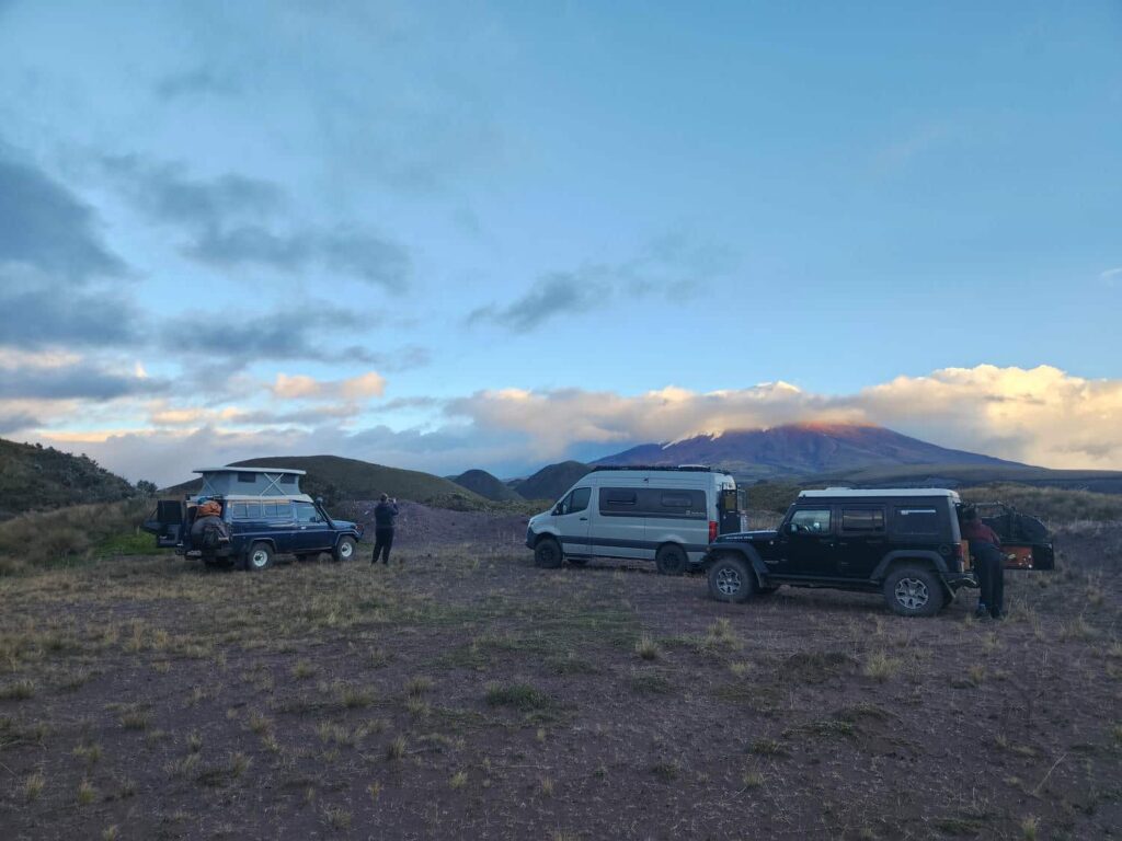

We followed a dusty road through the volcanic landscape, crossing a few streams along the way. The scenery was amazing and just what you would imagine being right next to a volcano- not a tree in sight, very little vegetation, and lots of dust and boulders. We took a rougher side road and pushed through some grassy areas to reach Dan & Patricia- they’d found an awesome spot in a clearing with amazing views of the volcano. We had a fun night together, exploring the area around the campsite and trading stories. The next morning we woke up early to see if the fog had cleared- and it had! Cotopaxi was in its full splendor. It looked like a scene from a movie. The volcano was a perfect cone, with brown soil on one side and rusty-red on the other, all topped with the morning alpenglow coloring the huge glaciated snowcap pink.
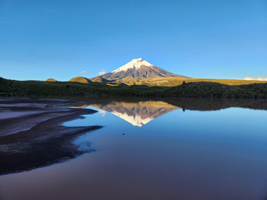
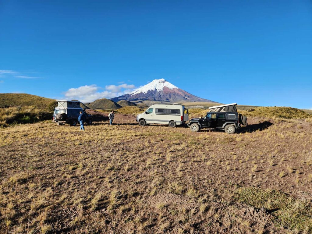
In the morning, we had a perfect unobstructed view. It was a bit of a lazy morning around our fantastic campsite, but we eventually all packed up and drove back to the main road. We headed up the road to the trailhead- well north of 15,000ft. The road was pretty terrible with some of the largest washboards I’ve ever seen in a road, but we all made it in one piece. The parking lot is around 15,100ft, and there is a refuge another 700ft higher. The weather was deteriorating and the refuge wouldn’t have had a better view than the parking lot, so we enjoyed the parking lot for a bit before heading down. Bri and Tevin headed off to a backpacker’s hostel that they’d heard about and really wanted to visit, while we joined Dan and Patricia back at the same campsite for a second night. We watched another World Cup game together in the van and had a great dinner together. In the morning, we all drove out through to the south ranger station so that we would see the full road system of the national park- but it really wasn’t anything special.
Our next destination was Quilotoa, Ecuador’s version of Oregon’s Crater Lake. It was a long drive day, but beautiful- most of it was well above treeline. We started by descending thousands of feet down from Cotopaxi to Ecuador’s main north/south highway, then turned west up a switchbacking road that was thankfully well paved. We passed tiny village after tiny village, climbing the whole time, until we were right back at 12,000ft where we had camped at Cotopaxi. We arrived at a beautiful property called Shalala, with the rim of the crater just a hundred yards away. We all found the property to be a bit odd- mostly because it was almost completely empty. There were cabins, vendor stalls, a restaurant, and more, but there were only one or two employees there and no other people, other than us. This has been a continual source of mystery for us- throughout the whole trip, we have come across places that seem ready to accept hundreds of tourists, but there is no one there. I’m not sure if we’ve somehow managed to miss the “tourist season” for nearly every place we’ve been to, or if Latin American tourist infrastructure is just hilariously overbuilt.

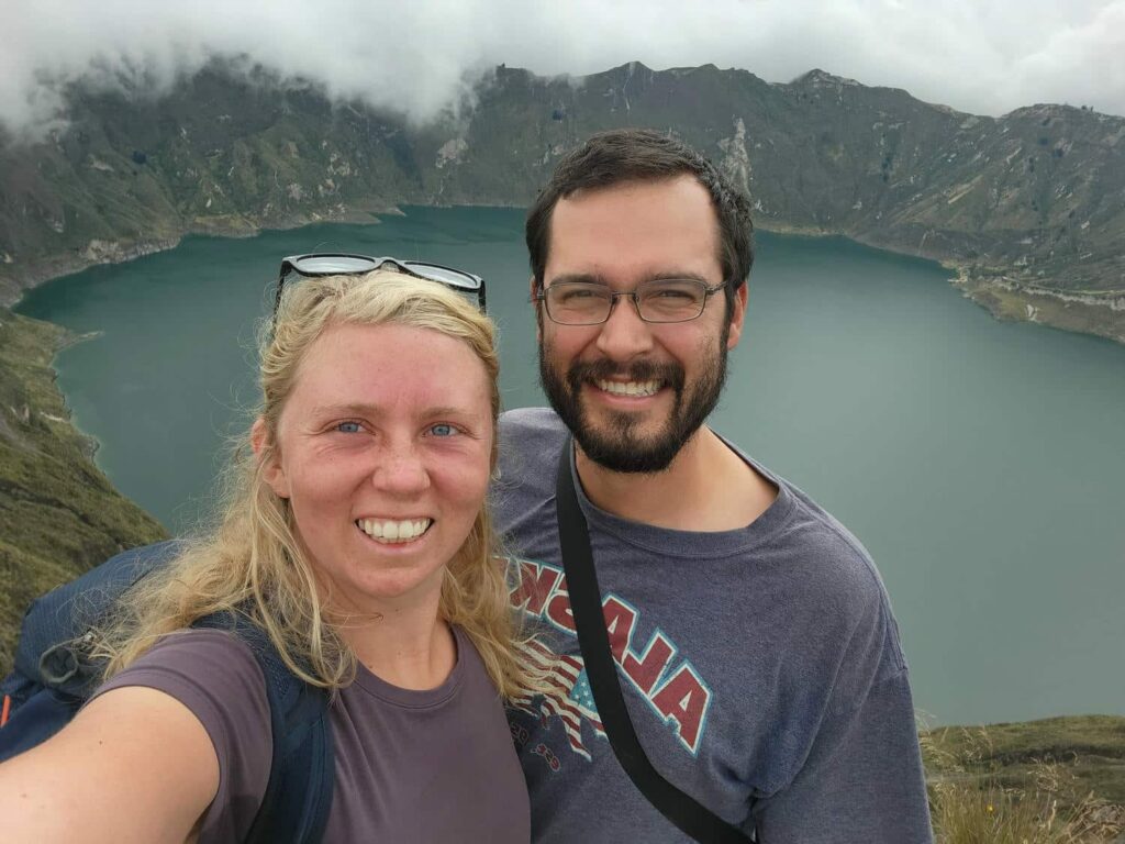
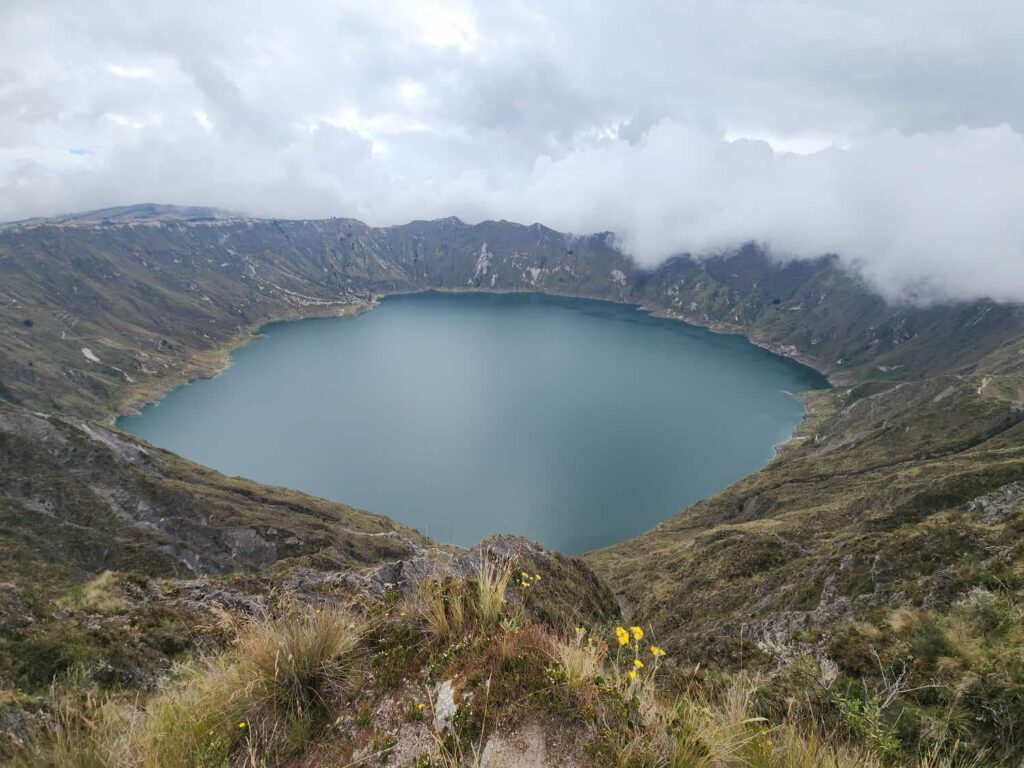
We got settled at the “campground”, which was really just an overgrown outdoor volleyball court, and hiked up to the viewpoint at the rim of the crater. The lake was 700 feet below us, completely encircled by the interior walls of the collapsed volcano. It was a breathtaking view, made better by the fact that us four (plus Brody) were the only people there to enjoy it! There is a trail that leads all the way around the crater, and the highest point on the crater rim didn’t look too difficult to hike up to, so Delaney and I geared up back at the jeep at climbed to the top. It wasn’t quite as strenuous as it looked from the viewpoint, but we were still huffing and puffing by the top. The view was excellent, but something that we’d noticed on the drive in was that Quilotoa had almost no prominence over the surrounding mountains, i.e. it wasn’t any taller than anything else around it. After seeing the stunning Cayambe, Antisana, and Cotopaxi, I kept looking for the telltale cone-shaped volcano on the horizon as we were driving in, but it never came. Quilotoa is almost more like a hole in the ground with a lake in it than a volcano with a lake at the top!
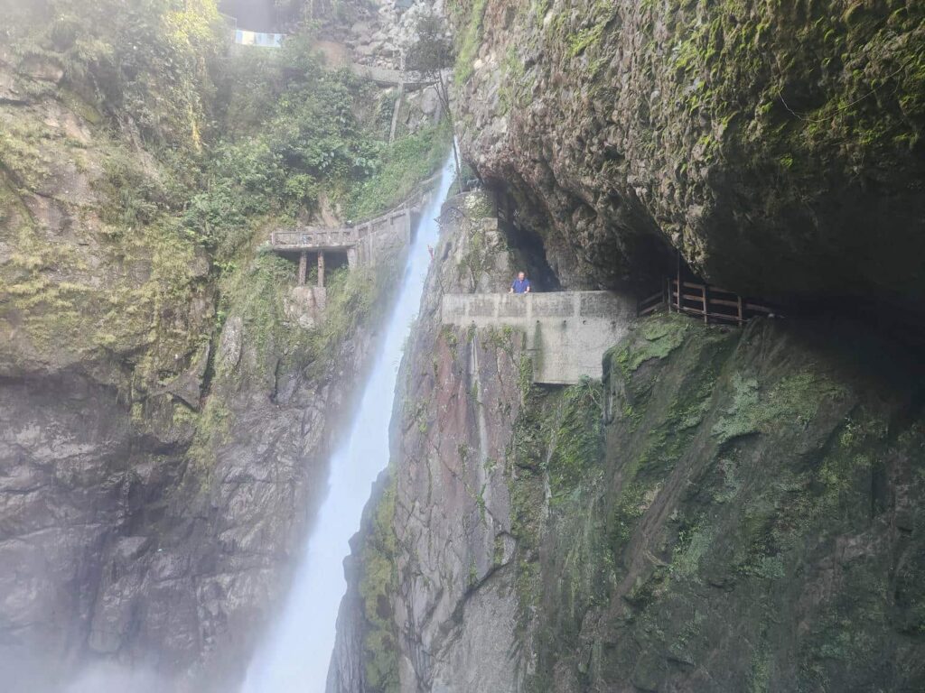
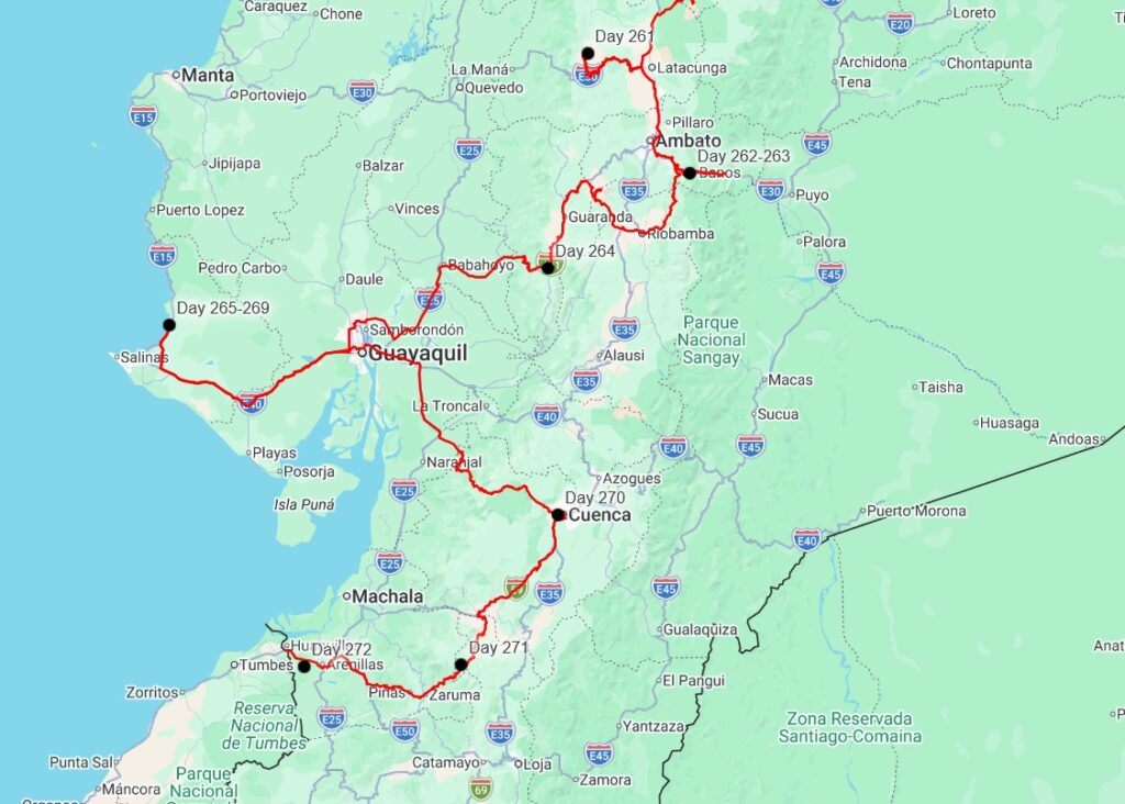
After a chilly night, we packed up and headed back down the mountain, all the way back to the main highway. After driving through the chaotic town of Ambato, we descended down and down to the east, slowed only by the endless line of trucks crawling down the mountain. It was useless to pass them- we would just run into another one 10 seconds later! We passed by the tourist town of Banos, which seemed to be the adventure sports capitol of Ecuador- whitewater rafting, bungee jumping, rock climbing, you name it! The valley tightened into a canyon, and the highway passed through several long tunnels, many of which had mini-waterfalls coming out of the rock inside them- quite unsettling! Further down was the waterfall El Pailon del Diablo, “The Devil’s Cauldron”. I’d known about it for years and years, and actually being there was totally surreal after dreaming about it for so long. We paid our entrance fee and hiked on in. It was a long way down, but well worth it- the waterfall was spectacular. The trail to get to the viewpoint is similarly awesome, climbing along a cliff. Part of it is nearly a cave, closed on 3 sides, and another part is actually a cave- you have to climb through a very tight passage to pop out with a view of the falls. At the top of the trail, you can climb up behind the torrent of water, and it was a blast, though we all got soaking wet with some very cold water. The waterfall itself is maybe 100 feet tall, and quite powerful- the river is basically constricted down to a nozzle at the top. It plummets down into a large bowl- the “cauldron”. This churning vortex then drains further down the tight gorge.

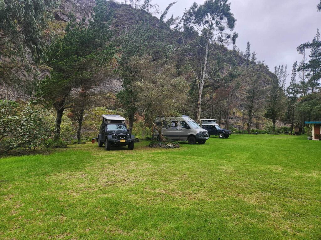
We walked back down to a small restaurant at the bottom of the trail, and ran into Bri and Tevin! We’d planned on meeting here, but they’d gotten delayed in Ambato, so we’d gone down to the waterfall without them. While they went and explored, we went across a long rope bridge to a different restaurant to eat lunch while watching yet another World Cup game. It was a long climb up and out of the valley back to the vehicles. We found a campsite on the other side of Banos that looked promising, and headed over. It turned out to be a fantastic spot- a large grassy area, outdoor kitchen, riverside views, and hot showers! We did a big group dinner together that night, enjoying cooking on a real stove. We were on the fence about staying another night at first, but after seeing the place we happily did. We did a whole lot of nothing the next day. There were quite a few citrus trees next to the parking area, and the campground host told us to take as many as we liked. The orchard was a bit overgrown and totally infested with spiders, but I managed to grab a handful of limes, lemons, oranges, and mandarins. The oranges and mandarins were very much hit and miss- some were fantastic, but some were the most sour fruits I’ve ever had! We definitely pranked each other a few times, offering a purportedly delicious slice of orange that turned out to be pucker-inducing. I spent a lot of the day working on bird photos and the last Colombia post, which I’d gotten quite behind on. It is so much more difficult to write and work on photos when with other travelers!

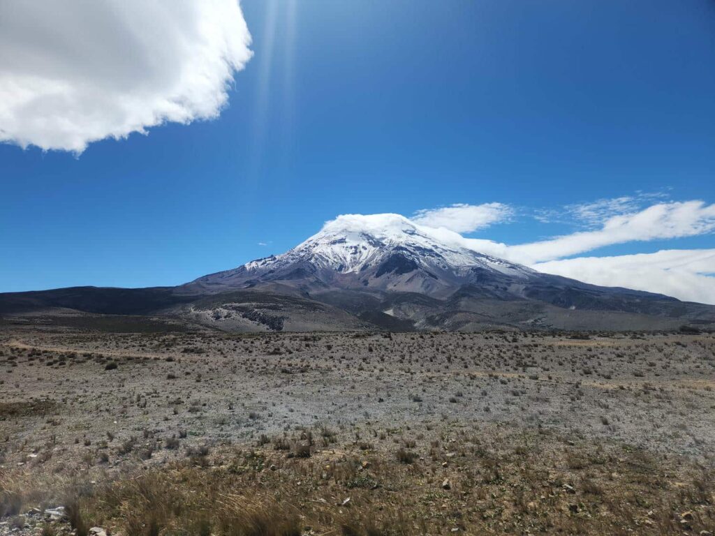
We left earlier than the rest of the group the next morning. We were all going to meet up that night, but Delaney and I wanted to see Chimborazo, a volcano with several superlatives. Firstly, at 20,549ft, there are no mountains further north in the Americas taller than it, narrowly edging out Denali at 20,320ft. Secondly, due to the earth not being a perfect sphere and bulging a bit near the equator, its summit is the furthest point on the globe from the center of the earth. In fact, until the early 1800s, it was thought to be the tallest mountain on the planet. We took a brief detour through Riobamba, but didn’t think much of it. Turning towards Chimborazo, we drove northwest on smaller and smaller roads. Finally, rounding a bend in the road, we saw it! It was another classic cone volcano, with an imposing ice cap. We drove up through the desolate landscape, nearly devoid of any vegetation whatsoever. It looked like the surface of the moon!
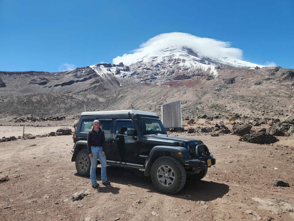
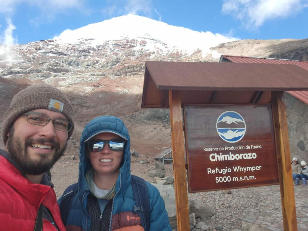
We checked in with the rangers at the giant stone entrance gate and then continued on up the road. It was similar to the road up Cotopaxi- in pretty terrible shape. It zigzagged up to the Refugio Carrel, the highest point you can drive, around 15,900ft. Right next to the refuge, in a small drainage ditch, we found 4 or 5 more Ecuadorian Hillstars, the hummingbird we’d spent so much time looking for near Antisana. This was so much easier! We even found a nest under the eves of the refuge. After grabbing some lunch back at the jeep, we started hiking up the volcano towards the next refuge, Refugio Whymper, named for the Englishman who was the first to summit in 1880. Even though we were totally breathless, we continued up a bit further, eventually turning around at a staggering 16,732ft, a new record for us! I’m sure we will break this record several more times, but it sure is cool each time we reach a new high point!

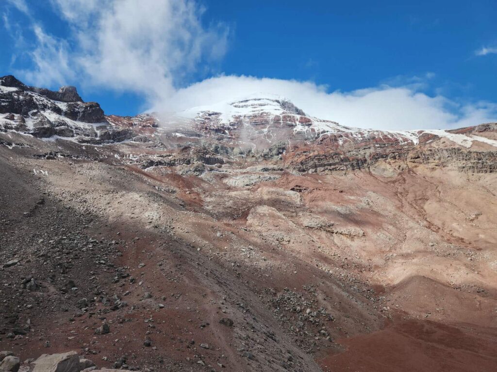
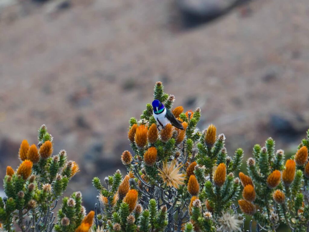
We headed back down the volcano, and back down through the entrance gate. Fortunately we didn’t have to backtrack other than that- we really dislike driving the same road twice if we can avoid it! We drove southwest from there, Chimborazo dominating the horizon for the next hour or two. We passed through a few villages on our way to meet the rest of the group, getting a few stares in some of the smaller villages- our detour through Chimborazo had definitely gotten us off the tourist route! We met back up Dan, Patricia, Bri, and Tevin in San Pablo at a small hotel that had a large parking lot. It wasn’t an ideal spot, but we were a bit hesitant to continue west from there- that would mean camping at a much lower altitude, and we wanted to avoid the hot and humid lowlands as much as we could! We got on the road early the next morning, and descended down a stunning road- switchback after switchback, with incredible views down to the lowlands the whole time. We were headed to Guayaquil, and then beyond that, a beach house Airbnb. Guayaquil has a bit of a poor reputation- it is a large city, at over 3 million, it has a high crime rate, and there were reports of corrupt police. Unfortunately there was no avoiding it, so we headed on in. After the near-freefall from the mountainous highlands that morning, we were now in the flat and boring lowlands. Traffic got a lot heavier as we got closer to the city, and we spent much of the drive trying to pass the sluggish trucks. We thankfully didn’t run into any police checkpoints, and we also found a nice highway that bypassed most of the city center. On the far west side of the city, we went to a Megamaxi, basically Ecuador’s version of Walmart, and stocked up for the 5 nights we’d be at the beach house. We continued west and then north up the coast for the next two hours or so, finally arriving at the small beach town of Monteverde.
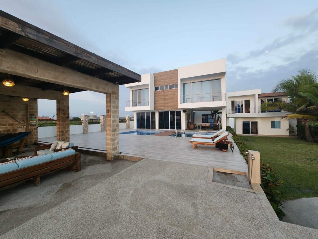
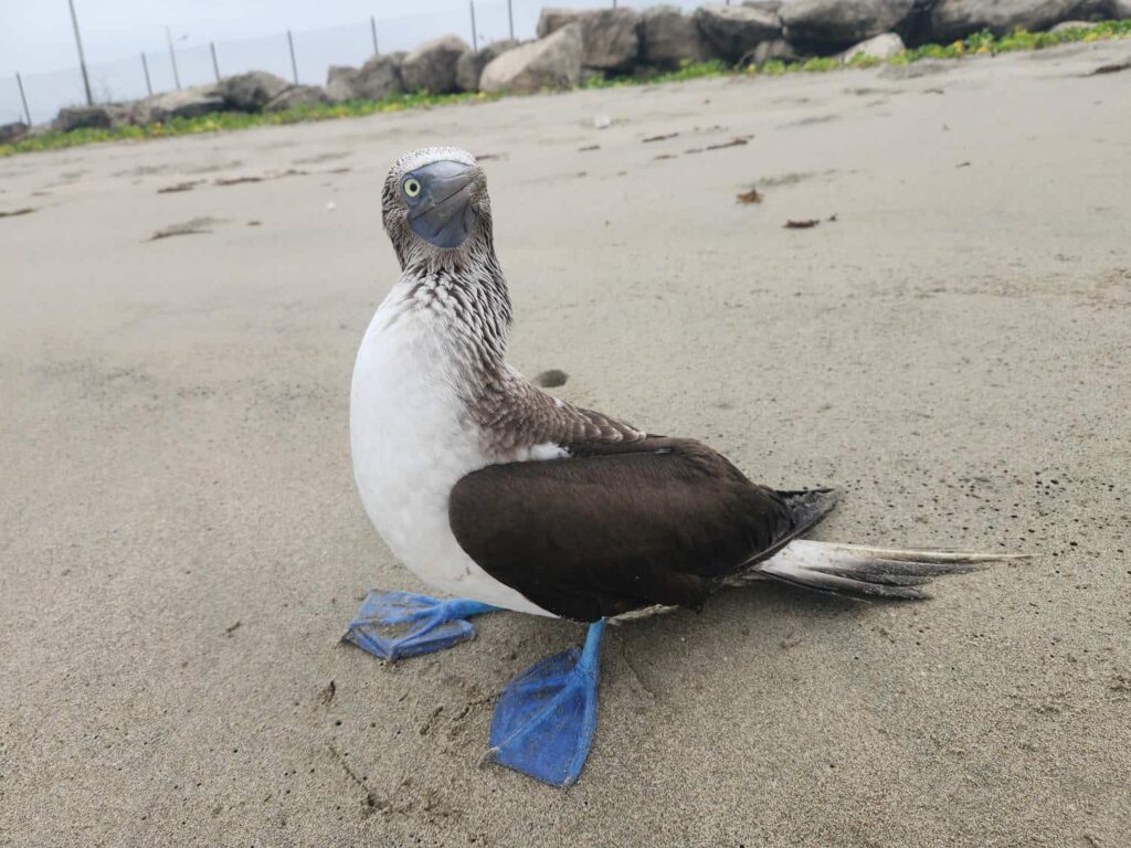
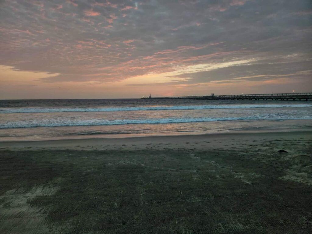
The Airbnb was just outside of town, a beautiful modern house with 6 bedrooms. It had a full kitchen, swimming pool, massive indoor living room, outdoor kitchen, and outdoor living room. It was huge, and right on the beach. We each had our pick of a bedroom! We spent 5 nights there enjoying each other’s company, cooking, playing cards, watching soccer games, walking on the beach, trying to boogie board (we finally figured it out!), and relaxing. While walking on the beach one day, I found an injured Blue-Footed Booby (that is its real name) on the beach. It is a large bird similar to a gull. I tried to move it further up out of the waves and into some shade, but it snapped at me and put a small slice in my finger. I suppose that’s what I get for trying to help! We had such a great time relaxing and living in a real house for once- cooking on a real stove, going to the bathroom without climbing out of the jeep, and unlimited hot running water are some luxuries that we’d almost forgotten about.
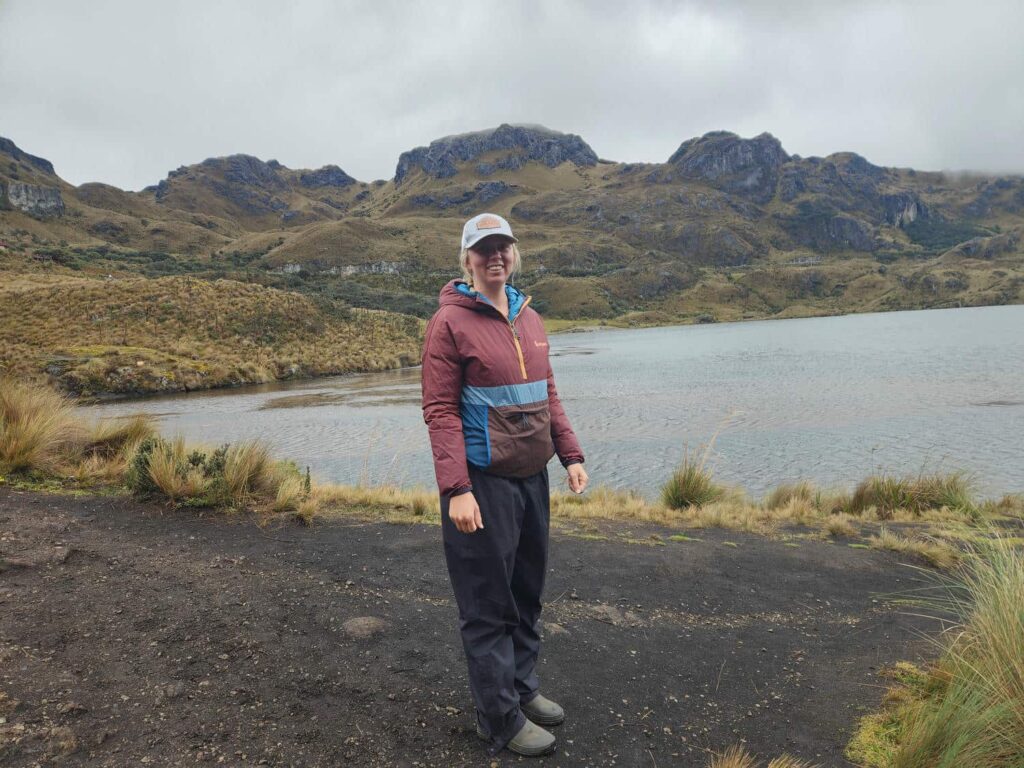
After 5 nights in one spot, we were ready to get moving again. Dan & Patricia stayed for another few nights, but Tevin and Bri joined us on our drive back through Guayaquil. We went straight through the city instead of taking the long way around this time, just to see it. I’m sure we went through the “good” parts of town, but it really didn’t seem quite as bad as we’d heard it can be. After getting through town, the next thing we had to worry about was police checkpoints. There are a lot of them marked on iOverlander, and many reported some attempted bribery. Fortunately, we weren’t stopped at all, and sailed right through. We then turned off to highway 582, a winding route that climbs back into the mountains. We climbed from basically sea level to 13,600ft in only an hour and a half, going only 45 miles! The highest parts of the mountains are a national park, Parque Nacional Cajas. We stopped for a bit to go for a short hike and look for an endemic hummingbird. I could totally see coming back to this area- it felt so much like the high country of Colorado or Montana, with rock outcrops, alpine lakes, and pointy mountains everywhere. Backpacking here would be epic.
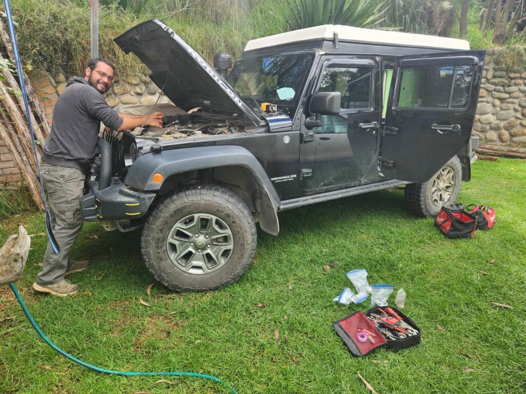
After our hike, we descended into the town of Cuenca, a cultural center of Ecuador and very popular with expats from all sorts of countries, especially the U.S. and Germany. I could see why- it has the climate of Telluride or Estes Park in the summer, but year round! We went to the popular “overlander” campground in town, run by a very friendly local named Humberto. He was quite an interesting character- he is from Ecuador originally and is partly indigenous, but he has studied around the world. He is fluent in Quechua, the indigenous language, as well as Spanish, English, French, German, and one other European language that I forget. We met some overlanders from Argentina there, and we shared some spots through northern Ecuador and Colombia that we’d enjoyed, and they shared a few spots from Argentina. The next morning, I borrowed an oil drain pan from the nearby auto shop, and did an oil change. I really don’t like having someone else work on the jeep if I can help it, and so far, we’ve been able to find shops that are happy to lend a drain pan. We met up with Bri and Tevin briefly- they had kept going when we had stopped for our hike, and then stayed out late exploring the town. They were going to spend another night or two in Cuenca and get some work done on their Landcruiser.
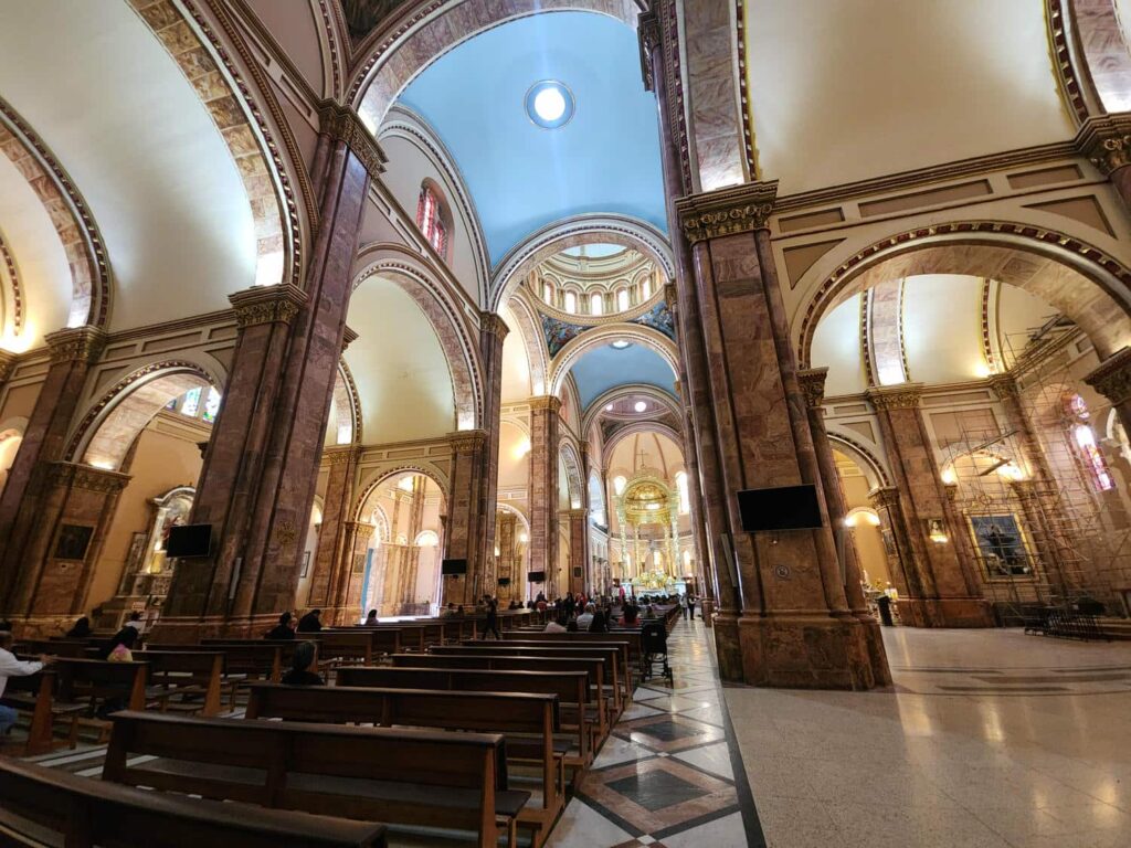
After the oil change, we drove to downtown Cuenca to see the massive church there, as well as walk around a bit. We miraculously found parking only 2 blocks away from the central plaza of town. Cuenca is a fascinating city- in pre-Hispanic times, it was the northern capital of the Inca empire. Today, it is a very well-preserved Spanish colonial town, with blocks and blocks of 17th century architecture. We walked through the massive church, whose facade is a bit disproportioned- the belltowers, usually much taller than the central arch of a church, are only about the same height. Apparently, there was a big engineering goof- the foundation was not made strong enough to support the weight of taller belltowers, so they were left short. The church is still incredibly impressive, and the interior is beautifully decorated. We then walked around to find a place for lunch, and like a bloodhound, Delaney sniffed out “Chocolateria Dos Chorreras”, a massive chocolate shop that also offers lunch. She got a ridiculously sugary and chocolaty coffee, I got the most delicious milkshake we’d ever had, and we shared a waffle topped with peaches, chocolate syrup, and chocolate ice cream. After our weekly sugar intake was exceeded, we walked back to the jeep and drove out of town.
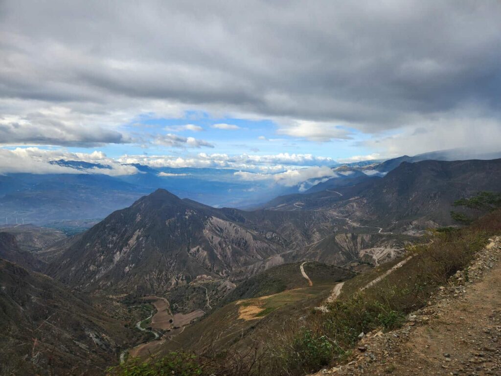
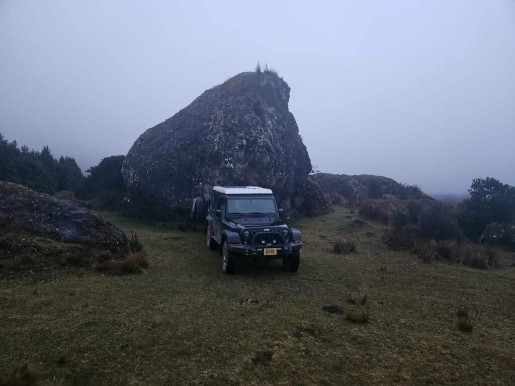
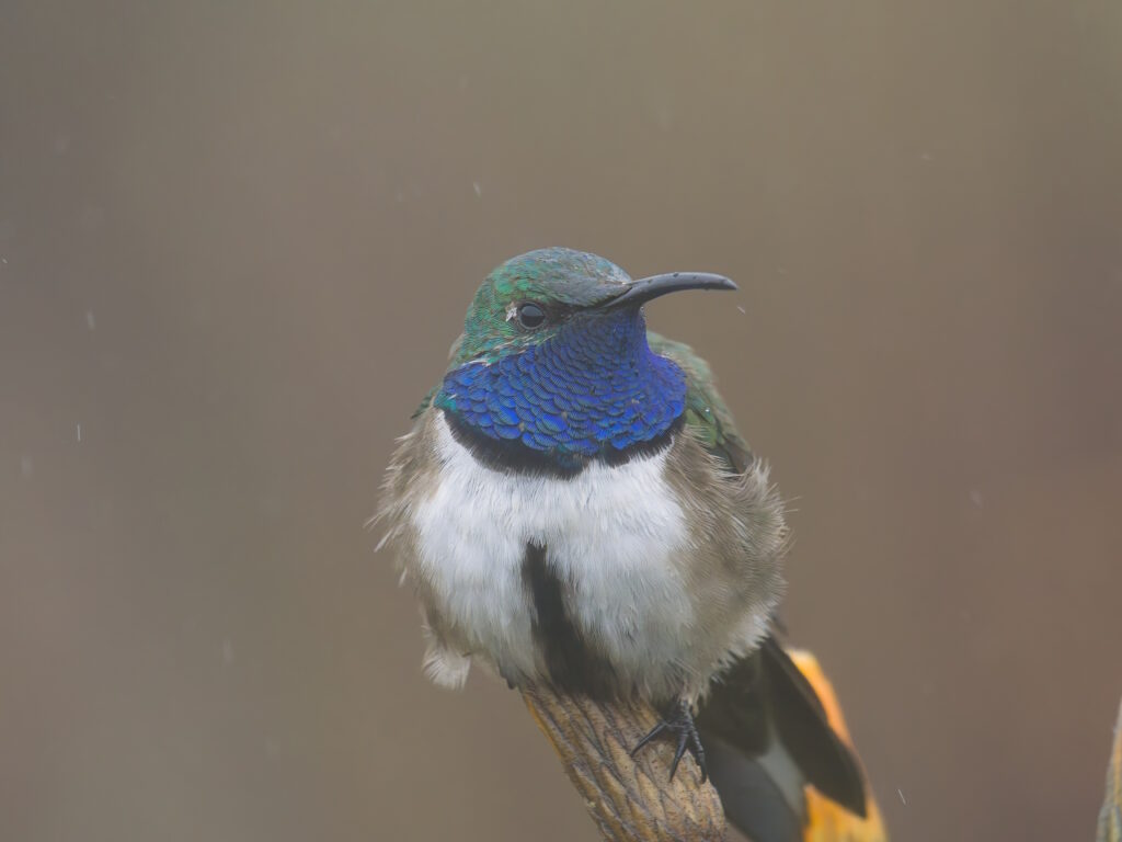
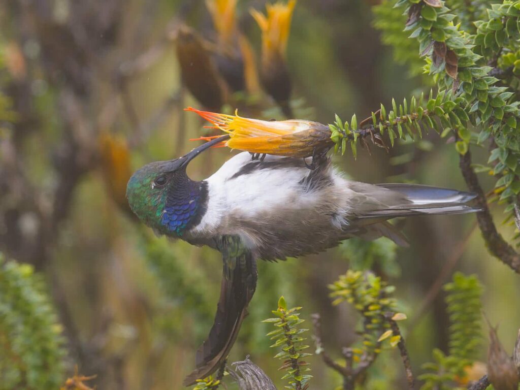
We drove south of Cuenca on highway 59, which was a beautiful drive through a broad dry valley. We then turned off to the south, on a tiny road that zigzagged up into the mountains. We got some strange looks as we passed some of the small farms- I don’t think a lot of foreigners come up this way! We were in search of yet another rare hummingbird, the Blue-Throated Hillstar. It is one of the rarest hummingbirds in the world, and only inhabits the top of one or two small mountains, in an area of only 28,000 acres. It is in such a remote area and occupies such a limited habitat that it was only discovered in 2017! After several hours of bouncing up the rough mountain road, it was dusky, windy, and drizzling when we arrived near the mountaintop spot. We found a sheltered spot behind some giant boulders, and turned in for the night.

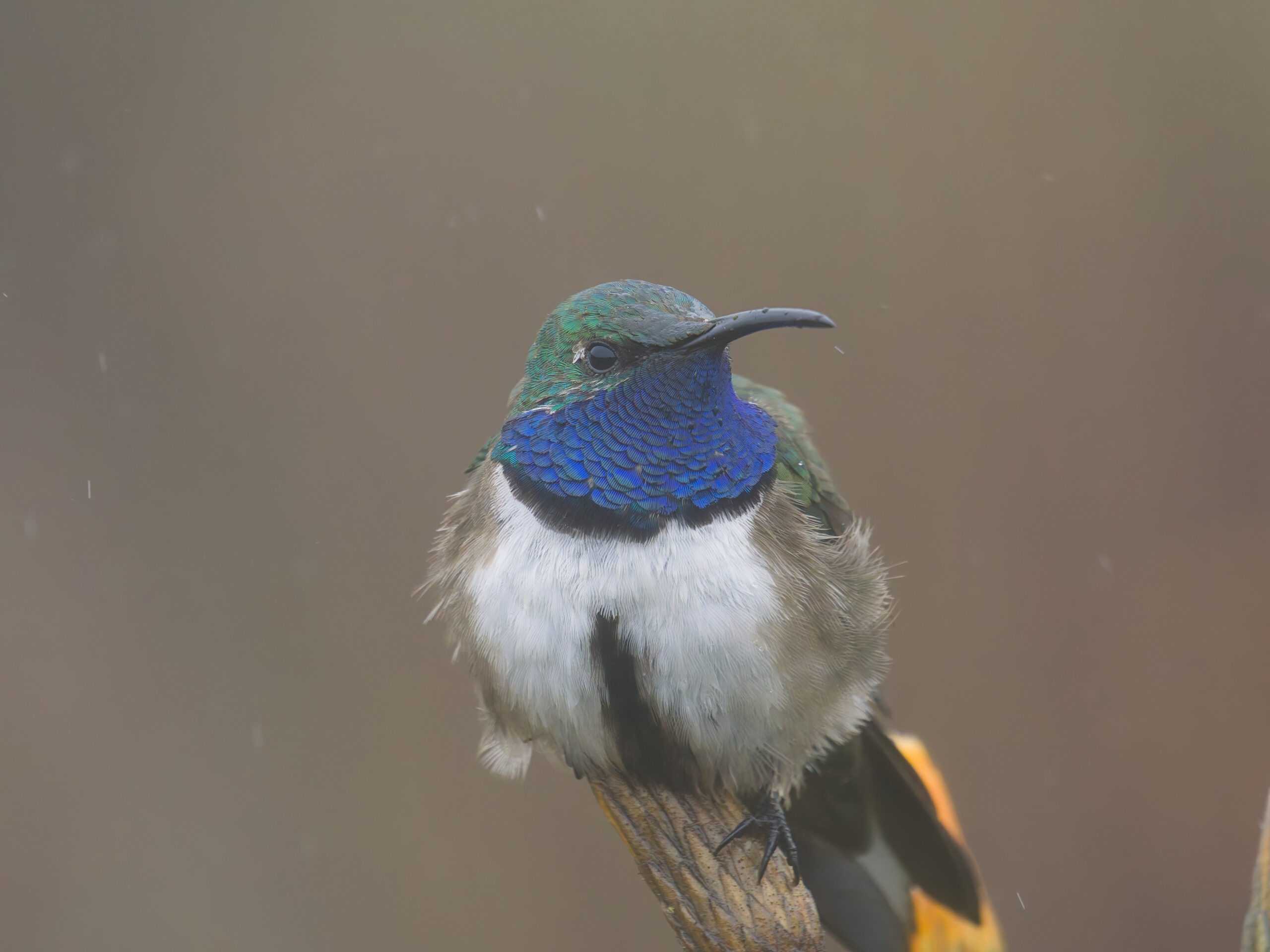
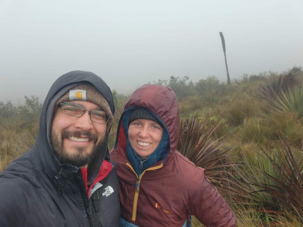
In the morning, the weather was still pretty miserable- dense fog, blustery wind, and persistent drizzle. I was not about to let that deter me from finding this hummingbird though! Its behavior is very similar to that of the closely-related Ecuadorian Hillstar- it feeds almost exclusively on the orange Chuquiraga flowers, so theoretically, all we had to do was find those. We wandered down a bit of a beaten trail off the road which seemed to lead in the right direction- but we only found a few small Chuquiraga plants. We sat and waited for a while, but nothing showed up. We walked back to the road and warmed up for a bit in the jeep. After nearly 3 hours of wandering around in the drizzling rain, Delaney by pure chance walked off the road and spotted a huge grove of the plants. We waited less than 5 minutes before one showed up- a beautiful large hummingbird with a shimmering green head and bright blue throat. He was quite busy feeding on the flowers and paid us no mind, landing within a few feet of each of us several times over the 20 minutes or so that we stayed there. It was such a fantastic feeling to finally find a super rare and endangered bird after sticking it out in some pretty miserable weather.
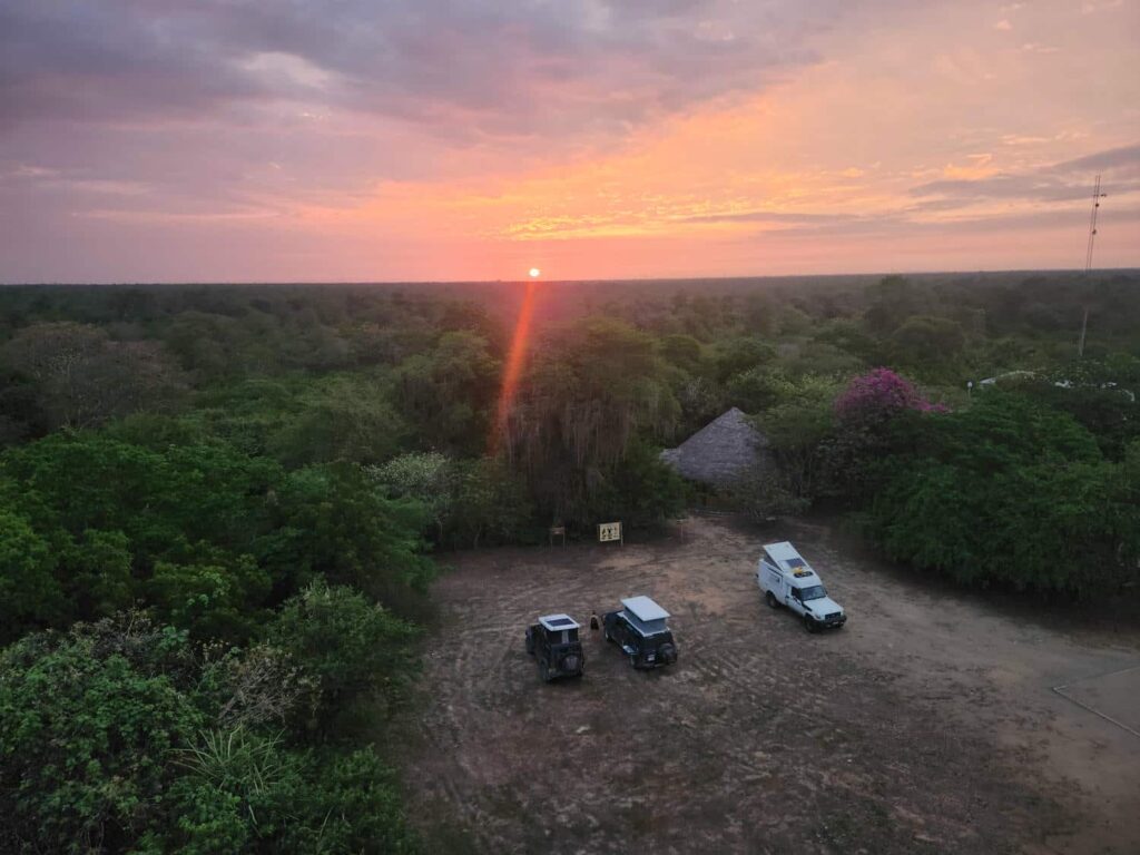
The bird found, we continued south, zigzagging down the other side of the mountain. It was an incredible drive on a crazy road- the road really had no business being where it was, stuck to the side of a landslide-prone mountain. We dropped into the town of Zaruma, which is possibly the most complicated town we’d been to so far on the trip. It is perched on the side of the mountain, and the roads through town had no logic whatsoever to them. Up, down, left, right, switchbacks, a tunnel, all in the middle of narrow and clogged city streets. We only made about 3 wrong turns, and finally made it out down to the highway. After passing through an industrialized area that seemed to be producing lots of gravel and rock, we descended further, going back into the cloud forest. There was a nature reserve that we’d hoped to visit, El Oro, but we were behind schedule, and the reserve’s gates were closed when we passed. Oh well! We dropped back onto the main highway back near sea level, after being at 12,000ft that morning. We were back in an area with lots of reported corrupt police checkpoints, but we weren’t stopped at all. We turned off just before the border town of Huaquillas to the Reserva Ecologia Arenillas, which was a popular spot to spend the night before crossing the border to Peru. The park ranger there was extremely friendly and talkative, and had obviously talked to a lot of other overlanders who had stayed there. Bri and Tevin met up with us about an hour after we arrived, and we had a nice evening together. The parking lot for the reserve was massive, and in one corner had a giant observation tower. We watched an incredible sunset from the top over the tower, far above the treetops. There were some cold showers in another corner of the parking lot, and I evicted a massive toad from one of them.

In the morning, we walked a short loop through the dry forest. Even though it was barely 9am, it was already quite hot by the time we got back to the vehicles! While we each put our stickers on the reserve’s dedicated sticker wall, I happened to look up into the rafters of the open-air shelter we were under, and spotted an owl hiding at the very top! Owls are quite difficult to find, and it was so cool to see one in the daytime. We packed up camp and drove back to the highway, and headed towards the border with Peru. At this border, all we had to do on the Ecuadorian side was cancel our vehicle paperwork. We parked and stood in line behind some Brazilian overlanders entering Ecuador. Just as they finished, the aduana officer told us that his internet had just gone down, and that we would have to wait. He said that the internet might be back in 5 minutes, might be back that afternoon, or might be back the next morning. From his mannerisms, it seemed like a fairly common occurrence. We sat outside the office waiting, as a very persistent elderly ice cream salesman tried to tempt us. He had a tricycle contraption with a big cooler on the front, with a speaker playing music on the back. He would peddle up to us, stop maybe 10 feet away, ring his little bell, and turn the music up! He wouldn’t say a thing, just sit there with the loud music and the quite tempting ice cream as the day got hotter and hotter. He came and left every 20 minutes or so, making his rounds to tempt the other people working their way through the border. We stayed strong, but he did quite well with many others for the 2 or 3 hours that we waited.
We’d met a Swiss couple also camping at Reserva Ecologia Arenillas, and had left the reserve before they did. They arrived at the border post after we’d already pulled out our camp chairs and made lunch, camped out in front of the office door. The aduana officer came out and talked with them briefly, and invited them inside to get their paperwork done. Wait a minute! We thought that there may have been a misunderstanding- from what we’d read, all we needed was a stamp on our vehicle paperwork. It turns out that he thought that we were entering Ecuador, not leaving it! He couldn’t get us in to Ecuador without internet, but he could get us out. Feeling like fools for not pushing a bit harder, we had our paperwork done seconds later, and drove across the border to the Peruvian side.
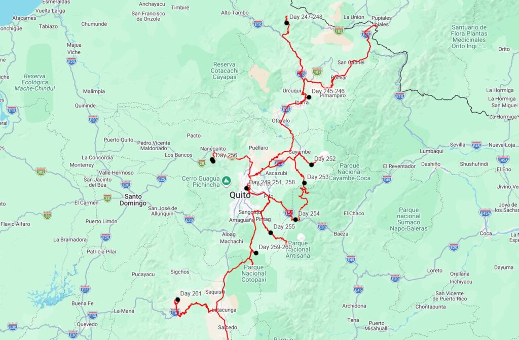
Some final thoughts about Ecuador: we thought it was very similar to Colombia. The cuisine, culture, landscapes, tourist attractions, and climate were all very alike. There were definitely some differences, the most noticeable for us being Ecuador’s national park system. Unlike Colombia, where we felt that they were actively trying to keep you out of the national parks with high fees and guide requirements, Ecuador’s national parks are free and easily accessible. Ecuador is a small country- I think if we wanted to drive from the northern border where we entered to the southern border where we exited, it is only around 14 hours of driving. The roads were in mostly good condition, making it easy to get from place to place, which takes me to my final thought: We will probably be back to Ecuador someday, as a 2-week vacation or something similar. There is so much tourism infrastructure in a relatively small area that it is entirely feasible to see a really good chunk of the country without a camper vehicle like ours. One of the reasons we spent a comparatively short time in Ecuador is that it will be easy to see later in life- same with the Galapagos Islands. I could totally imagine taking a 2-week vacation from work in a few years, flying to Quito and spending a few days there, flying out to the Galapagos for a few days, then driving down to Cuenca and spending some time in Cajas National Park, then flying back to the U.S. from Cuenca. But those are plans for much later- on to Peru!
Keep em coming guys! What an amazing trip!
Thanks Zach! Missing you guys!