We got up with the sunrise the next morning, 11/19/26, and packed up camp. We’d chosen to cross the border at Tecate, 30 miles east of the main border crossing at Tijuana. The American side at Tecate isn’t much- a few duty-free stores, a gas station, and some money changers. The Mexican side is a real town, but much less busy and hectic than Tijuana. We drove up to the border and were waved through a large gate, straight onto the tiny city streets on the other side. If we’d wanted to, we could have just drove off and into Mexico! However, we needed some documentation. We parked a few blocks away and walked back to the border crossing, and into the small Immigration office. There we each received our Forma Migratoria Multiple, or FMM, which directly translates to “Multiple Immigration Form”. We took these forms across the street to the Banjercito, a government entity that handles payments at the border. We paid for our FMMs there, before returning back to the Immigration office where the forms were stamped. Now we were legal to be in Mexico- but the jeep still wasn’t.
As we walked back to the jeep together, we were both kind of shocked that we’d managed to complete this step with barely any English. The Immigration officer hadn’t spoken any other than a thickly accented, “Where are you going?”. The Banjercito clerk had used a bit more, but we still used single words in Spanish and hand gestures to answer her questions. Delaney stayed with the jeep while I went back in with the vehicle paperwork. We needed to get a TIP, or Temporary Import Permit for the jeep. I struggled a lot more here because Baja is a “free zone”- you don’t need any special vehicle paperwork if you stay in Baja. This means that at the Tecate border, unlike for example a border in Texas, most people do not get a TIP. Because of this unfamiliarity, the Banjercito clerk took a long time to fill out the TIP, and seemed to be really struggling with something. After almost 10 minutes, as a line built up behind me, she told me in broken English that she couldn’t find Alaska in her system and that we would have to wait for her boss. A lightbulb went off in my head and I told her that I was “de Estados Unidos, one of Estados Unidos”: I’m from the U.S., one of the United States. That was it! I had the completed TIP a few minutes later. She had thought that Alaska was it’s own country!
All in all, we paid $52 USD each for our FMMs, and $46 for the TIP, plus a $400 deposit that we will get back when we leave Mexico. I returned to Delaney triumphantly with the TIP- we had done it! Now we had to get vehicle insurance- U.S. insurance does not apply in Mexico. An insurance office was another few blocks away, so Delaney stayed with the jeep again and I walked over. After more gesturing and one-word answers, I had insurance! We got in the jeep and headed straight out of town as quickly as we could.
Other than an afternoon in Tijuana one spring break during college, I had never been outside the U.S. or Canada before. I was expecting poverty, but as we drove south through the countryside, I was struck by just how poor the area was, even just 10 miles south of the border. Most of the buildings were half-finished, none of the buildings that were finished looked well-maintained, and though many of the vehicles on the highway were somewhat newer, the vehicles in the small towns we passed through looked like they were being held together with baling wire. Delaney had seen far worse during her time in Malawi, but this was very new for me.
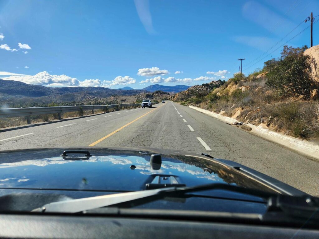
Driving in a different country was also very new. None of the speed signs were in a consistent place- they could be on the left side of the road, right side of the road, low, high, who knows! It was also striking how few stop lights there were- but there were stop signs aplenty! Surprisingly, all the 4 way stops we passed seemed orderly, and people knew how to take their turn. They perhaps even approached the efficiency of a roundabout. Another thing that struck us was how small the roads were- the highway was a narrow 2-lane road with no shoulder, and the city streets were smaller still. The jeep, which is not a gigantic vehicle in the U.S., is one of the largest non-commercial vehicles on the road.
As we entered Ensenada, we finally saw the ocean! We had probably seen it during our errand day in San Diego, but now we were driving right next to it! After a hectic 15 minutes getting to the south side of town, we pulled into a Costco. We had planned to stop here and stock up on both food and fuel. Most of the products inside looked the same, with the same selection, but the labels were all in Spanish. We were grateful to be able to fill up with gas at Costco, as there are many reports of the local gas stations scamming tourists in all sorts of creative ways. We topped of the tanks and headed south, looking for a campsite.
Delaney found a good area to look past the village of Erendria, 10 miles off the main highway. We drove north of Erendria on a rough dirt road, right on the coast, with waves crashing into the shore. We found a great spot in a cove a few miles north of town and settled in for the night among some sand dunes. When we woke, we were glad we had camped up above the rocks rather than on the beach- the tide had come up far more than I had anticipated! We spent the day relaxing, walking up and down the beach, and tidepooling. We found all sorts of crabs, snails, and anemones in the rocky pools. The water was frigid, but the sun was wonderfully warm and pleasant. It was a perfect day after the hectic pace we had been on the last few days.
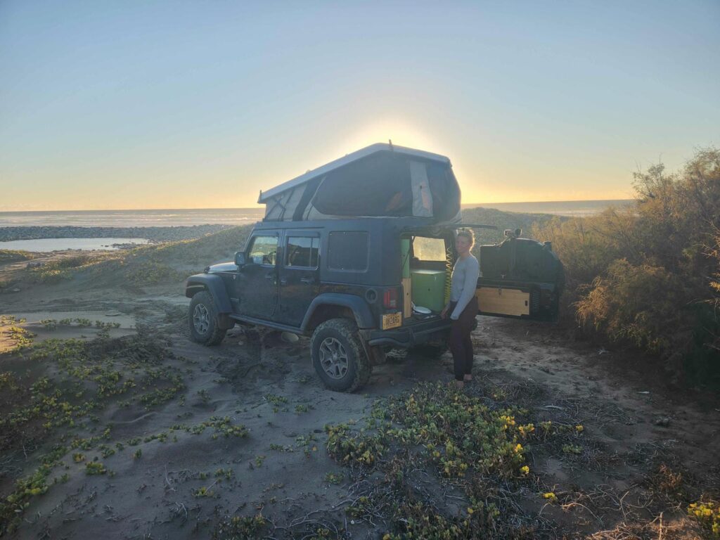
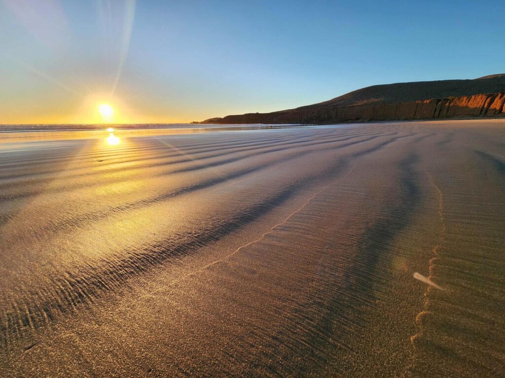
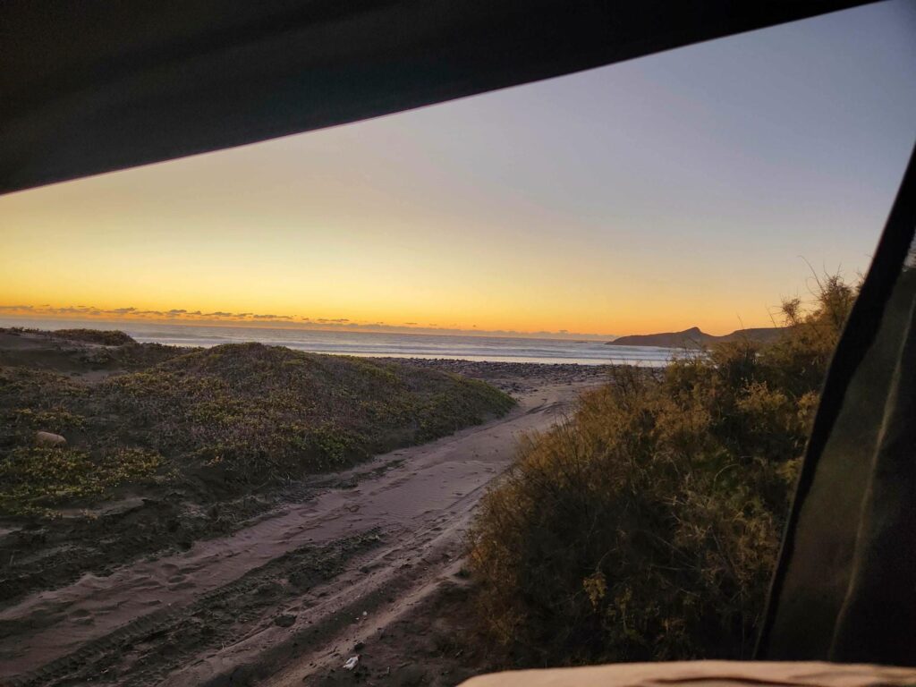
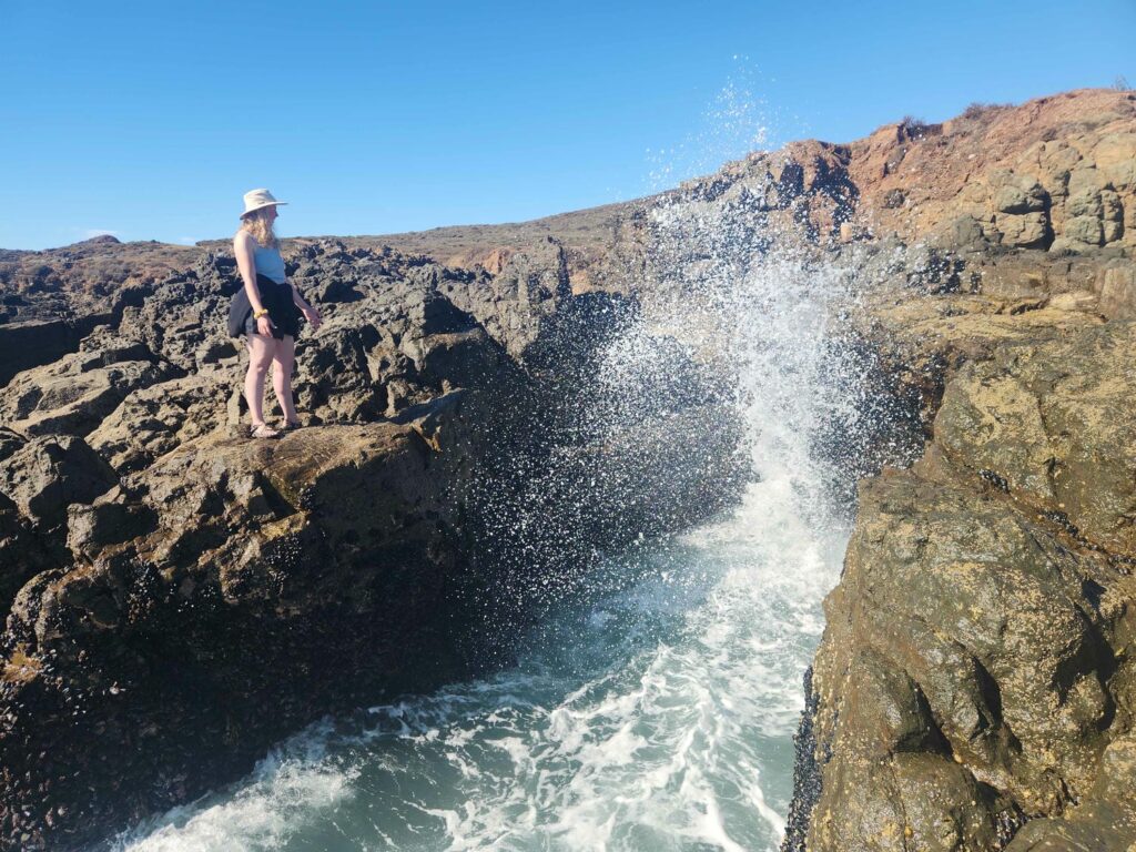
We spend our second night in Mexico there as well, eating dinner sitting atop a sand dune looking out over the ocean at the sunset. We slept great in the cool sea air. The next morning, we watched fisherman of some sort on the next rocky point north of us put wetsuits on. I imagine they were after lobsters, but there were also piles of dead sea urchins near the road on our drive out that morning. We headed south back through Erendria, but instead of going back to the main highway we followed the coast south. There was a back road on Google Maps that looked like it would go south and eventually connect back up to the highway- not having to retrace our steps sounded great! On our way down the coast, we noticed that it was much rockier than north of Erendria, and the waves crashing into the rocky outcrops were huge! At one stop, watching the waves, we noticed that there was an intermittent geyser-like spray of water coming from the coast another mile up.
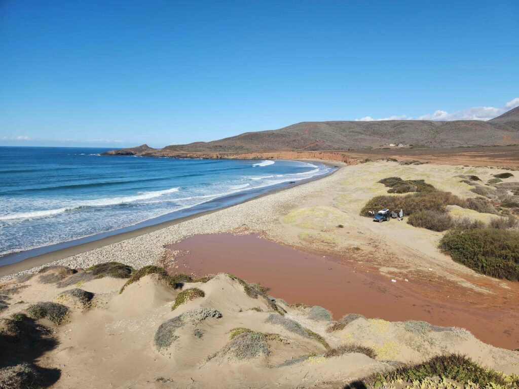
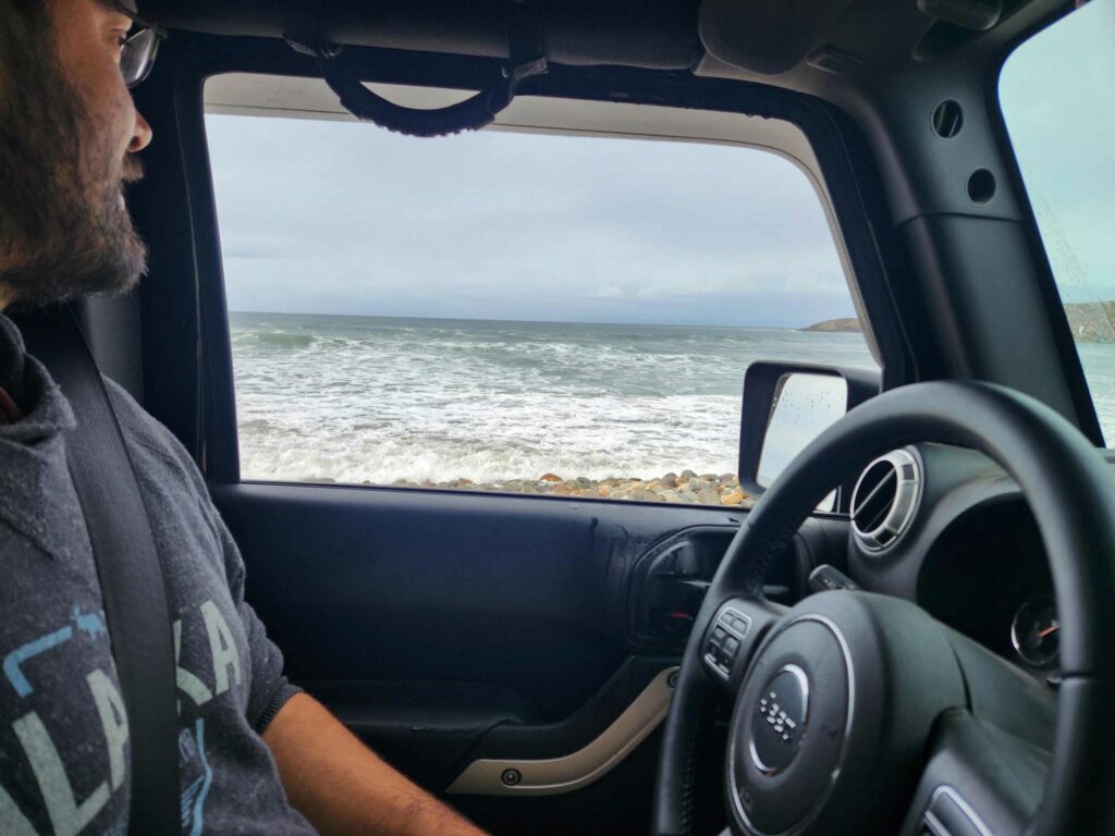
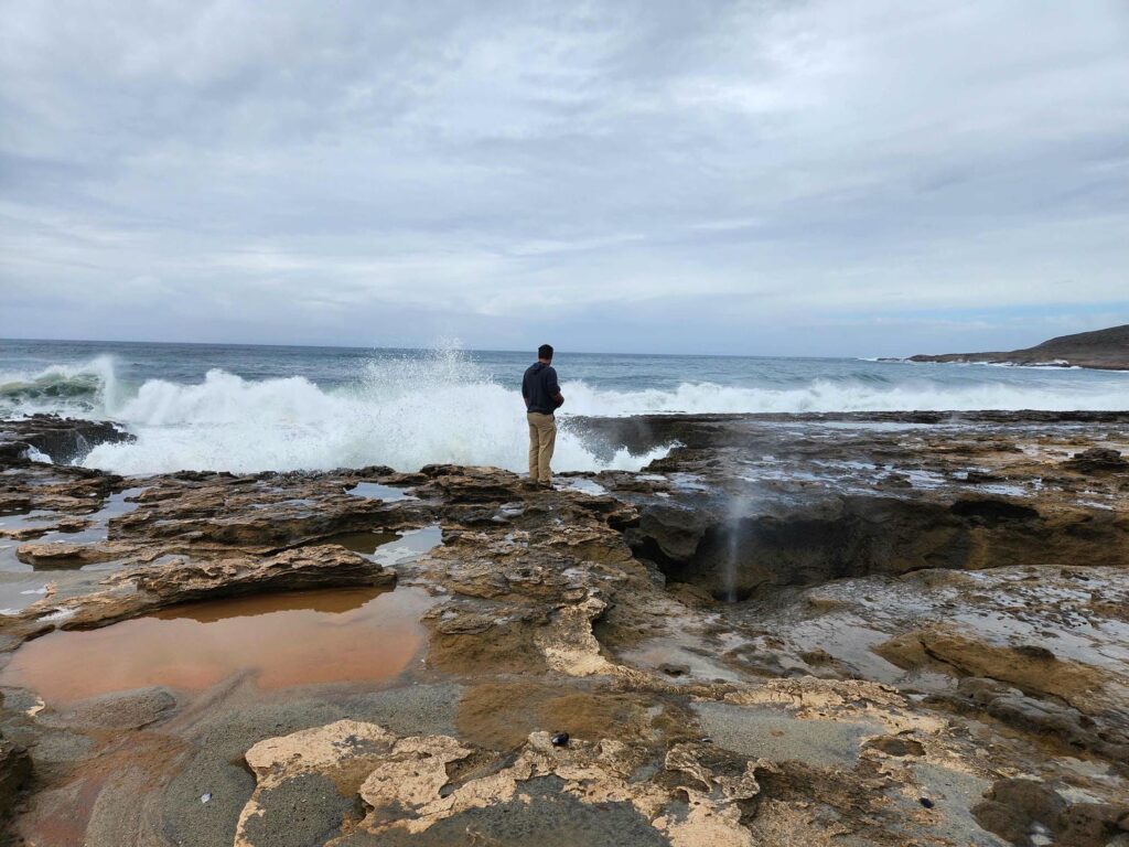
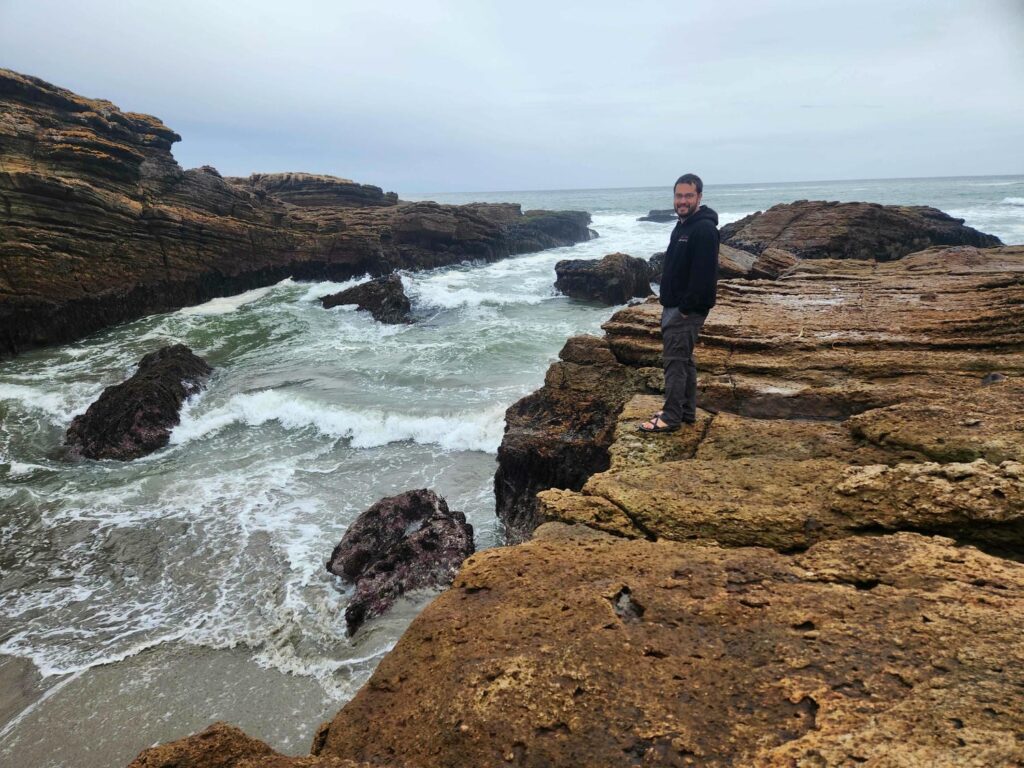
The spray was called “La bufadorcita” or “little blowhole.” There is an attraction outside of Ensenada called “La bufadora”, which we had skipped, but it is a much larger version of what we had found here- a sort of geyser that is formed when waves erode away rock, creating an overhang. Rock is further eroded away inland, creating a tunnel through to the surface, in this case perhaps 20 feet back from where the overhang to the crashing waves was. When the tunnel fully fills up, the air that is in the cavity is forced through to the surface, forming a spurt of air and water. The exact wave conditions to form a good spray are intermittent, and we were surprised by a few, leaving us soaking wet! When some of the larger waves would hit, we would feel the rock underneath us shudder- we came to the realization that the rock below our feet was mostly hollow, with much of it already eroded away by the relentless waves. Many of the coves nearby must have formed by the overhanging rock collapsing into the surf. We stayed a while longer, fascinated by this unique geological phenomenon, before continuing down the lonely dirt road on the coast.
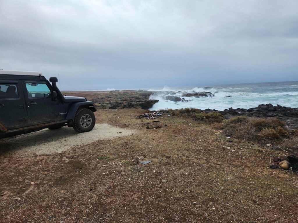
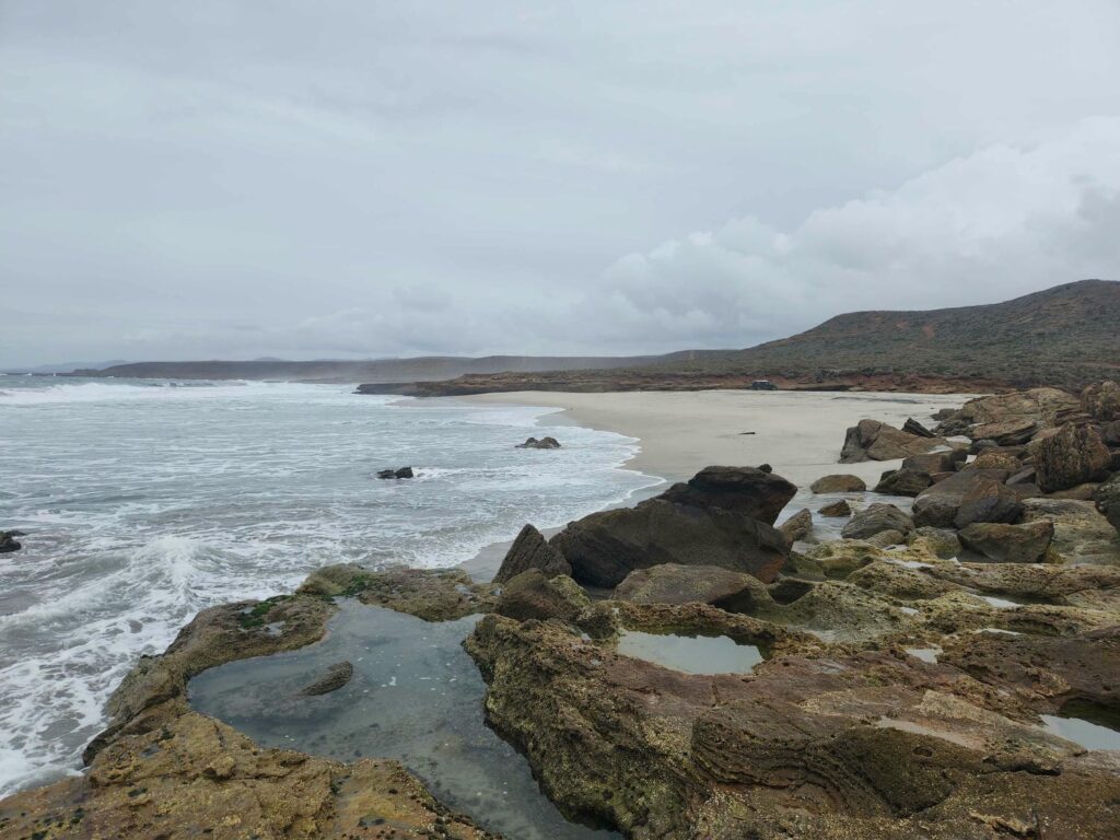
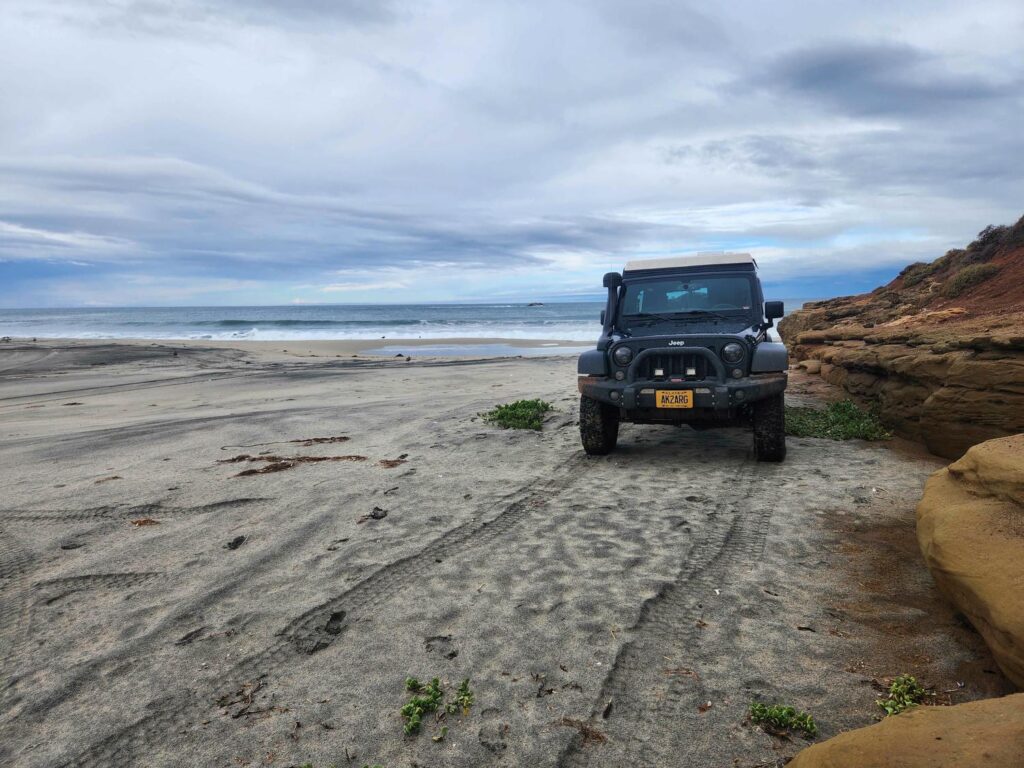
We found that the route we had been planning to take was completely washed out a few coves south of “la bufadorcita”. Since we had been planning on camping before we got back to the highway anyhow, we backtracked a cove or two and were able to get right down onto the sandy beach, in a beautiful cove. We explored the rocky points on either side of the cove, finding lots of crabs, anemones, and mussels, before having a very sound sleep that night with the waves crashing 20 feet away.
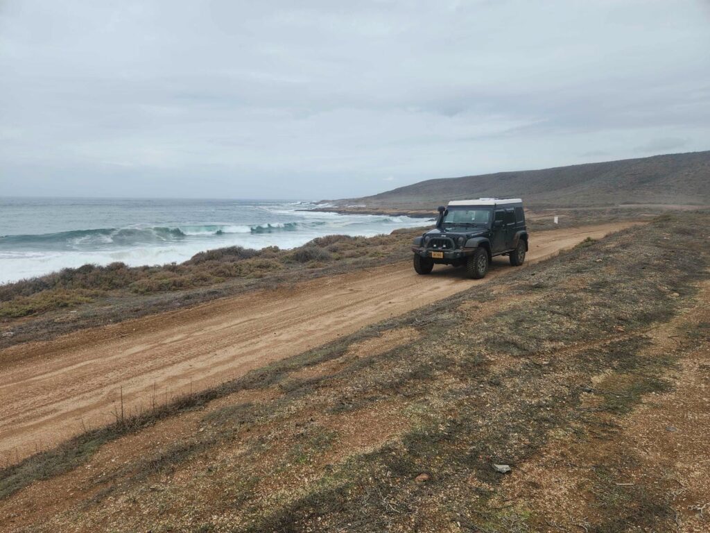
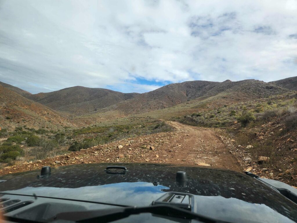
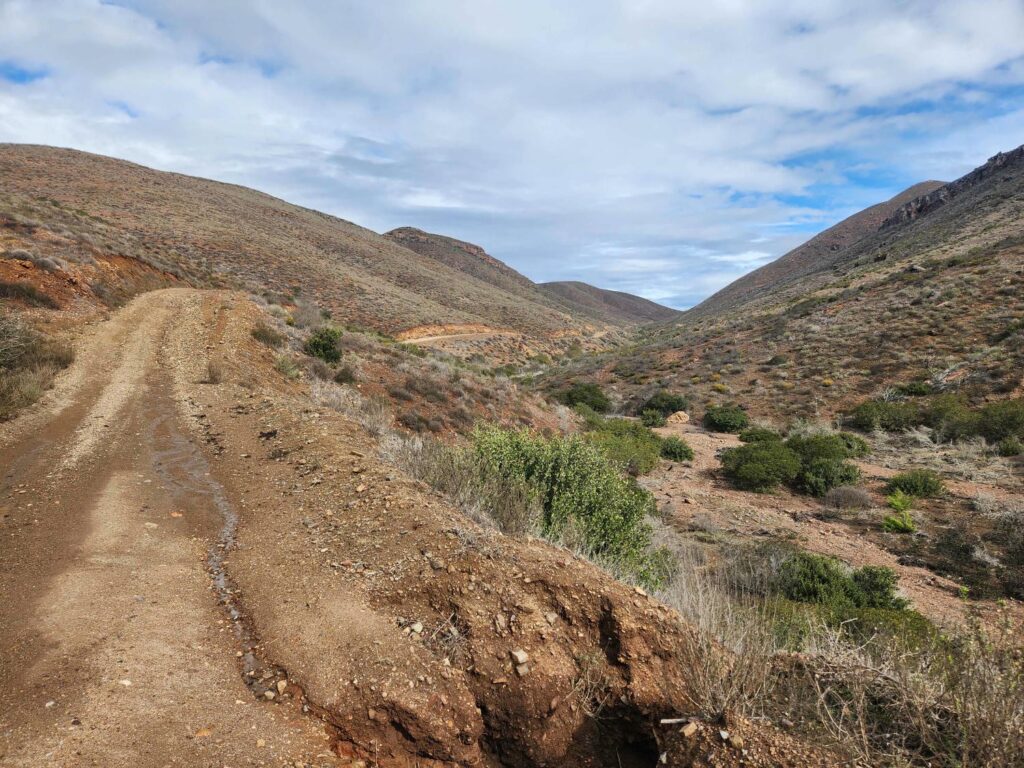
We had a bit of a lazy morning, before starting on our way back to the main highway. Since our planned route down the coast was washed out, we found a route inland back to the highway, rather than backtrack through Erendria. I think it must have rained pretty hard here in the past few days, because the dirt trails we were on were very muddy below the sandy surface. After our first planned route turned too muddy for us to risk it, plan C finally was a ranch road that branched off into the mountains between us and the highway. This road was in great shape, and thankfully not too waterlogged. It took us an hour or two to wind our way along the narrow road. We hadn’t seen a single other person since we passed through Erendria the day before.
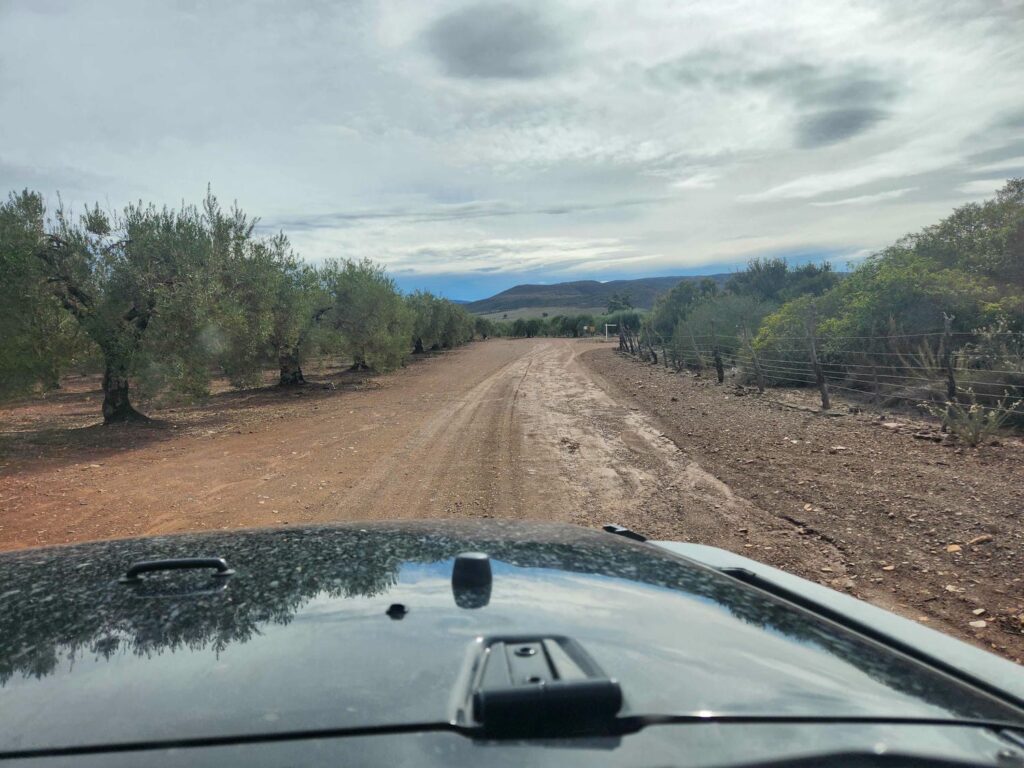
We finally dropped down out of the mountains into some ranchland, and chose to keep trying back roads instead of going directly back to the highway. The road we were on got smaller and smaller, as we passed cattle ranches, cactus farms, and finally an olive farm (orchard?). The road went directly though the olive trees, so we followed it as it got rougher and rougher. It finally ended at a ranch, where the workers told us that the road did not go through. We drove all the way back to the main route, where we finally spilled out onto the highway at San Vicente- only 7 miles south of where we had left it 4 days earlier!
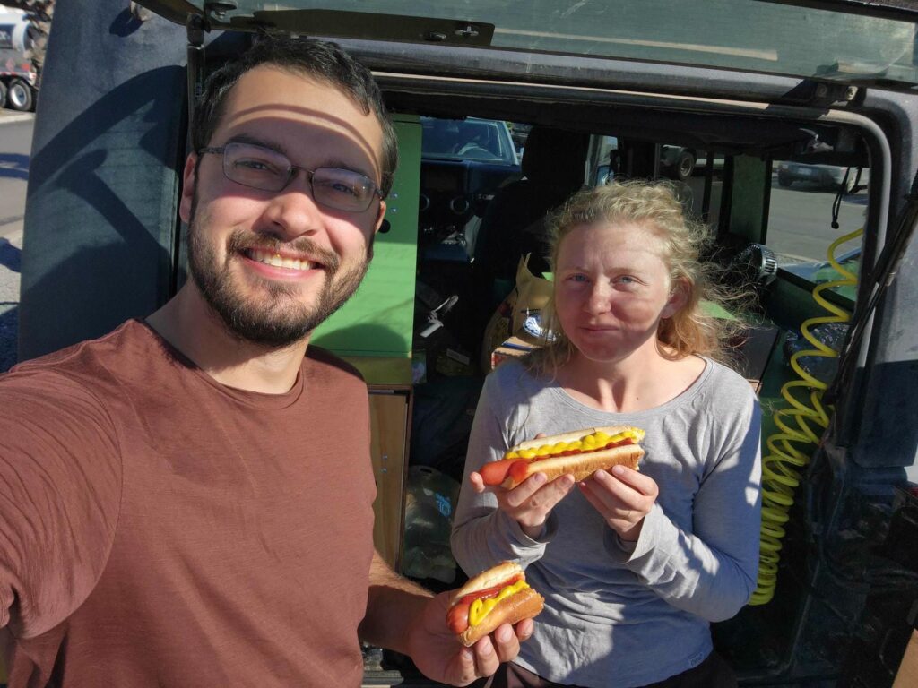
Back on the highway, we drove south. The speed limit for the road fluctuated between 80km/hr and 40km/hr- about 50 to 25mph. It changed constantly and without reason- we would have maybe a few hundred yards of 80km/hr before going right back down to 40, or it would have us slow down from 60 to 40 for a tight corner- but there wouldn’t be another sign saying we could go 60 again for miles of straight road! None of the towns we passed through had stop lights- only 4-way stop signs. As we drove into the town of Lazaro Cardenas, we began looking for one of Mexico’s famous taco stands for a late lunch. We found one, and managed to communicate to the proprietor that we we wanted 2 tacos each. It was only 140 pesos for the 4 tacos- about $7.50. We imitated the other customers, eating our tacos standing. They were fantastic!
With full bellies, we headed west towards Punta Mazo Natural Reserve. The road out of town was incredibly bumpy, and full of both private vehicles and commercial trucks. After a few blocks of punishment, we pulled off to the side and aired the tires down- what a relief! It is amazing how much more comfortable it is on rough roads with 20psi instead of 40. Finally out of town, we passed by a marshy bay full of oyster farms- and oyster bars. There were piles and piles of shells in a dump on the side of the road, from years of tourists getting their fill of fresh oysters, right out of the ocean. We passed between some small volcanic cones before making it to some grassy sand dunes on our way to the entrance station to the reserve. We had heard that it was free to camp, but that you needed to sign in. There was no one at the entrance station, but a red pickup soon appeared. The young man in the pickup was in charge of the reserve, and after a conversation consisting of me asking extremely simple questions in extremely poor Spanish and him replying in extremely fast Spanish, we understood that we were welcome to camp and that no registration or sign-in was necessary. He was very friendly, and warned us about a big sand dune that we would have to cross if we wanted to get to the best camping area.
Punta Mazo is a long peninsula with a huge sandy beach on the western, sea-facing side, and a marshy estuary on the eastern inland side. We first looked at the estuary side, which is famous for being one of the few places that Brants, a type of goose, spend the winters. I’ve seen them on the North Slope before, but nowhere else- and here there were thousands and thousands of them, all bobbing along in the ocean like a black-and-white carpet. It was quite the spectacle. We had initially hoped to drive south down the estuary side and then return down the beach side after a few days of camping, but the road quickly petered out in the surf. In hindsight we probably could have made it just fine, but we are much more careful offroad than we are in Alaska where help is only a phone call to Owen away.
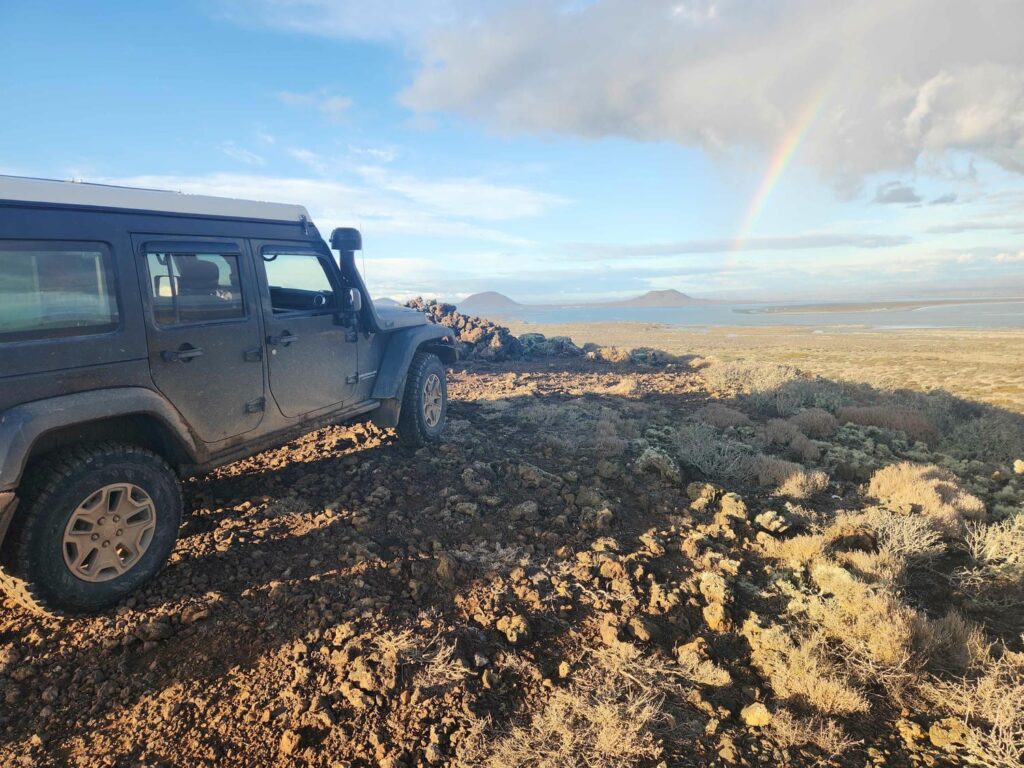
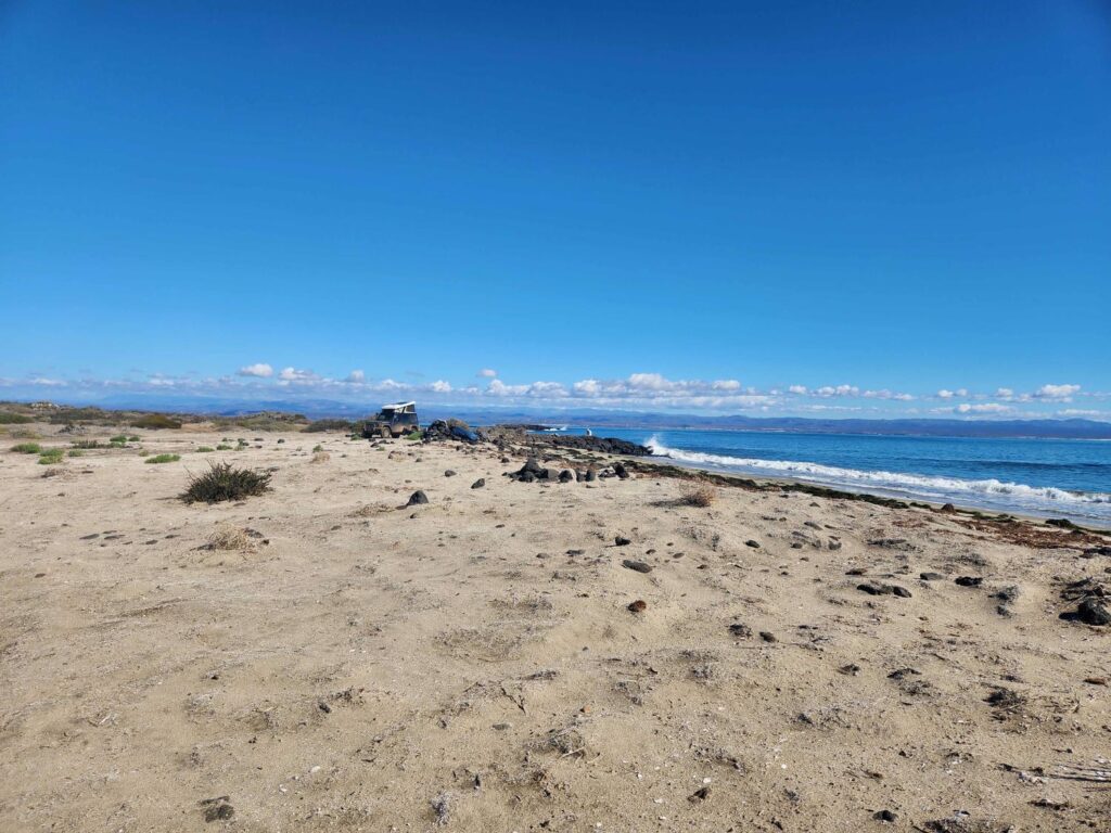
We backtracked to the western side and got onto the beach. The beach is huge- 4 miles of completely uninterrupted sand. We dodged piles of seaweed all the way down, trying to avoid the wetter sand where we would sink in a bit. At the end of the beach was a rocky point. There was a road that stayed on the coast and wound around the point, but it looked a bit sketchy and the other road looked more fun- a big sand dune we had to drive up and over! The jeep had no trouble with it at all, and after winding through a few smaller dunes we were up on top of a large flat point on the end of the peninsula. The vegetation was mostly scrub and cactus, but the rock was all black and porous- volcanic. There was a volcanic cone in the center of the point that we were able to drive to the top of- it was super steep! Again, no trouble for the jeep. After admiring the view, we backtracked back down and wound around the point and had our pick of the beaches. We picked one with some interesting rocky points and settled in for the night.
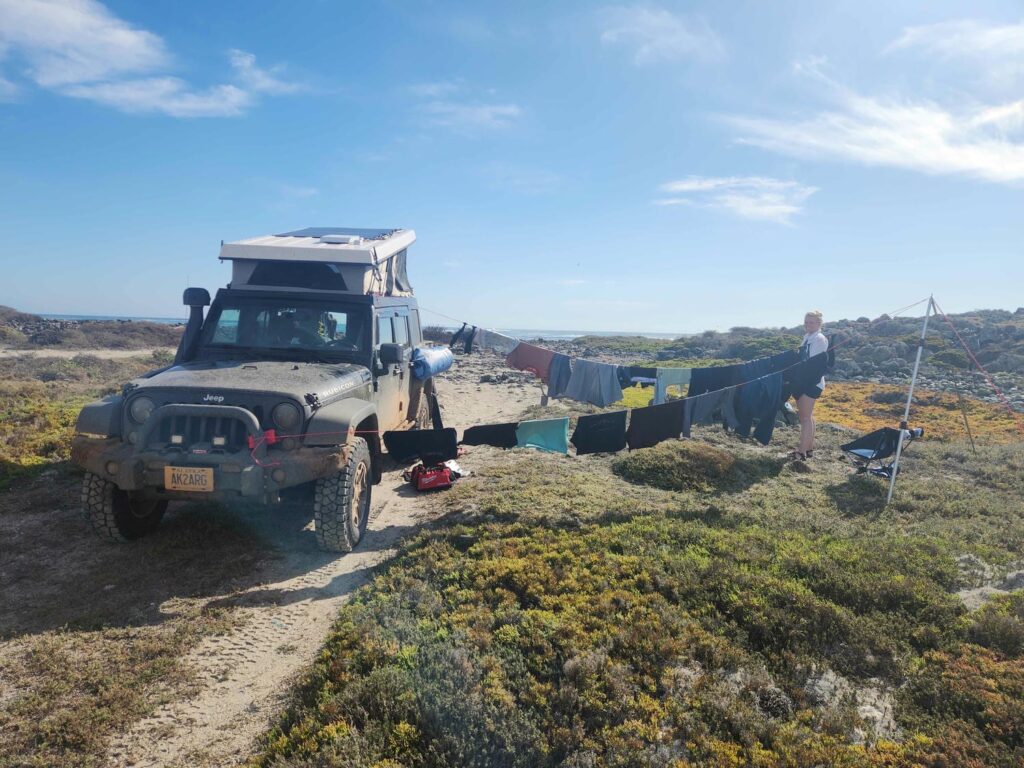
The next morning, we had a lot of things planned. Number 1 was to waterproof the Sunbrella tent fabric of the top. The fabric is often used on sailboats and is quite waterproof, but a special spray needs to be re-applied every year or so. I think it had been quite some time since it had been done! We had noticed the past few nights that the tent fabric would be soaking wet from dew in the morning, and it was beginning to wick into the inside as well, leaving us with wet sheets. The spray had to sit and cure for at least 24 hours as well, which meant we needed to stay put in the same spot for 2 nights. We also re-caulked the inside of the top where the fabric connects to the fiberglass- water that sits on the outside of the tent on top of the fiberglass can sneak underneath the fabric, and we hadn’t re-applied the caulk after removing it months ago when we modified the top. We also did several loads of laundry- we have a dry bag with some plastic ribs on the inside so we can do laundry on the road. Clothing, water, and soap go in, the air is purged out, you knead the bag around for a few minutes, drain the water out, squeeze the clothes out, put them back in the bag with more clean water, knead it all again, then finally wring the clothes up and hang them to dry. It’s a lot of work, but it works well. Hanging clothes to dry right next to the ocean was a bit of a challenge as there is much more dew in the morning than we expected, but we eventually figured it out after waking up to clothes that had become wet again!
Another project was mounting a new 3rd brake light. We wanted to attached our canvas Trasharoo trash bag to the spare tire, but it would cover up the 3rd brake light behind the tire. Back in Minnesota, with the help of Delaney’s dad, I’d built a bracket to attach a light to that would be visible with the trash bag on, but I didn’t have a light yet. I’d bought one in San Diego, and now I had to screw in self-tapping screws into the bracket without power tools. It was a pain in the rear and cost me several blisters and an hour and a half, but I was able to drill and tap holes in the bracket with nothing but a screwdriver. I re-ran the wires from the old 3rd brake light to the new one and I was done!
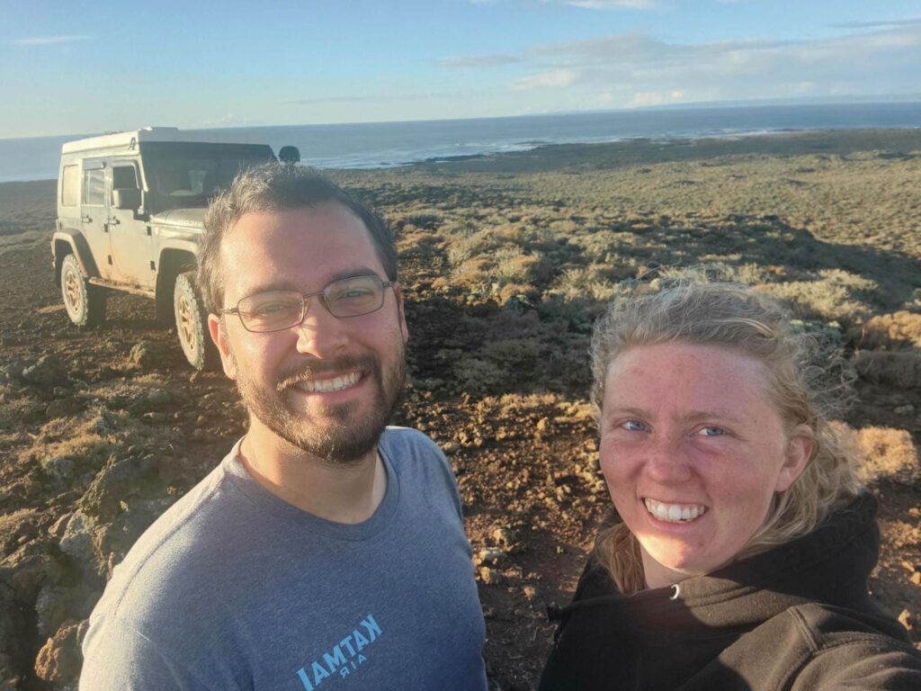
In between projects, we explored the area a bit. There were lots of tide pools with the standard crabs and anemones, but also wide, sandy beaches with shorebirds, scrubby brush with lizards, and after a longer walk, we found a rocky outcrop a hundred yards offshore with 120 sea lions on it! After 2 nights in our first spot, we moved over closer to the sea lions for the 3rd night, and heard them barking and roaring all night. We ate our meals looking out across the Pacific, watching the sun rise and set, with sea lions a short distance away. Paradise!
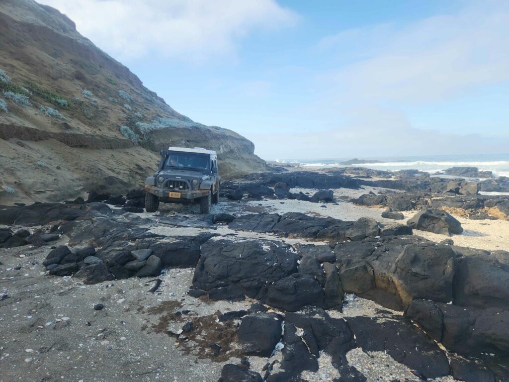
After 3 nights out on the point, we sadly headed back. We hadn’t seen a single other person or vehicle since the park ranger 4 days earlier, and we’d had the entire peninsula to ourselves. We went back the “sketchier” route we hadn’t taken earlier, and had to do a bit of rock crawling to avoid driving in the surf. Back the 4 miles up the beach dodging seaweed, and to the entrance station. The entrance station was also a bit of a campground, but there was absolutely no one there. There was a clean water source, so we took bucket showers and filled up our water tanks. It is a great feeling to have full water tanks, clean clothes, and be recently showered! We bumped our way back into town.
Delaney stopped in at a small grocery store in Lazaro Cardenes to stock up on some food, while I aired the tires back up in the parking lot. Back on the highway, we made tracks south. There wasn’t a lot in central Baja that we were terribly interested in, and we’d already spent 6 nights less than 70 miles apart. We loved the little town of El Rosario as we passed through- it is in a deep dry valley, with colorful buildings, palm trees, and friendly people. We got birria tacos in town at another taco stand, which we thought were incredible! Birria is meat that has been marinated in vinegar, chilis, and spices, then cooked in a broth. It is served in tortillas, with broth on the side to sip on or dip the tacos in. It is incredibly delicious. Again, it was only about 8$ for a meal that filled both of us up.
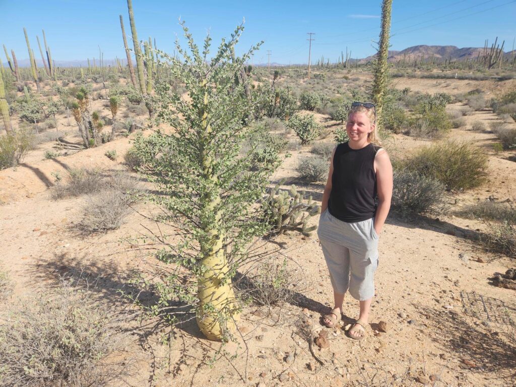
Past El Rosario, google maps shows quite a few little towns, but none of them is anything more than a few small ranch buildings. This area of Baja has almost no people in it- but it does have a lot of cactus! There are all sorts- barrel cactus, mexican giant cactus or Cardon cactus, galloping cactus, chola cactus, and I’m sure far more. We also started seeing Boojum trees, which defy comparison. Their name is taken from a Lewis Carroll poem, and they look like a Dr. Seuss cartoon. They are about a foot and a half across at the base, and taper gradually to the tip, where they split into several tiny flowering branches. They are covered from top to bottom with tiny branches, each with some very large thorns and small leaves. The “standard” Boojum tree stands straight, but there are all sorts of crazy variations- some split into several tops, some are bent back and forth, and they rarely even form loops in the trunk, and some do all these things! They stand at over 50 feet tall, but we later read that they can grow to almost 80 feet, and that they only grow a foot every 10 years. That means the oldest ones are nearly 800 years old!
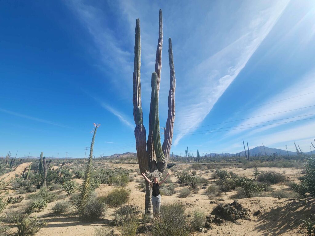
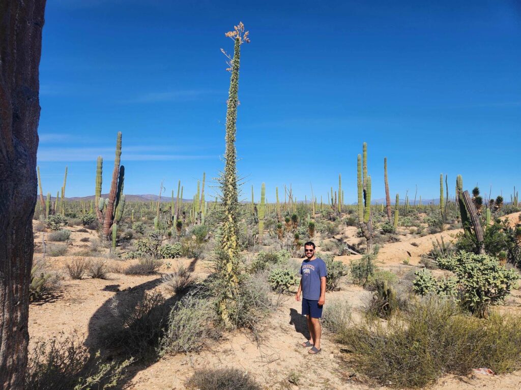
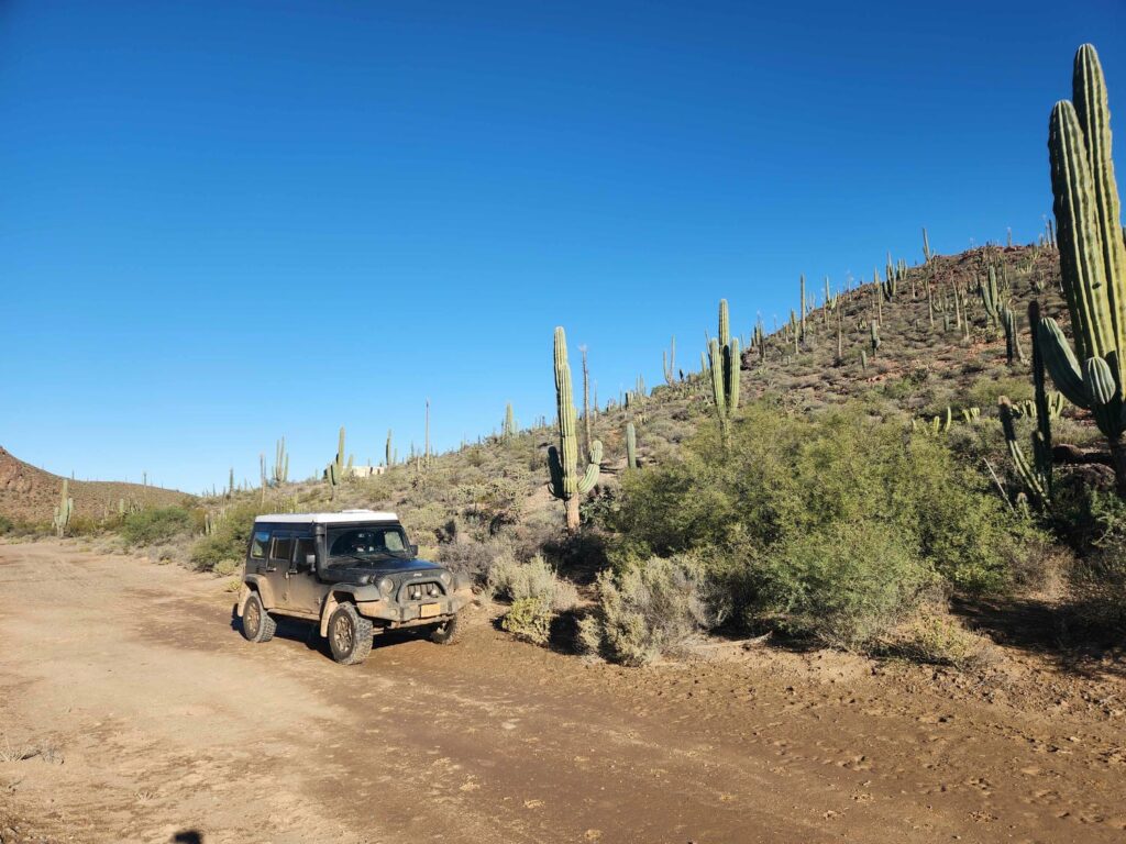
We camped on a bypassed highway section near “Mision San Fernando”, but there was nothing there but some old building foundations, a bunch of trash, and a creepy concrete well. The well was dug near the bottom of a desert wash, or arroyo as they are called here, but there wasn’t any water until at least 10 feet down. We had a great night’s sleep, other than being awoken by a very loud cow mooing right next to the jeep at about 2am! We started moving again early the next morning, as we had another long driving day planned. Most of this day would be spent driving through Valle de los Cirios, or “Candlestick Valley”, named for the Boojum trees and the Mexican Giant Cactus, which is the tallest cactus in the world. They are closely related to the Saguaro cactus of the southwestern U.S. It was an incredible landscape, with a surprising amount of topograpy- huge cliffs, rock outcrops, and volcanic cones were everywhere, all covered by the “candlesticks”.
As lunchtime was approaching, we crossed into Baja California Sur, the southern of the Baja peninsula’s two states. At the border was a fumigation station, which is ostensibly meant to prevent the spread of insects from one state to the other, but most cars were just flying past it. Still a bit naive, we pulled in, and after arguing for a few minutes that it wasn’t necessary and that everyone else was bypassing it, we paid 20 pesos or a bit over a dollar to drive over a light mist of who knows what. Next time we won’t stop! We did pull into the town of Guerrero Negro and after driving from one end to the other, found what I’d been looking for- shrimp tacos! They were absolutely fantastic, and we had to have some of the fish tacos they were selling as well.
Back on the highway outside of Guerrero Negro, we drove inland towards Baja’s eastern coast. This part of the road wasn’t very interesting- very flat with a very straight highway. There was quite a bit of agriculture in the area, but most of it was in greenhouses so we weren’t able to see what was being grown. We have noticed that Baja has much more agriculture than we were anticipating, but there aren’t a lot of medium-sized farms. It’s either someone’s personal garden or it is a factory farm with thousands of acres and hundreds of employees. Unsurprisingly I suppose, there also doesn’t seem to be a lot of what we would consider “normal” crops- corn and soybeans. Again, most of it is in gigantic greenhouses made of a metal frame and plastic sheeting, but the crops we have seen have been gourds, cactus, palm trees, and agave. We did pass a giant Driscoll strawberry farm back near Lazaro Cardenas!
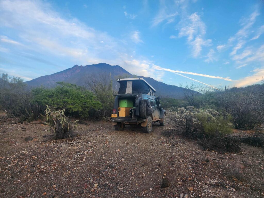
The road got more interesting as we went further east, back into the mountains. After a long day of driving, much of it at 40 or 60 km/hr (25 or 37mph), we turned off onto a dirt road west of “Las Tres Virgines”, a prominent volcanic mountain. The dirt road was great, and wasn’t even that steep, but we couldn’t find anywhere to pull off of it! The scrubby brush was incredibly dense. Finally, after probably 5 miles, we found a small wash that we stopped in. There were spiny cactus everywhere, so we didn’t explore a whole lot- but we did find a wild gourd plant that had climbed up a chola cactus, with an apple-sized gourd on the end! We cut it open and it looked a lot like a tiny pumpkin on the inside. How cool to find a gourd in the wild!
The next morning, we drove down to the coast. The road was quite interesting, with lots of ups, downs, and narrow curves. We filled up with gas at Santa Rosalia, our second fill-up of Mexico. It was very odd having the attendant pump the gas for me- nearly every gas station in Mexico has attendants who do everything for you. It unfortunately gives them some very creative opportunities to perform various scams, which we fortunately have not encountered yet as I write this in San Luis Potosi. We parked near one of the ubiquitous Oxxo convenience stores (think 7/11) and planned out our next few days.
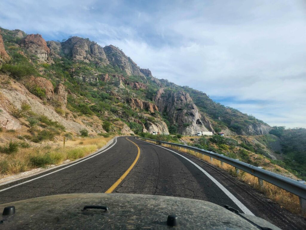
The highway south from here was not nearly as busy as it had been in the places we’d been the last few days, and it was narrower to match. It did hug the coast pretty closely, but stayed just far enough away from it to not provide the ocean views we had been looking forward to. We made lunch in Mulege, which was incredibly tropical- complete with a flowing powder-blue river, jungly underbrush, and huge palm trees. Further south, we drove along Bahia Conception, famous for its white sand beaches. The highway passes quite close to the ocean here, and each little cove was packed with campers on the beach and sailboats in the water. We’d seen almost no signs of tourism so far, and here it was! We were glad to have the jeep and to not have to park next to 20 other giant RVs, each with their own 10 feet of beach.
We’d planned on camping on a beach south of Loreto that looked like it was only accessible by a rough two-track road. The highway climbed steeply out of Ligui as we passed the entrance to La Dazante, a very ritzy looking golf resort. We switchbacked up the mountain and then pulled out on to the two-track at the top- now we just had to find a way back down to the water! The road unfortunately was in worse shape than the satellite imagery showed. We made it down a little ways, but came to a washed out section that we almost certainly could have made it through, but we were still a very long ways up from the bottom. Again, if we’d had Owen nearby we wouldn’t have hesitated, but we are quite aware of how alone we are. After a bit of hemming and hawing, we went back down and found our way to the beach at Playa Ligui. There were a few other people in large RVs camped where the road spilled onto the beach, but with the jeep’s 4×4 capability we were able to drive away from the entrance a good distance- well out of earshot. This was the only beach in Baja that we would camp anywhere near another person- every other beach was all our own.
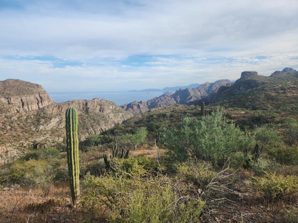
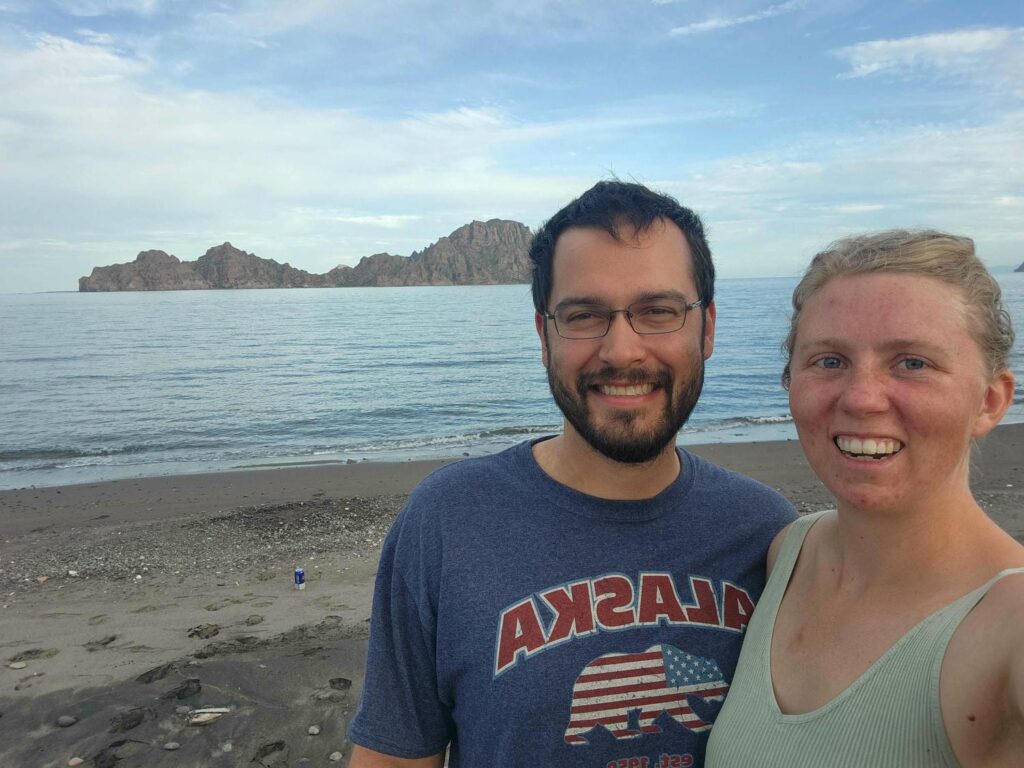
This beach was incredible- beautiful sand, amazing islands across the water, but most importantly the mountains! The mountains behind us were simply incredible- deep red rock cliffs covered in greenery. It was very similar to pictures I’ve seen of Hawaii. If this scenery were in the United States it would be a very popular national park, but here it was just another place along the road.
The next morning we headed back up the grade we’d driven up and down the previous night, and then a long gradual descent towards the western flatlands. We stopped in Ciudad Constitucion for groceries, and felt safe enough there that we both went in to the grocery store, instead of one of us staying with the jeep. We were able to find what we needed, but there was a smell in there that left both of us a bit nauseous. We aren’t sure if it was cleaning supplies, bad food, or just normal Mexican seafood smell, but we hurried to get out of there and back into the fresh air. After a fairly boring drive, we stopped at Las Pocitas. We filled up on gas again and stopped next door for empanadas, which are basically Hispanic calzones.
We were planning to take a road west through the mountains that we’d seen on YouTube- another Pan-American traveler who’d done the trip several years ago. The road looked remote, rough, and beautiful- just what we look for! We aired down again and left the highway towards the mountains. The road seems to be mainly used to access the many ranches we passed, and it was super rocky and washboarded for the first 50 miles or so. We were amazed at how fast the locals drove on this incredibly rough road- their poor vehicles! They always waved frantically to say thank you when we would pull over well in advance of them trying to pass- I’m sure none of them have air conditioning and have to drive with the windows down, chewing our dust! After several hours of up and down through washes, we finally started climbing into the mountains. The road grew smaller and smaller, and also rougher. There was a small waterfall marked on our map, which turned out to be a small oasis in the dry and dusty mountains- flowing water over bare rock, with palm trees and greenery around. We weren’t able to find a way down to the main waterfall, but it was such a cool stop after hours of seeing nothing but scrubby thorn bushes.
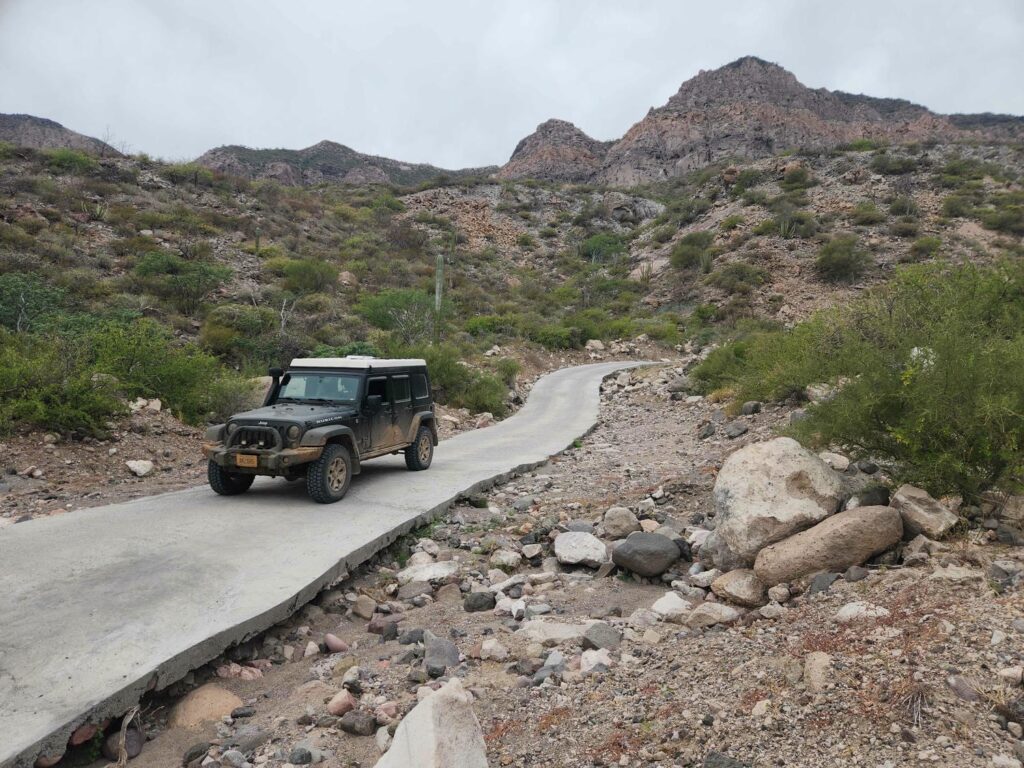
We climbed further still, through a valley with steep cliffs on each side. The area was stunningly beautiful, with no signs of development other than the road and the odd ranch gate. The mountains rose above us as we trundled on. Finally at the pass, we looked down at the ocean 2000ft below us. We’d been a bit worried about this section, as it is apparently impassable after heavy rain, but I think those days may be over- the steepest sections of the trail had been paved over. It was a bit odd using low range engine braking to slow down on pavement- usually if it is that steep, no one would think about paving it! We descended down for another hour or so, until we were at the last little bit before the flat area leading up to the ocean, when we rounded a corner to see a construction crew paving the section of road! The construction method was interesting- they would pour a ring foundation, then fill the ring with rocks, making sure every rock was below the top of the ring, before filling in the rest of the ring with concrete to make a flat surface. Unfortunately, there was no bypass! I’m sure all the locals knew, “Of course you aren’t supposed to drive the road that day, they’re fixing it!”, but there had been no signs whatsoever. Fortunately, they were at the stage where they were filling in the ring with rocks, so there wasn’t any wet concrete to ruin. In incredibly poor Spanish, with lots of hand gesturing, I communicated that I would like to try to drive off the road, and balance one side of the jeep on the ring foundation, with the other side on the far side of the ditch, straddling it. All the workers stopped to watch. With one of them spotting me, we managed it! Thank goodness for the capability of the jeep- I’m not sure something much less capable would have been able to do it. I do wonder how the locals deal with construction on the road- it will surely be unusable for a few days after they pour the concrete.
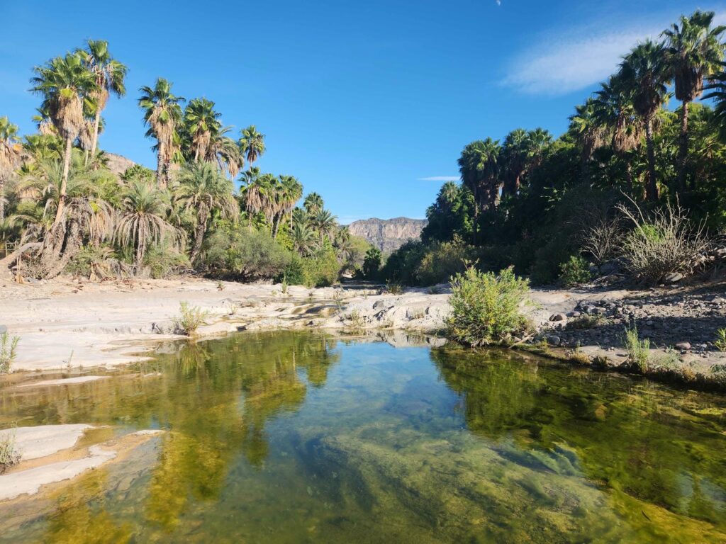
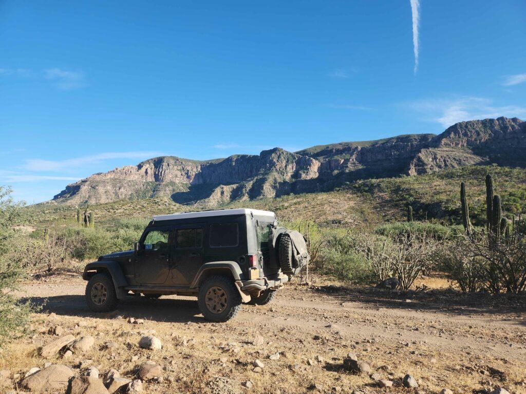
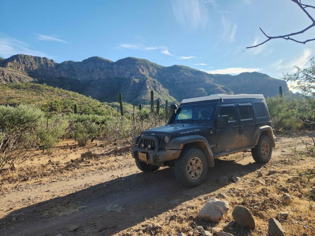
After one more small hill, we descended into the town of San Evaristo, a small fishing village north of La Paz on the Gulf of California. It was amazingly beautiful, with colorful houses, mountains behind, and a cove surrounded by cliffs. We looked for a good camp spot just north of town, but access seemed limited, and we couldn’t get as far enough away as we like. After some discussion, we headed back through the town and onto the other dirt road to San Evaristo, which comes from La Paz and is supposedly much more difficult. Using satellite imagery, Delaney found a wash that led to a beautiful beach about 10 miles south of town, and we were very glad to be done driving after a very long day.
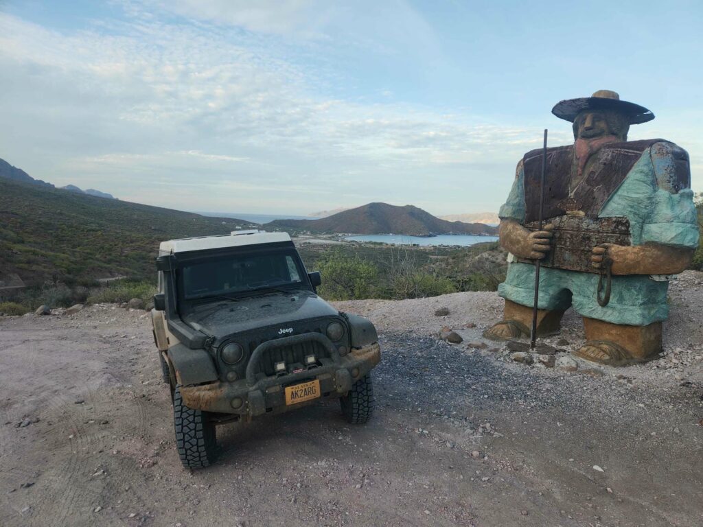
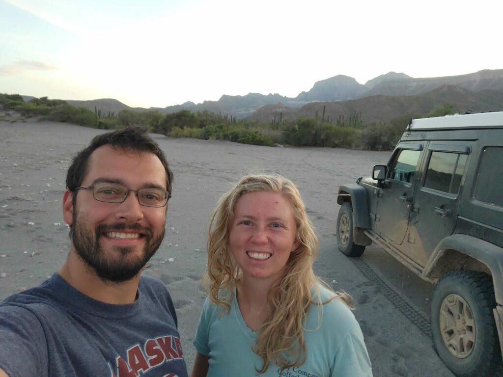
We had absolutely nothing planned for the following day, and we planned to do exactly that. We had completed all our chores and maintenance in the days before, so we had nothing to do but relax after some very long driving days. We slept in and had a slow morning, before wandering down the beach. There were shells everywhere! We watched sailboats 5 miles across the bay sail back and forth, and the local fisherman were always on the move as well. We found lobster shells, eel skeletons, pufferfish skeletons, and even two tortoise shells! But we could never have anticipated what happened next.
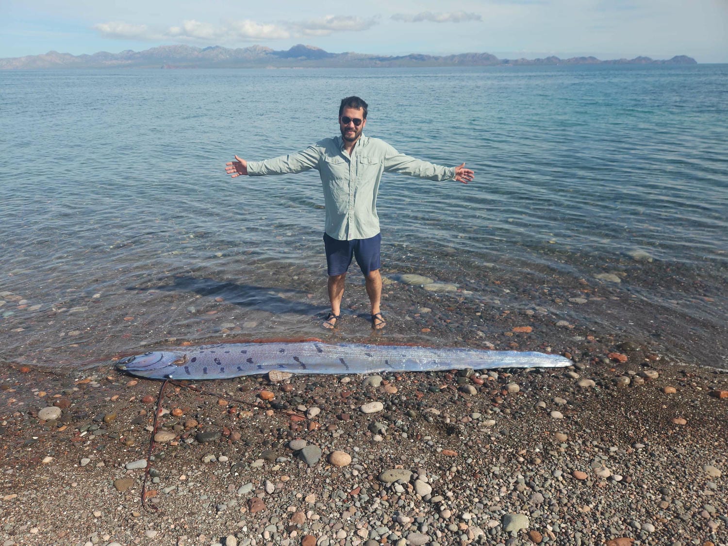
As we walked down the beach, we suddenly heard loud splashing behind us. Turning around, we saw a huge eel-looking creature thrashing in the surf, about 20 feet behind us. We ran up to it, watching it flopping around. It was beautifully colored- blue and silver with black spots, with bright red fins. It was nearly 10 feet long, but only about 18 inches tall, and only an inch or two thick- like a giant ribbon. Its skin was very bumpy, with the texture of tiny marbles. After it calmed down a bit, we pushed it back into the ocean- no easy task, as its length and unpredictable movements made it quite difficult. After getting it back into the water, it swam sideways for a bit, before righting itself when it got to deeper waters. We watched it swim away, staying at the surface, but we could tell it wasn’t doing well. It seemed to only be able to swim in left-hand circles, and it didn’t seem able to dive. We did see a second one at the surface that seemed a bit more lively. We kept walking up the beach, and came back through about 20 minutes later, to sadly find the fish dead on the beach. I suppose it had beached itself for a reason. We found that it was an Oarfish, a rare species of fish, and even rarer to find alive- according to Wikipedia, only 20 have been seen along the California coast since 1901. It is the longest bony fish in the world, and seems to be the source of the mythical sea serpent. We couldn’t believe how lucky we were to see one of these incredible animals!
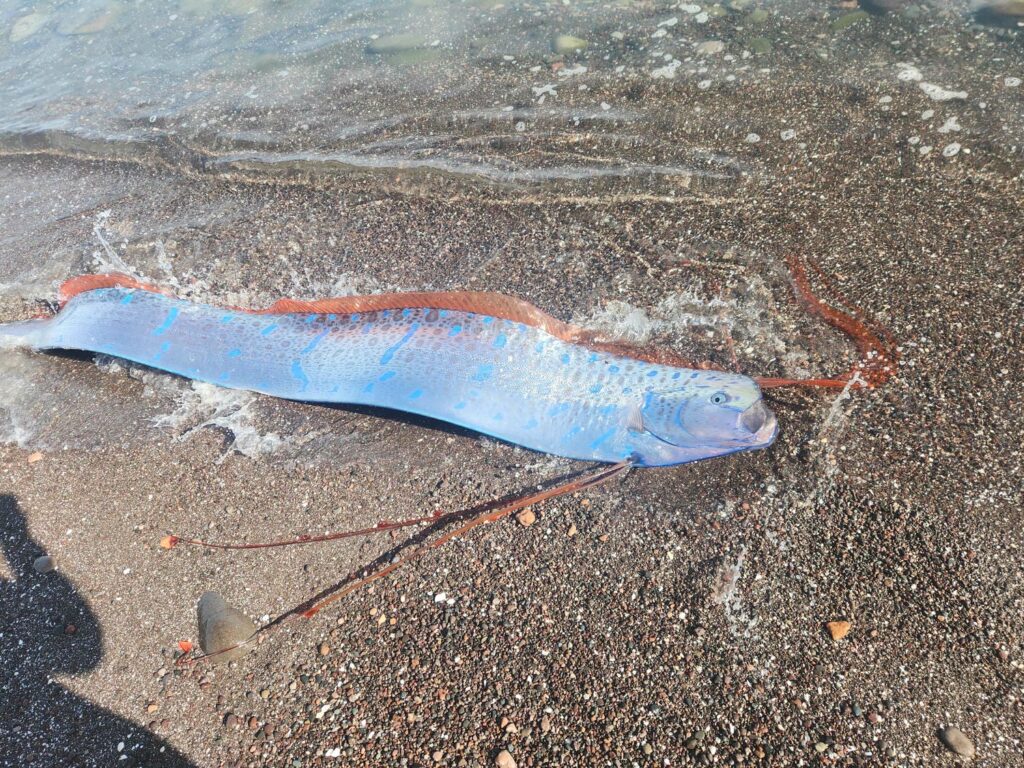
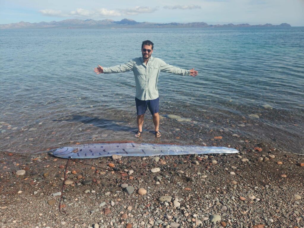
We explored the other end of the beach before having a driftwood bonfire by the jeep that evening. We also solved a small mystery- we’d noticed when we arrived at this beach that there were all sorts of tracks through the sand, and we couldn’t quite place them. The tracks looked like they were from a creature that had legs and what looked like a thick tail- and we knew that they’d been active recently, as we found that morning that some of the tracks were on top of our tire tracks from the previous night! I thought that they were probably lizards, or worse, rats, but after putting out the bonfire, I got a flashlight out and went looking around the beach- and I found hermit crabs! The “tail” that I’d seen in the tracks was them dragging their shell through the sand behind them. We found nearly 20 hermit crabs in a 50 foot radius around the jeep, all with a place to go. We had a great time watching them scurry around and interact with each other. Some were less shy than others too- I picked a few up, and some would walk around in my hand.
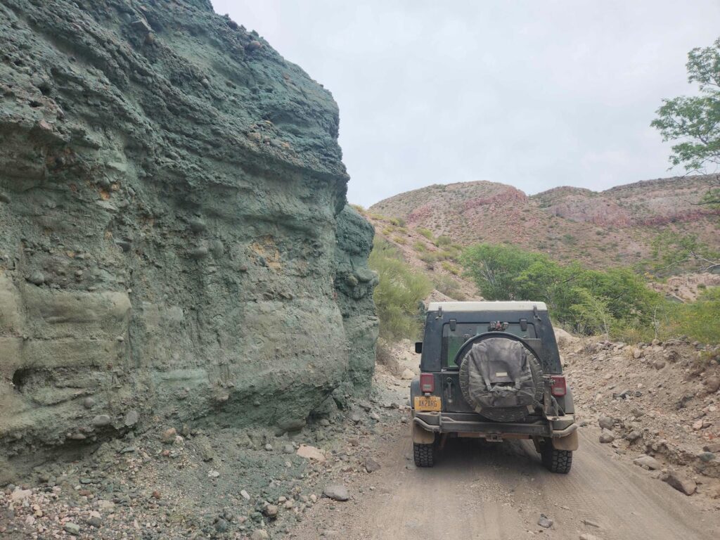
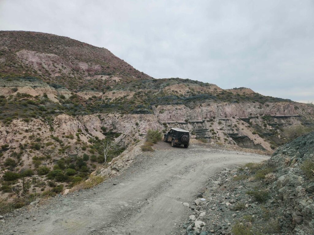
We left our San Evaristo campsite headed south along the coast. The road was tight with scrub and cactus pushing in. It soon began climbing through layers of rock, alternating green and red. I’ve seen red rock before, but never green, other than at copper mines! We had begun seeing it on our drive in 2 days before, but it was much more prominent here on the west side of the mountains. I can’t believe that it is copper, as someone would be making a fortune mining it- it must be something else. The road climbed and climbed, switchbacking up the mountain. The steep paved sections returned as we reached the crux, before descending down a beautiful canyon with the road hugging the cliffs. I’d heard a lot about a specific short section of road that even some 4x4s would struggle on, but I’m sure it is paved over now.
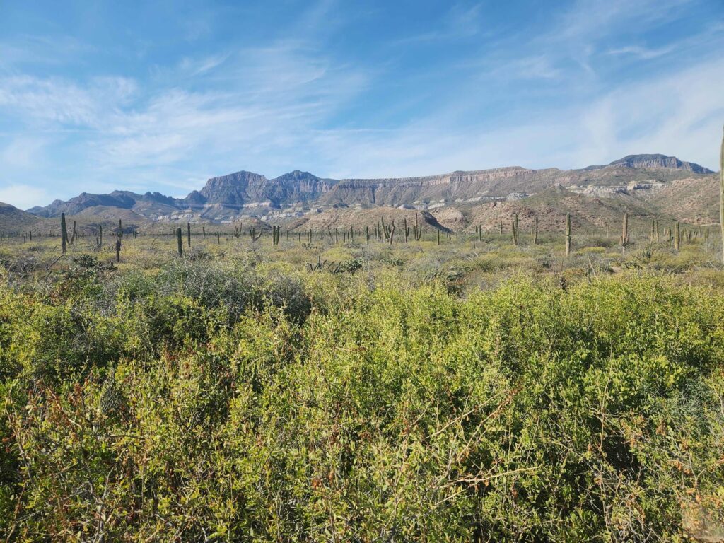
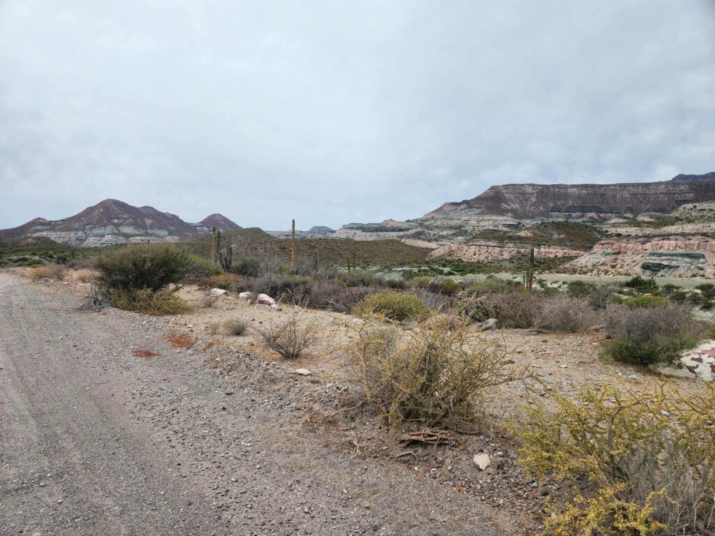
Back down on the coast, the washboard returned as we headed south towards La Paz. We passed a shrimp farm, which had huge canals and reservoirs carved out of the dirt. I imagine that they pump seawater up into the reservoirs to farm the shrimp- but it must be done in the summer as there wasn’t any water. The road wound along the coast, sometimes very close- just above the high tide line. After another hour or two of punishing washboard, we hit pavement.
Soon we were in La Paz, and back into some traffic for the first time since Ciudad Constitucion, and really since Ensenada. We were aiming to head down to the western coast south of La Paz, but we needed to reserve ferry tickets over to Mazatlan. It can be done online, but I wanted to see the place since we were passing so close anyhow. The port and ferry terminal is 20 miles north of La Paz in Pichilingue, and the road is full of truckers entering and leaving the port. Unfortunately for us, the speed limit was super slow most of the way- between 25 and 35mph on a very good paved highway. It took us much longer than expected to reach the port, and after talking to some of the guards there, they directed us to the correct office.
The lady at the office took our passports and asked for our vehicle length. We had fortunately anticipated that question and measured before leaving the Jeep- 5.0 meters long! Despite her barely speaking any English and us barely speaking any Spanish, we were able to communicate that we wanted to go to Mazatlan on Friday, December 5th, 5 days from now. She communicated to us that our reservations were set and that we should arrive at 2pm on the 5th, that we would pay when we arrived, and some steps to follow before we came back to her office. I was surprised how easy it was to do something as complicated as reserve a ferry ticket, without sharing a language at all!
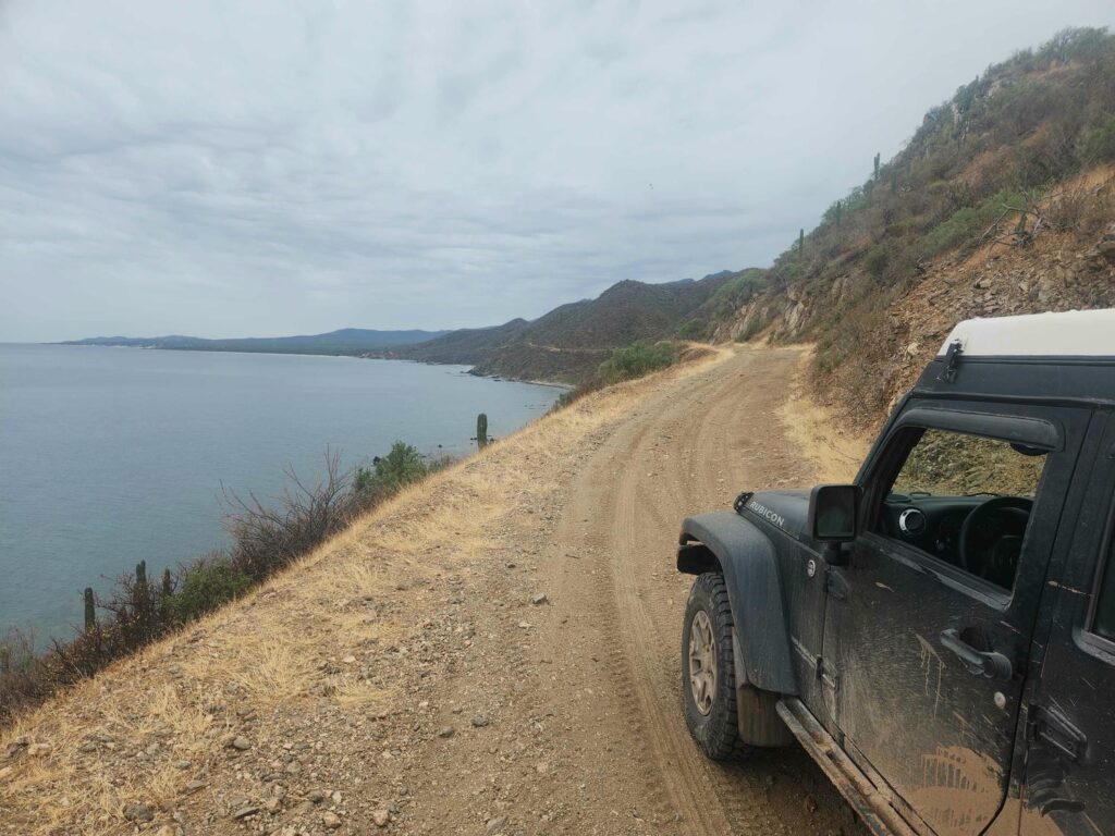
Ferry reserved, we took the slow road back towards La Paz before heading south over a beautiful mountain range into San Juan de los Planes. There was a squiggly road on google maps that led over the next mountains down to the coast, which promised to be a beautiful drive. We were glad we had the Jeep, as the road up was really quite rough and steep- but not nearly as rough and steep as the descent down the back side to the coast! It was a shelf road, and it wiggled back and forth across the cliffs down to the ocean. Even when it reached the ocean, it was still several miles of shelf road with cliffs above us and the ocean below before we could get down to a beach. We didn’t like the first two beaches we looked at, but the third was perfect- barely visible from the road, lots of interesting rocks, and a flat spot for the Jeep.
Our beach was quite rocky, but the beach just around the point south of us had beautiful white sand. We found some Ghost Crabs on this beach, which are lighting fast! As soon as they saw us they would dash, faster than we could follow with our eyes, into the surf and disappear. The next morning, the whole Jeep was wet with dew. We drove out towards Los Barriles, and found that we had camped just one or two obstacles before the road became flat and sandy again. There were ranches and what looked like vacation homes everywhere- we were glad we had stopped where we did the previous night. We drove straight through Los Barriles, and got our first taste of “resort life”. It was obvious that there was a lot of money here, with beautiful white homes and brand new side-by-sides buzzing up and down the street. Most of the people we saw seemed to be affluent non-Mexican tourists.
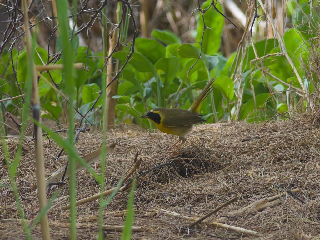
On the other side of Los Barriles, we headed for the outfall of a large desert wash. There is a bird that is endemic to southern Baja called Belding’s Yellowthroat, and the marsh at the end of this wash is one of the only places to see it- it only lives in marshes, which in Baja are quite scarce! It took me a while, but I managed to find one and get a few pictures of it. They are incredibly secretive birds.
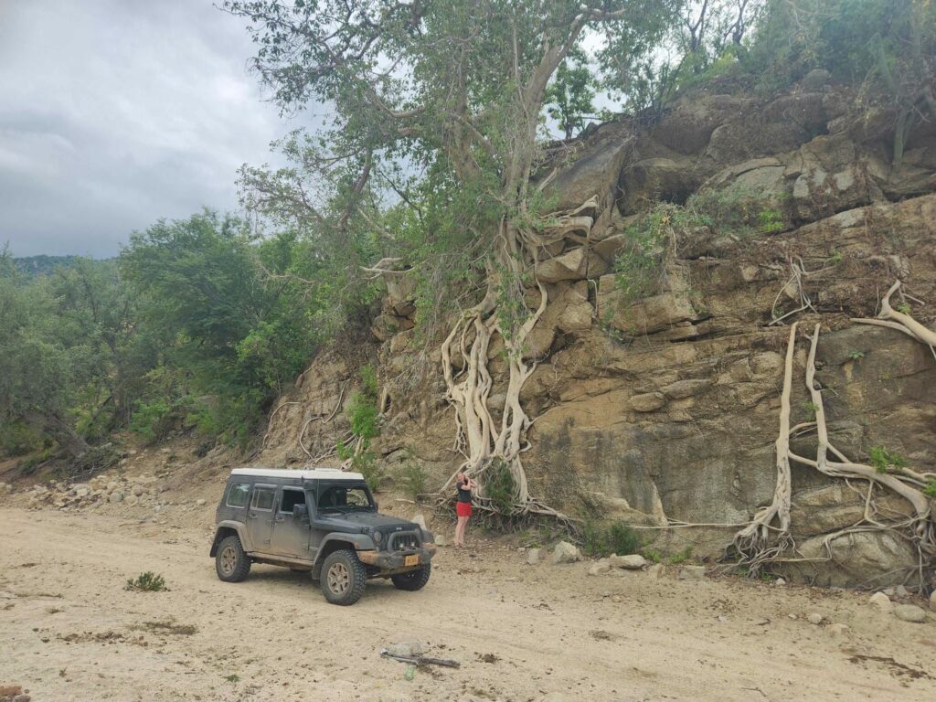
The bird checked off the list, we headed south down the east side of the mountains towards Cabo San Lucas- but we turned west before reaching it, up a ranch road. This road is the only one to cross the mountains completely- all other roads, which are paved, go south through Cabo or north towards the plains. This is exactly what we look for! As the road climbed, the vegetation changed from desert scrub into flowering bushes and huge leafy trees. It felt like a jungle, and the craggy mountains around made it look like Jumanji. There was a reservoir west of the road that we had heard you could get to, so we made the turnoff and headed down. There were 5 to 10 homes down this road, that instead of looking like ranches, looked more like rustic vacation homes. If I owned a place in Baja, I would want it to be here, though I’m not sure about how easy access would be when it rained! The roads were steep and rutted out, and we needed to use low range in a few places. We descended all the way down to the wash that fed the reservoir, but it was clear that the reservoir was a bit lower than usual, so we camped down the wash just out of sight of the trail.
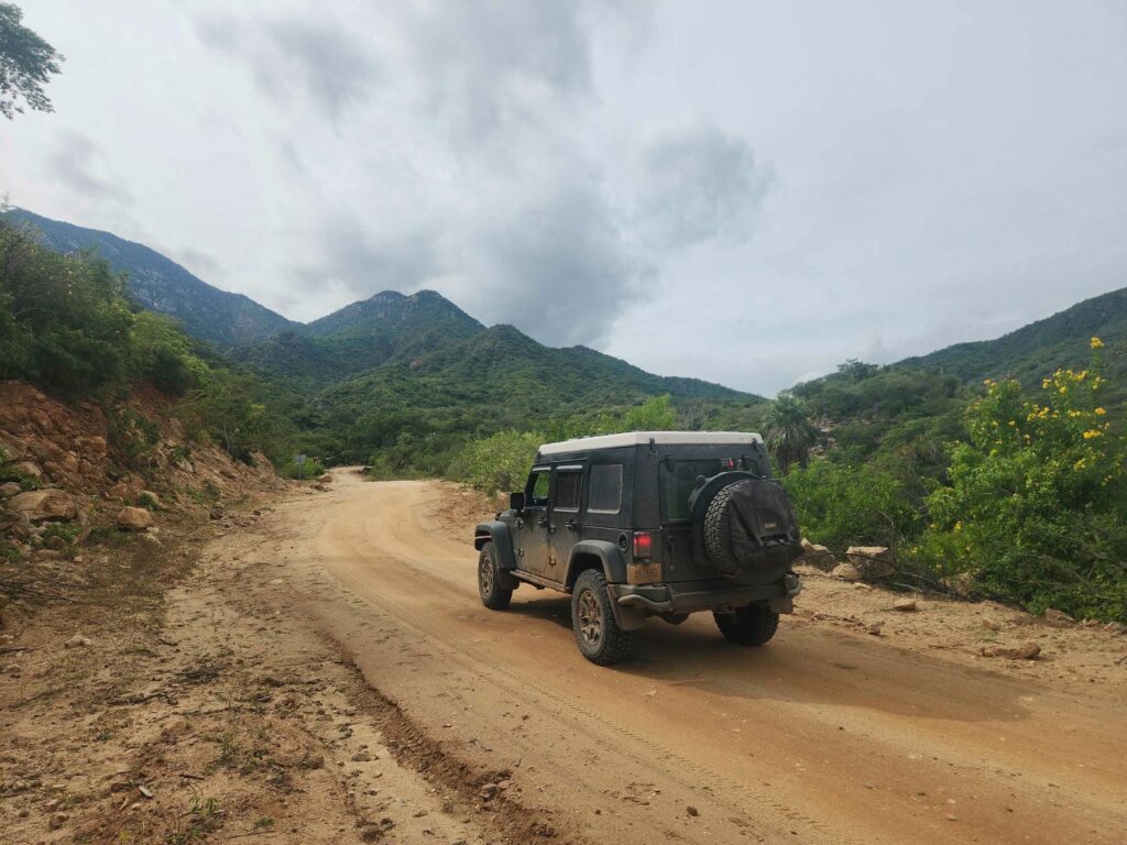
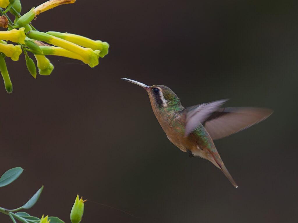
The area was beautiful- high, craggy peaks with lush vegetation everywhere. I’m sure it will not compare to the real jungles that we will see in central America, but after spending the last few weeks in the southwestern U.S. and in Baja, this area felt incredibly tropical. Here I found another endemic bird species (sensing a theme?) called Xantus’s Hummingbird, and while not particularly rare, is not found outside the southern half of the Baja pensinsula.
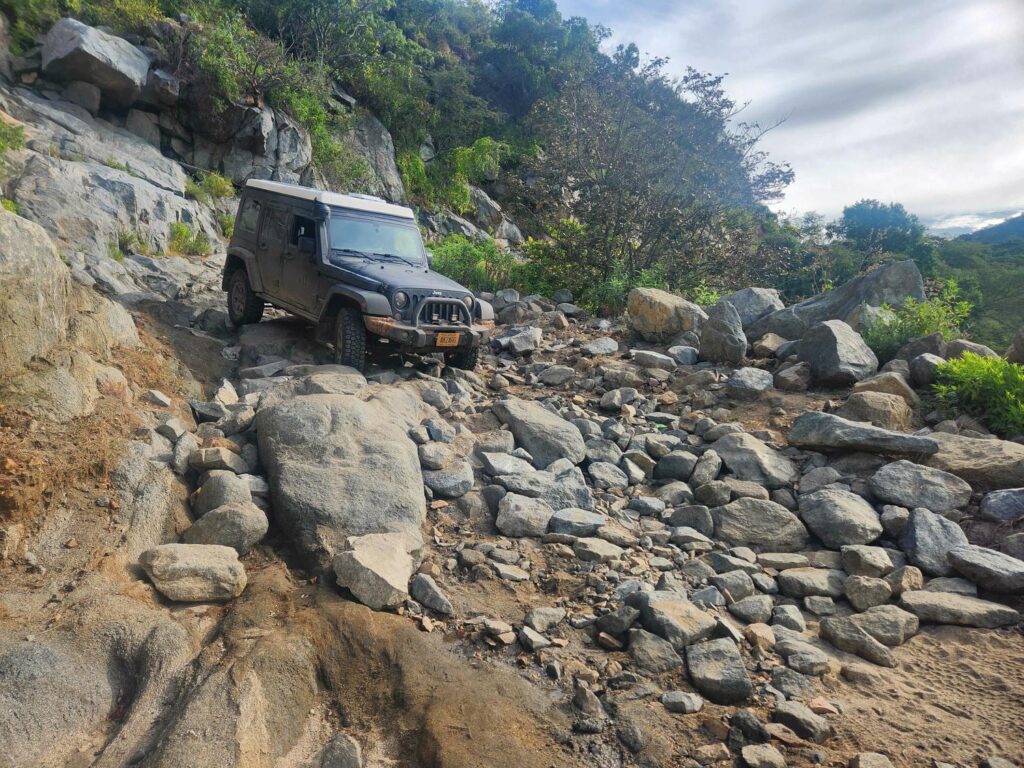
The next morning, we headed further up the road to the west. The road, already quite narrow, got smaller still and it was clear there was very little traffic. As we crossed the mountains, I noticed that even though we were definitely past the halfway point, all the little ranches along the way had entrances that faced east, with no tire tracks coming from the direction we were going. Not a great sign! The road got narrower and rougher, and turned into quite the shelf road. At the top of a pass, we found why the ranches all were accessed from the east- the road turned into a big rockpile, and though while not washed out completely, it would definitely take some rock crawling to get across. Delaney spotted me through it, and we didn’t scrape a thing- yay for the Jeep!
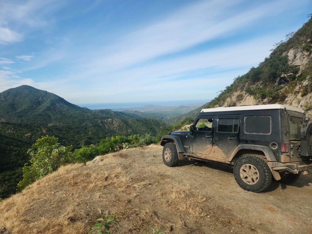
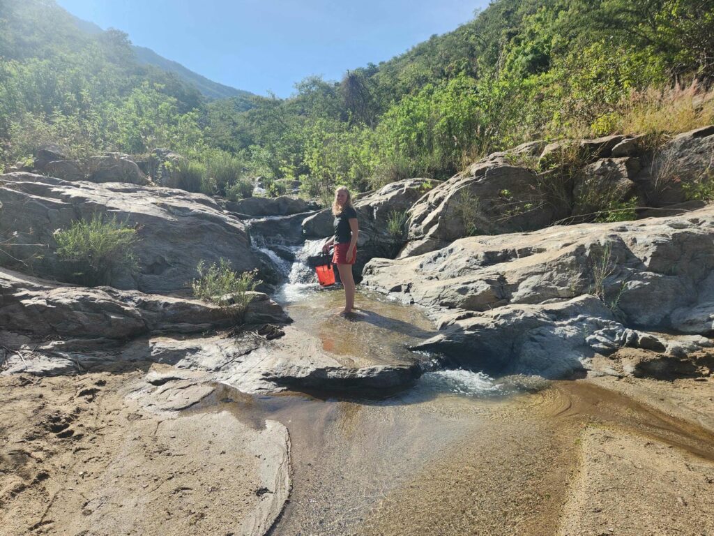
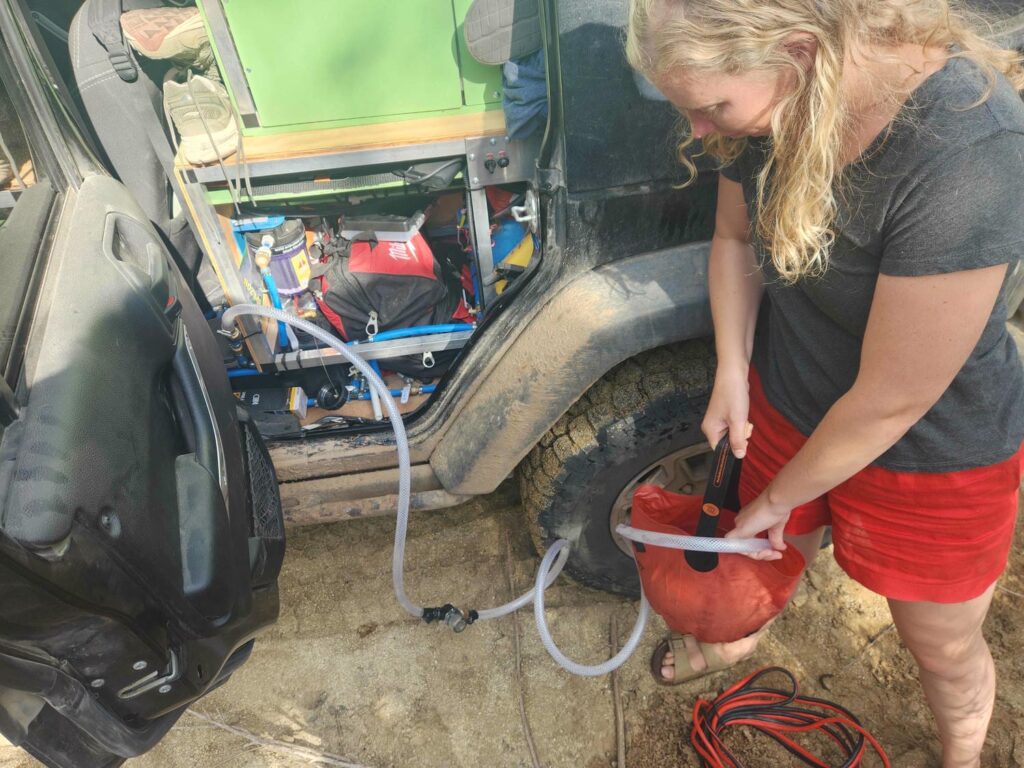
On the other side, the road opened up and we could see the ocean miles away to the west. We could also see the road, still quite a sketchy shelf road, wind its way down the mountain. There were some vehicle tracks in the road on this side, indicating that we had passed the worst! I’m sure people come up for the view, which was simply spectacular. The road got better and better as we descended, finally reaching the valley floor. We crossed a small creek, which fell from high above, and took the chance to fill up our water tanks. Other than filling up from a reservoir in California, this was our first time filling up in the “wild”, and the system worked great.
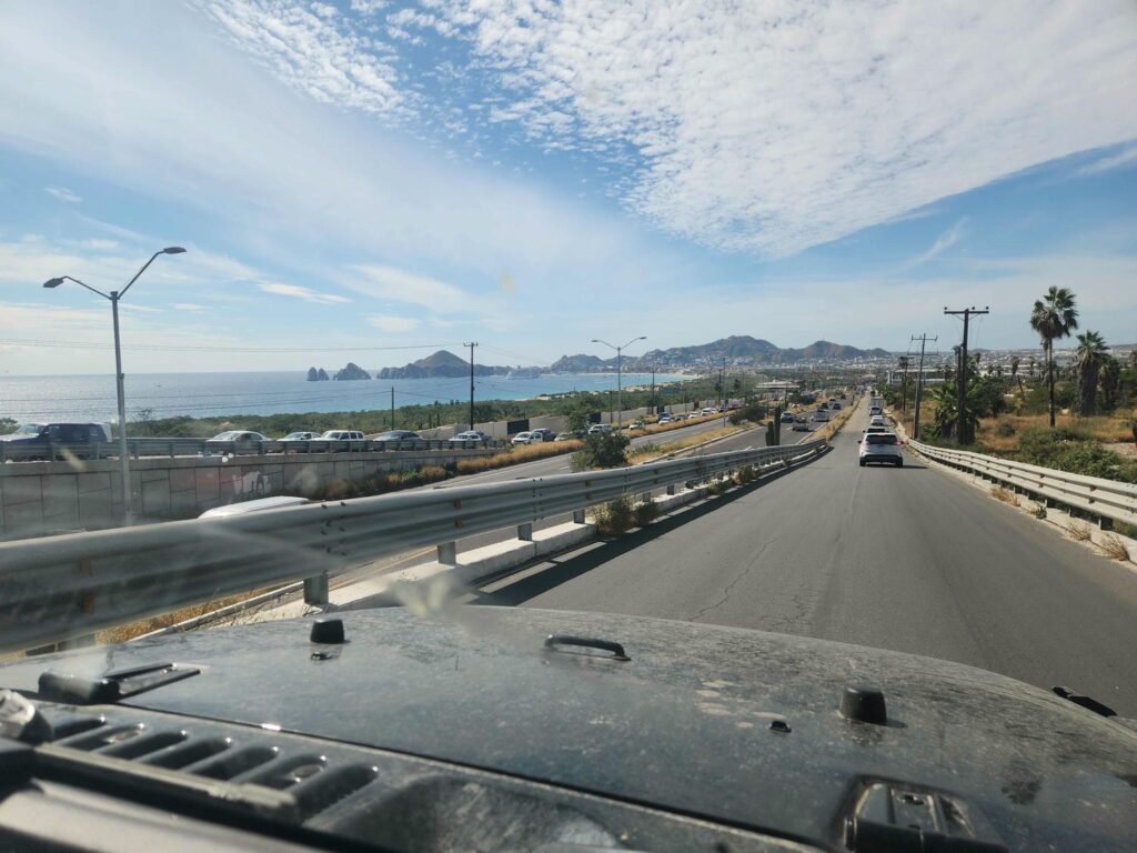
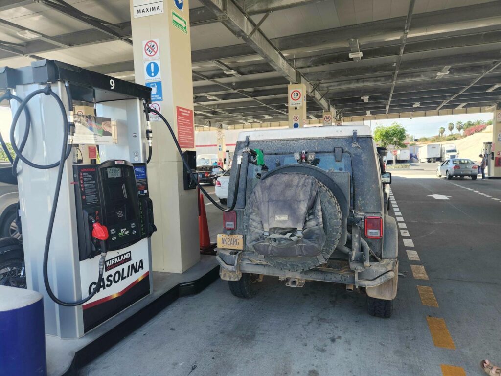
After a long, dusty road back to the main highway, we headed south to Cabo San Lucas, now on the western coast. Cabo was definitely not our kind of place, though it was really cool seeing all the crazy resorts and hotels. It sure looks like a playground! Traffic was hectic as we chose to take the scenic route through town, before stopping at Costco to stock up on food and fuel. We headed west from there towards San Jose del Cabo, and got stuck in a terrific traffic jam as crews were replacing a bridge. North from there, we went all the way back up Highway 1 before turning south onto a dirt road at San Antonio, near El Triunfo. The road was in great shape for a rural dirt road, and we made good time back into the mountains. We had our eyes on a hike up to a beautiful view and another Baja endemic bird- the Yellow-Eyed Junco, which is only found high in these mountains.
Unfortunately, the land access rules had changed since I had first heard of this location. There was a gate across the road, with “no access” signs, which I later learned had been put up specifically to deter people from going up without 1) paying a guide, 2) paying the nearby ranch for exclusive access, and 3) paying the reserve for access, which can only be done back in town. Only with all three can you pass. We have learned that public land, nature reserves, national parks, etc are quite different here. Even though the ranch somehow exists within this nature reserve, it can legally restrict access, and charge for it! We were a bit frustrated, but had a great night in the nearby wash. We were woken up by some pigs wandering through in the night, which was a bit scary until we realized what they were!
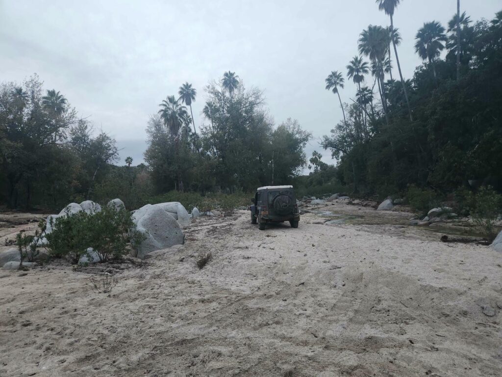
The night before, my brother Joseph had contacted me to let me know that the department manager at my old job, Mireya, had offered for Delaney and I to spend a night or two at her condo in La Ventana, just outside of La Paz. We were thrilled at the offer and hurriedly accepted! It was just a short drive from where we were, and we went there right away in the morning, instead of doing the hike we had planned on. The condo was beautiful- just a few blocks from the ocean, with secure parking, and a private pool. In the 2 nights we spent there, we barely did anything other than nap, catch up on this website, shower, and do some laundry. We did eat out at some of the local restaurants- a seafood restaurant called La Picazon was our favorite, with delicious and cheap shrimp and scallops!
It was such an awesome break from the road, and we pretty much did nothing but sit on the couch and hang out- something I knew we would miss doing when we left on this trip. It also rained for much of our stay there, adding to the coziness. Unfortunately, the power for the whole town went out at about 10pm on our second night, and didn’t come on until the literal instant I turned the key to lock the place up as we were leaving at noon the next day. This meant we weren’t able to wash the sheets and towels before we left- we are sorry Mireya, but thank you so much for letting us stay!
The condo was only about an hour from the ferry terminal, so we arrived at the terminal an hour before when we were told to. We are always glad to have plenty of extra time for things like this! Our first step was going through Aduana, or Customs. All of Baja is a “free zone”, with much fewer restrictions on traveling, but over on the “mainland”, we are required to have our Temporary Import Permit- which we got back in Tecate when we entered Mexico. After the agent reviewed our passports and TIP, we got in line for the scale to get the Jeep weighed and length officially measured. The workers at the scale seemed to be having a great time, laughing and talking with each other as they weighed and measured all the vehicles.
I was very curious how much the Jeep would weigh- there is a lot of discussion among overlanders regarding weight. There are quite a few variables to consider, and I’m about to go into them, so if this bores you please skip all this! The main consideration is the vehicle’s GVWR, or Gross Vehicle Weight Rating. Every vehicle has this number, and it is the maximum amount that the vehicle is legally allowed to weigh, including passengers, fuel, and cargo. This number is calculated by the vehicle’s design engineers, and is influenced by a huge number of things, including:
- the GAWR, or Gross Axle Weight Rating. Vehicle axles are all rated by their own manufacturers (vehicle companies seldom design their own axles) for how much weight they can carry, which is influenced by axle tube thickness, gear sizes, bearing sizes, etc. The front and rear axles usually have different ratings, with the rear having a higher rating as it usually carries more weight. The sum of the GAWRs is usually greater than the GVWR.
- Frame strength- usually far stronger than it needs to be, as a frame breaking is about the worst thing that can happen to a vehicle. Our Jeep frame is rumored to be even stronger than the frame of a Ram 1500.
- Weight distribution- a top-heavy vehicle will usually be rated lower, because of rollover risks. The Jeep has a very good weight distribution, especially with how we’ve packed all our heavy items as low as possible, such as water tanks, tools, and spare parts.
- Spring rates- how stiff the springs are, more on this later
- Brakes- surprisingly not super influential, as vehicles can legally tow far more than they can legally carry inside. For example, the Jeep’s “payload”, or how much weight it can carry, is roughly 850lbs. It can legally tow 3500lbs, so the brakes need to be designed to stop 3500lbs more than the Jeep weighs empty, not 850lbs. The empty weight of a vehicle, without fuel, passengers, or cargo, is called the “curb weight”. Curb weight + payload = GVWR.
- Engine- also not super influential, for the same reason as the brakes- the engine needs to be able to pull 3500lbs up a hill, not just haul 850lbs up a hill.
The next consideration is legality. Legally, the GVWR cannot be exceeded. Practically, it is exceeded all the time. For example, a Toyota Camry’s GVWR is exceeded if four 220-lb people get into it when it has a full tank of gas. It simply is not enforced in the U.S. for private vehicles, or for small commercial vehicles like work vans, which are almost always overweight. Large commercial vehicles like box trucks and semis are a different story, but I have not heard of a single instance of a private vehicle receiving a ticket simply for being overweight. I have heard of tickets being issued for unsafe loads, such having a 5 foot tall pile of junk on the roof rack, but never for being overweight. Other countries, most prominently Australia, enforce private vehicle GVWRs very strictly. However, Australia allows you to modify your GVWR, which in the U.S. is not possible. In Australia, there are engineering companies that will recertify the GVWR if the owner upgrades certain parts- suspension, axles, brakes, etc. Because of this, there are vehicle parts made in Australia that are specifically built to upgrade the GVWR by a specific amount.
Another consideration is speed limits. Speed limits in the U.S. are just about the highest in the world- which means that vehicles also have to be able to stop from a much higher speed. GVWRs are somewhat influenced by the local speed limits. Everywhere we will be traveling, speeds will be far, far lower than the U.S.- almost never exceeding 60mph, and only rarely exceeding 40mph by the time we are south of Mexico. This means that the brakes and suspension of the jeep will not be stressed nearly as much in an emergency braking situation- as we will be braking from a much lower speed.
The final consideration I’ll talk about here is mileage. With great weight comes a great fuel bill! We’ve found so far that we average ~16mpg if we are on the highway doing >65mph, and ~18mpg if we keep it below 60. We don’t expect to see more than about 50mph for the vast majority of our trip. I do wish it was better but it is what it is- with our extra fuel tanks, range isn’t an issue, and over the 50,000 miles we plan to drive, the difference between 18 and 20 mpg is only 275 gallons, or $1100 at $4/gal.
To cut to the chase, when we went over the scale at the ferry terminal, with nearly full fuel, water, and food, we weighed 2900kg, or 6400lbs- 700lbs over our GVWR of 5700lbs. That is a LOT! However, I’m not too worried about it. According to former Jeep engineers, the single component that limits the GVWR of our model of Jeep wrangler is the rear springs. Instead of being sized to carry a specific amount of weight, they were sized to provide a specific level of ride quality while the Jeep is empty- lighter springs generally mean a better ride. It is rumored that the Australian Jeep wranglers are only different in that they have stiffer rear springs from the factory- and they are rated to carry about 500lbs more than in the U.S. We have installed springs from ARB, an Australian company, that are rated in Australia to carry 660lbs more than the stock Australian springs, which are already rated much higher than our stock U.S. springs. We won’t be towing a trailer, so I’m not worried about overstressing the engine or brakes. I’ve never heard of a single wrangler frame breaking- even on jeeps that are offroad only, with 40 inch tires and 1-ton axles. We’ll be driving much slower than we do in the U.S., so from a safety perspective, I’m not concerned at all. I’m not concerned about legality, as all of the countries that care about private vehicle GVWR are either Australia or in Asia. The one thing I am a bit concerned about is increased wear and tear on various parts- wheel bearings, ball joints, suspension bushings, etc. However, those items are easy to fix if they do wear out prematurely. I am encouraged that the jeep doesn’t feel overloaded- it handles washboard, frost heaves, sharp corners, quick braking, and offroading with no problem at all, and the ride quality is great. We also don’t feel underpowered- the jeep accelerates just fine. I’m also encouraged by knowing that there are wranglers out there that weigh over 8000lbs without too many problems- how they get to that weight I have no idea.
Now, off my soapbox and back to the ferry terminal! We got our weight slip from the jolly workers at the scale, and then parked among the many giant semis around and walked back to the ferry office. We presented our weight slip, along with our passports again, and after paying $450 U.S., we had our tickets to Mazatlan!
Both of us loved Baja- it was far less populated and far more mountainous that we both expected. Neither one of us are “beach” people but we certainly enjoyed our many nights camped right on the beach, with no one for miles! We were expecting a more touristy, “americanized” area, but we were pleasantly surprised. Very few people that we ran into spoke any English at all, and the only touristy areas we found were Cabo, of course, and some beaches near Mulege with 10s of huge RVs. In fact, I think those were the only areas we ran into other tourists at all. We will be back someday!
Joseph shared your blogs link, and I am so happy he did! Travel blogs are the best use of the internet, this is amazing. When I have more time, I will dig into the full post and the writing. I was taken aback by the Oar fish and only read deeply into that section and the beach adventures with hermit crabs and green copper cliffs! Such incredible creatures, it is unfortunate that we usually only get to interact with them when they are sick or dying. It’s beaty is remarkable, a wonder of the sea.
Hey Moe! Glad Joseph passed the link on. The oarfish was crazy! You would go nuts with all the fish down here. They’re so much more colorful than Alaska!
I feel like Im reading a chapter book and when I finish one chapter, cant wait to read on to the next. I should be going to bed, as it is 12:30 am and I have to get up at 5:30. So captivating. I even read all about the vehicle weights, interesting. Keep on truckin’!!
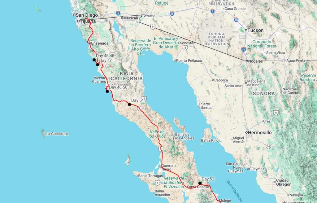
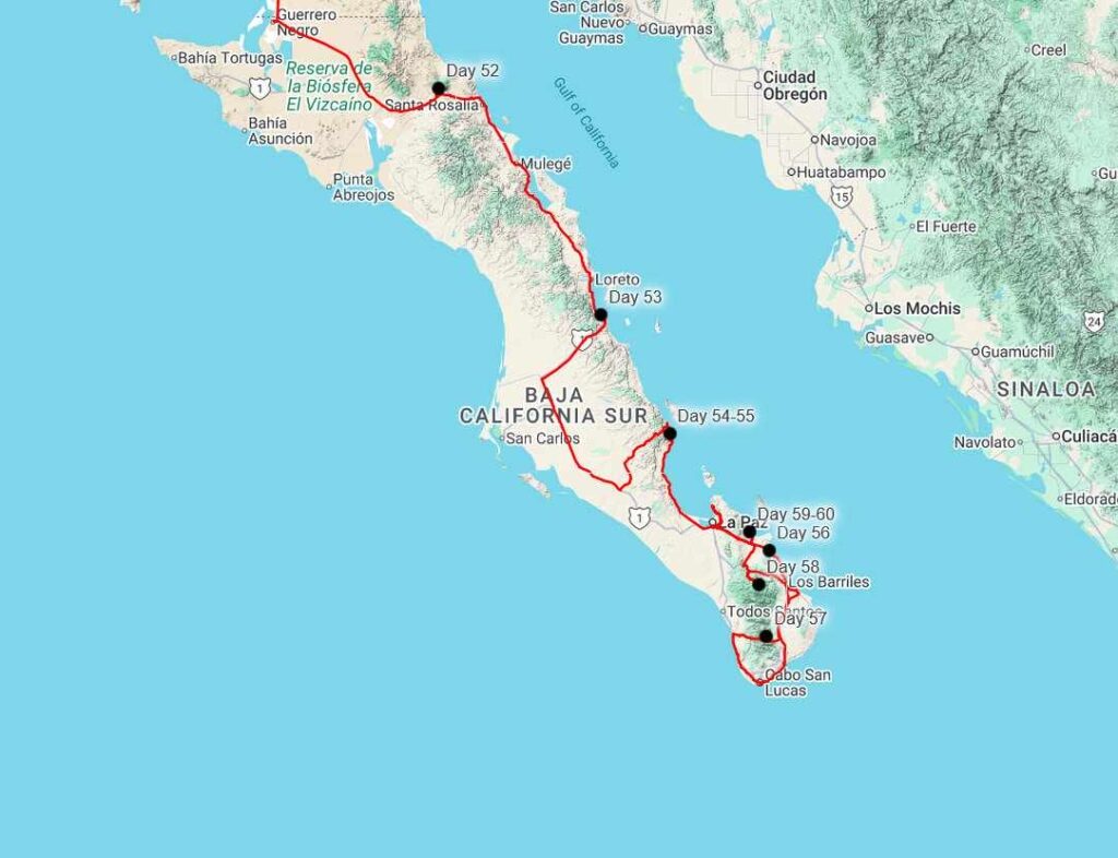
I feel like Im reading a chapter book and when I finish one chapter, cant wait to read on to the next. I should be going to bed, as it is 12:30 am and I have to get up at 5:30. So captivating. I even read all about the vehicle weights, interesting. Keep on truckin’!! Appreciate you putting in the maps to follow your trails